Recent British Isles significant weather observations
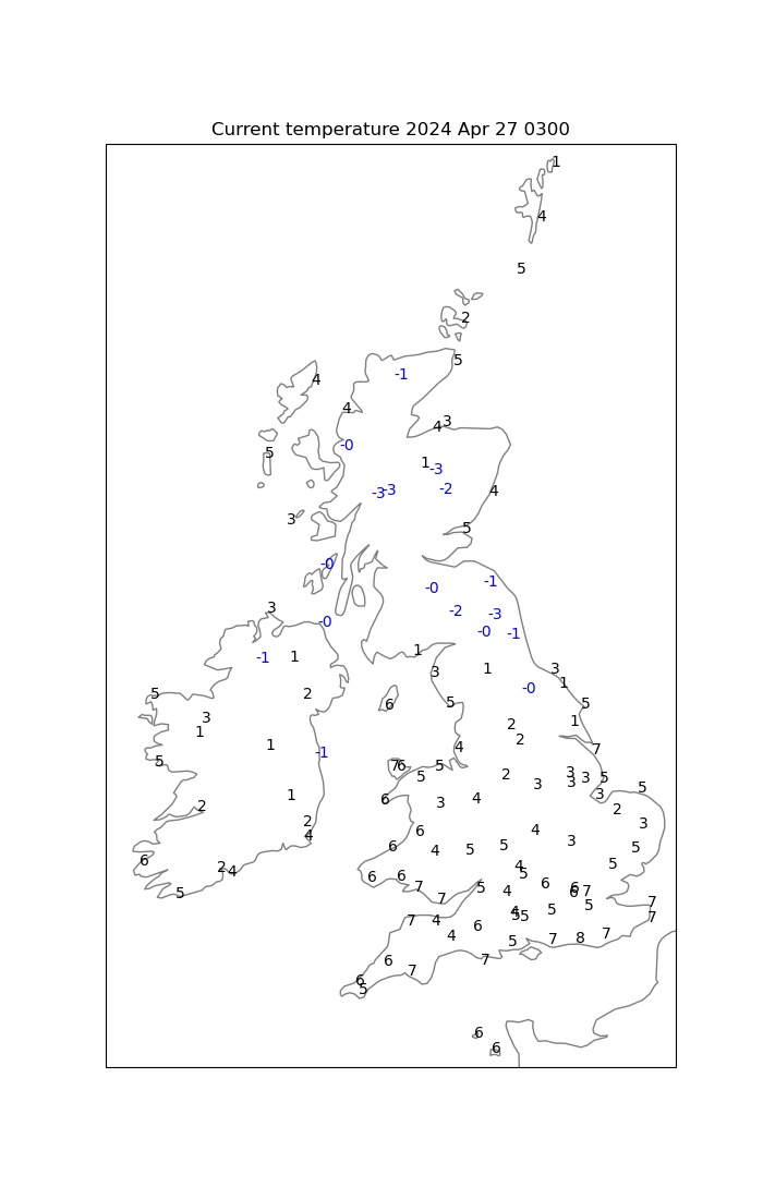
Select an image and then use the left mouse button to view a larger version of the image.00, 03, 06 and 09 GMT


12, 15, 18 and 21 GMT


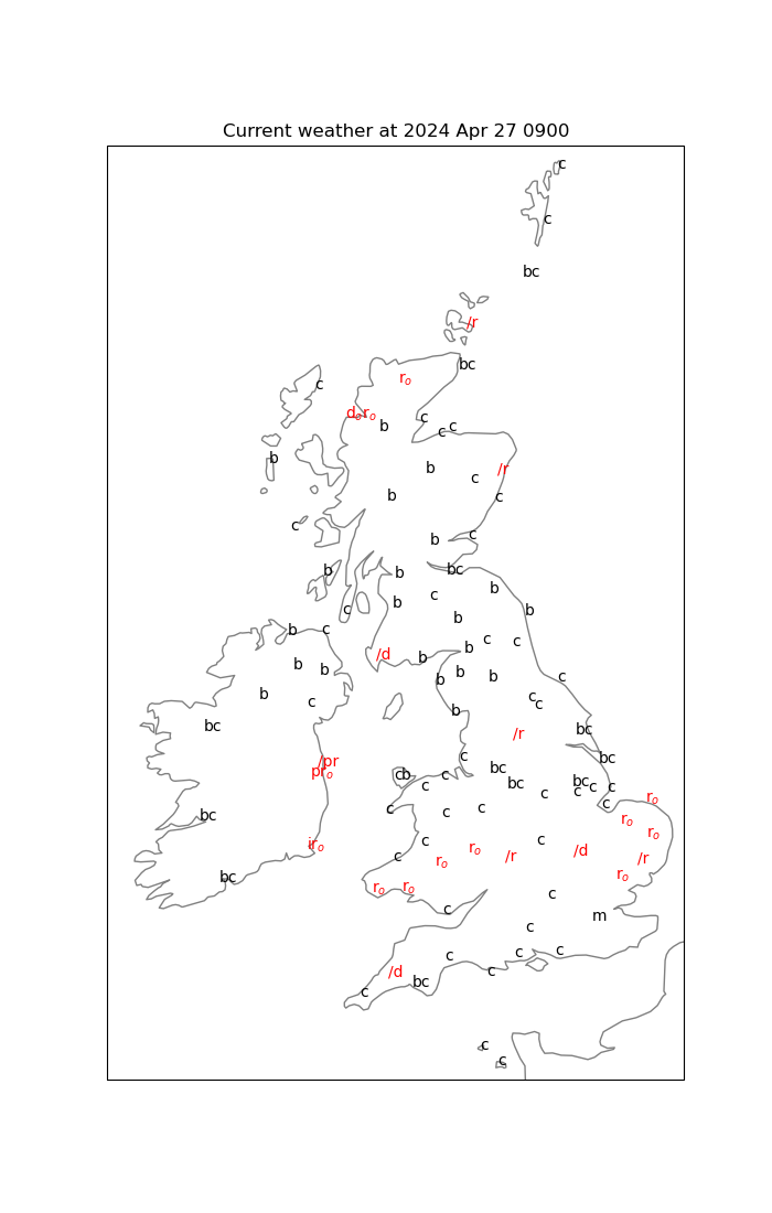
The maps above contain an indication of the current weather using the Beaufort weather symbol notation. blue denotes sleet or snow, red denotes rain or drizzle and black denotes cloud, visibility-related and other weather types.
| b | total cloud amount 0 to 2 oktas |
| bc | total cloud amount 3 to 5 oktas |
| c | total cloud amount 6 to 8 oktas |
| d | drizzle |
| f | fog (F denotes thick fog) |
| fg or fs | shallow fog |
| h | hail (sh denotes snow grains) |
| i | intermittent or patches |
| j | phenomena within sight of but not at the station (jp precipitation within sight) |
| l | lightning |
| kq | line squall |
| ks | drifting or blowing snow |
| m | mist |
| o | uniform layer of cloud completely covering the sky |
| p | shower (used in combination with the type of precipitation) |
| q | squall |
| r | rain |
| s | snow |
| t | thunder (tl thunderstorm) |
| z | haze |
The following are not used on the maps shown on this page.
| e | wet air, without rain falling |
| fe | wet fog |
| g | gale (G denotes storm force winds) |
| u | ugly threatening sky |
| v | abnormally good visibility |
| w | dew |
| x | hoar frost |
| y | dry air (less than 60% relative humidity) |
Other useful links
- My homepage/surface charts
- Local weather:
- Maidenhead's recent weather and climate
- Reading's climate, 1991-2020
- Current UK/Ireland weather information:
- Maps:
- Current temperature
- Current weather
- Plotted daily extremes
- Current weather
- Monthly summaries:
- The month so far - text
- Last month - text
- The month so far - charts
- Last month - text
 August 2016: Details
and order form for this new book about weather observing.
August 2016: Details
and order form for this new book about weather observing.
 Details
and order form for this limited edition publication.
Details
and order form for this limited edition publication.
Met Dept Home
- My publications
- Maidenhead weather
- Current, recent and historical weather in Reading, Berkshire
- East Berkshire temperatures
- Maidenhead (Berkshire) rainfall
- UK weather diary
- Reading weather 'on this day in ...'
- World weather news stories
- Met-Jobs mailing list
 Read about and order this NEW book about the weather of Reading.
See also
Make your own weather observations? Then see the Climatological Observers Link
The Tornado and Storm Research Organisation
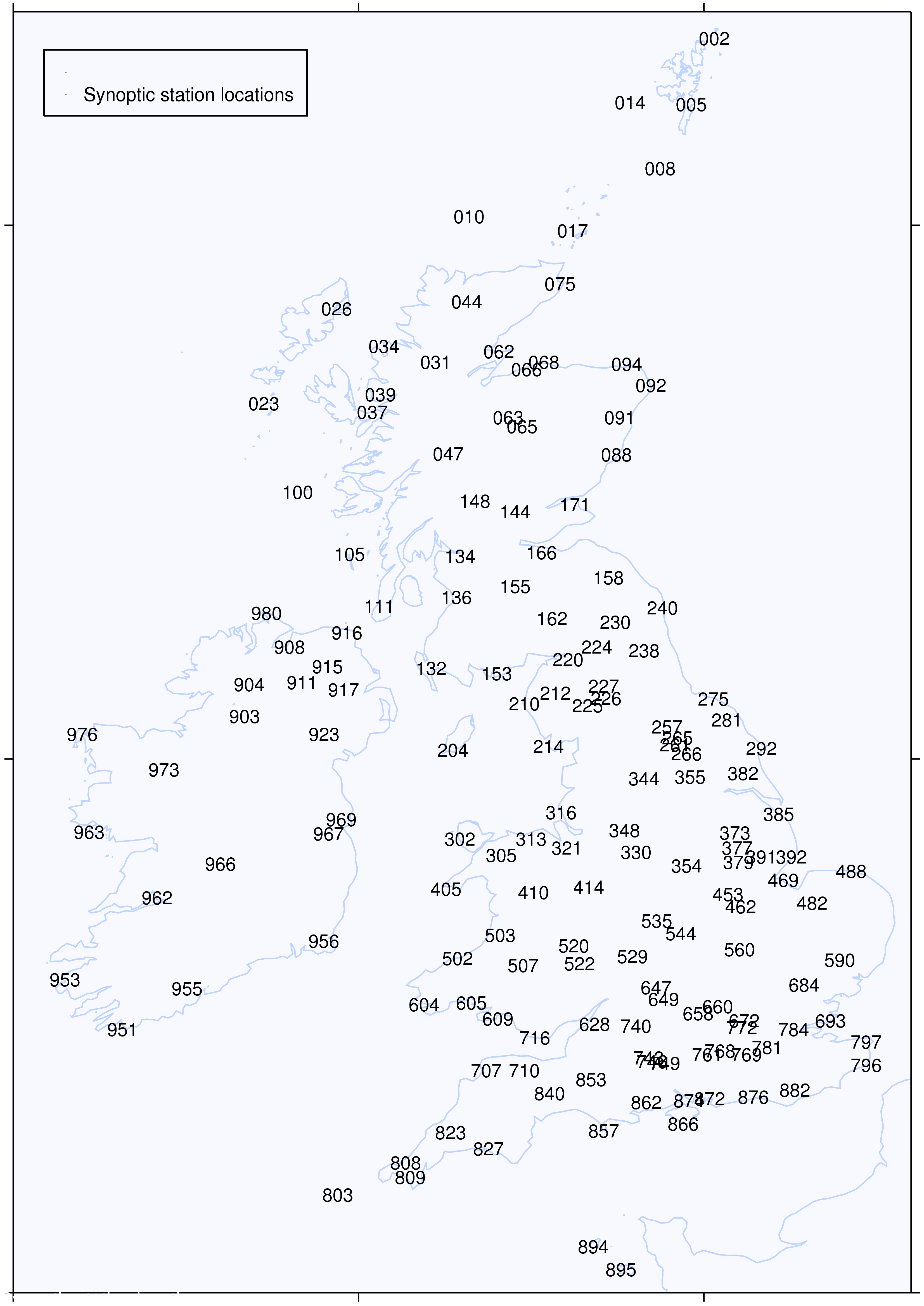
UK/Ireland synoptic station locations:
- Maidenhead weather