
September 2012:
More Flooding in the UK, September 24/25
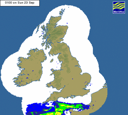
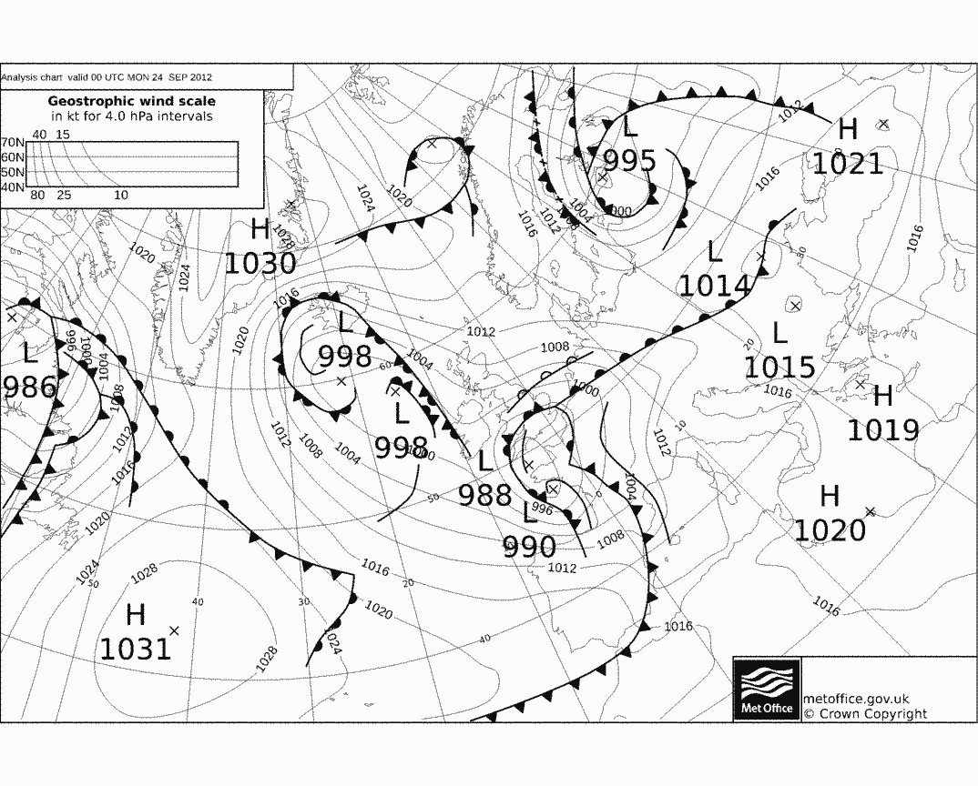
More flooding strikes the UK as an intense low pressure system (see Met Office Synoptic Chart), with lots of associated atmospheric moisture, tracks slowly over the UK from the south. Here is a Met Office radar animation of the rainfall intensity (pink is heavy, red is very heavy) from Sunday 23rd to Monday 24th September:
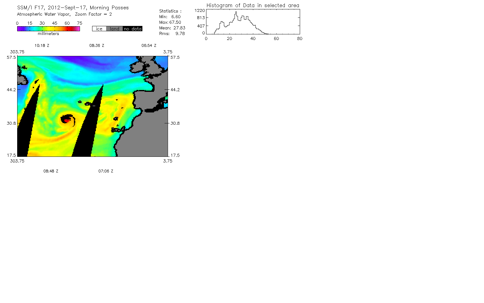
The depression is not the remnants Hurricane Nadine which is centred near the Azores (as noted by the Met Office). However, Remote Sensing Systems satellite passive microwave water vapour imagary indicates that large amounts of moisture (the fuel for heavy rainfall) were being steered up towards the UK with certainly an influence from the decaying Huricane.
A vertical cross section of the system on 23 September over the Bay of Biscay from active CloudSAT radar data shows the remains of Nadine centre left and convection in the warm sector to the right over northern Spain.
Flood warnings were issued over many parts of the UK (see BBC report and update). While recent research at the University of Reading has linked flooding in the UK with intense flows of atmospheric moisture during the winter half of the year (October-March), the large quantities of water vapour transported by the atmosphere are also key in detemining the nature of summer flooding events.
Richard P. Allan Location: Department of Meteorology (2U15)
