
Flooding in Newcastle, June 28 2012
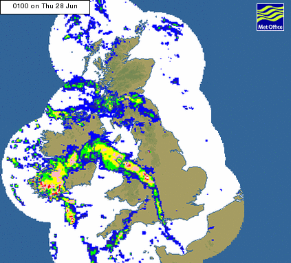
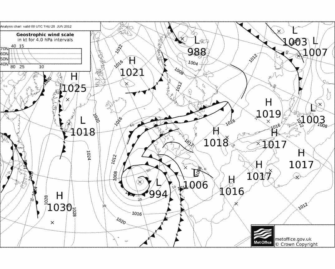
A series of intense thunderstorms crossed England during 28th June 2012 associated with a series of cold fronts (see synoptic chart below). In Reading it was mostly dry, hot and sultry (up to 26.5oC just after 4pm and over 90% humidty in the early hours at the Reading Meteorology field site).
The radar images (right) show some extremely intense rainfall rates over the Midlands (large hailstones were reported) while intense rainfall over Northumberland caused serious flooding in Newcastle (where the water failed to drain away rapidly enough) and a landslide closed the East coast trainline between Newcastle and Edinburgh causing difficulties for the organisors of a Changing Water Cycle workshop in Reading (which covered, amongst other things, extreme rainfall) who had to return to Edinburgh!
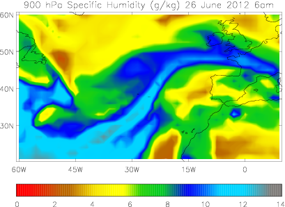
Data from the European Centre for Medium Range Weather Forecasts "Interim" reanalysis of the atmosphere 2 days before the flooding events show a toungue of very moist air extending from the sub tropics towards the UK (left). Recent research at the University of Reading has linked flooding in the UK with Atmospheric Rivers of moisture, like the ones shown, but for the winter half of the year (October-March). The diagram also indicates that these atmospheric flows are also associated with summer flooding events.
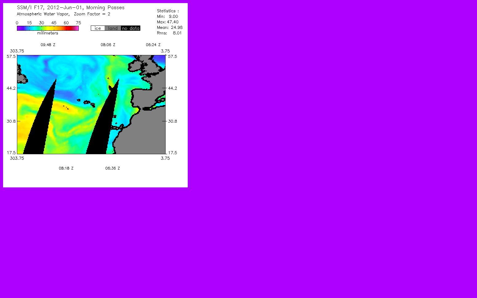
Although the flooding and intense rainfall was caused by the weather pattern (which wasn't unusual for summer in the UK) research (presented at the workshop) shows that a warmer atmosphere contains greater quantities of invisible water vapour (see animation), the fuel for intense rainfall, and this is why warming due to emissions of greenhouse gases is very likely to result in heavy rainfall becoming even heavier in the future
Flooding in Southern England, June 2012
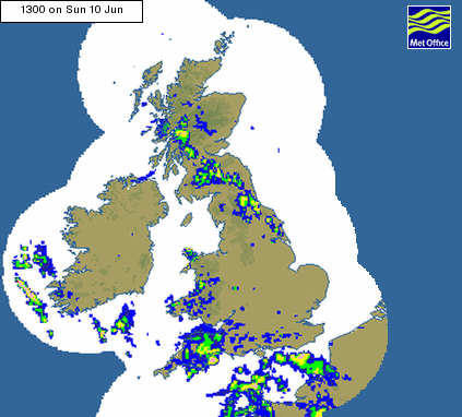
Here is an animation of the Met Office 'classic' radar images from 10-12 June 2012 (right) which shows an arc of intense rainfall associated with a low pressure system almost stationary over South East England. Following severe localised flooding in mid Wales a few days earlier, further flooding occurred in urban areas along the Southern coast, in particular West Sussex.
The flooding has been linked to an unusually southern track of the jet stream: specifically a deepening, stationary low pressure system over the Southern UK with rising air, cloud formation and heavy rainfall lingering over particular locations. The larger totals of atmospheric water vapour in the relatively warm atmosphere fuels the intense rainfall.
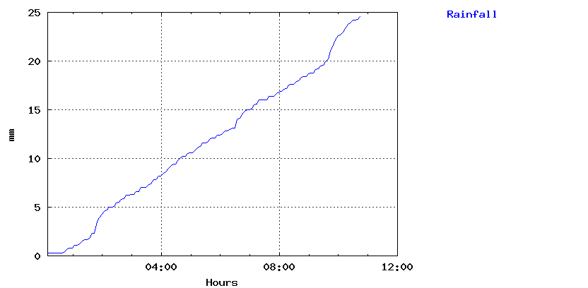
In Reading, the Meteorology department field site automated gauge recorded 25mm in 11 hours on the 11th (below) before the rainfall totals went off the scale (perhaps it thought it needed a break). The standard rain gauge at the Meteorology Department Atmospheric Observatory measured 40.7mm of rain over the 10-11th June period (observations taken at 9am). At the time of writing, more heavy rain was expected on the Friday, just in time for the Meteorology department BBQ and Barn Dance!
Richard P. Allan Location: Department of Meteorology (2U15)
