Menu
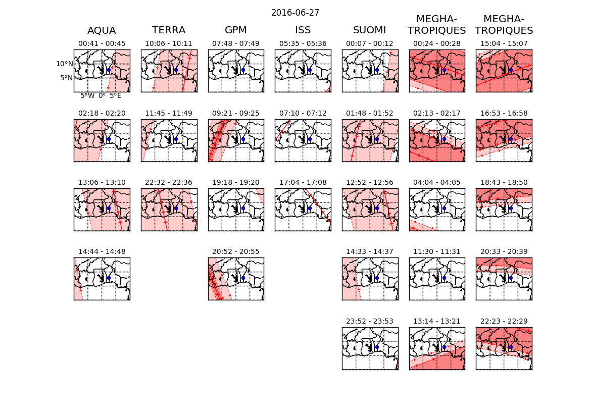
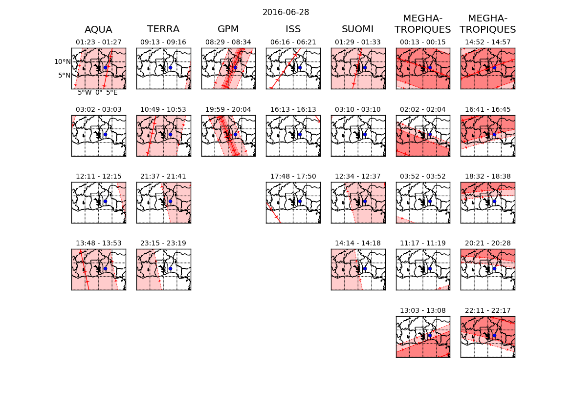
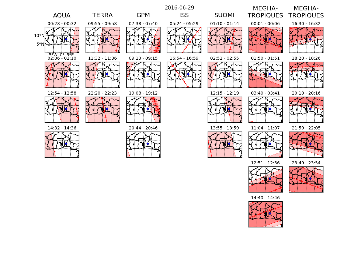
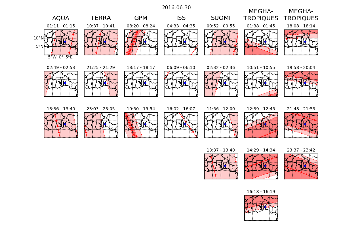
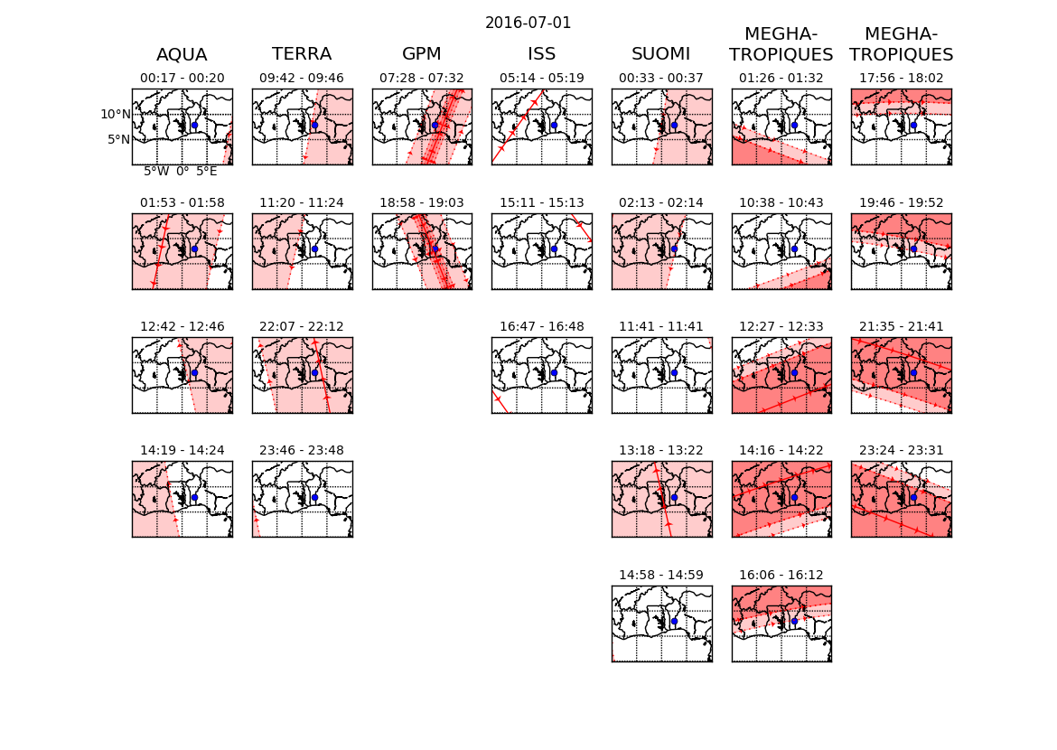
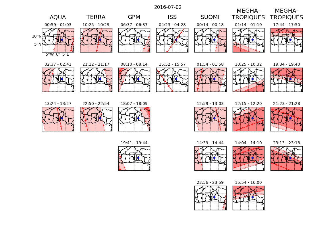
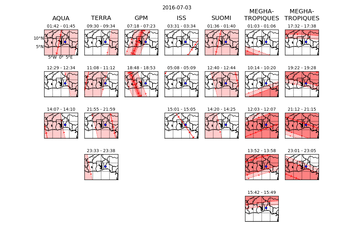
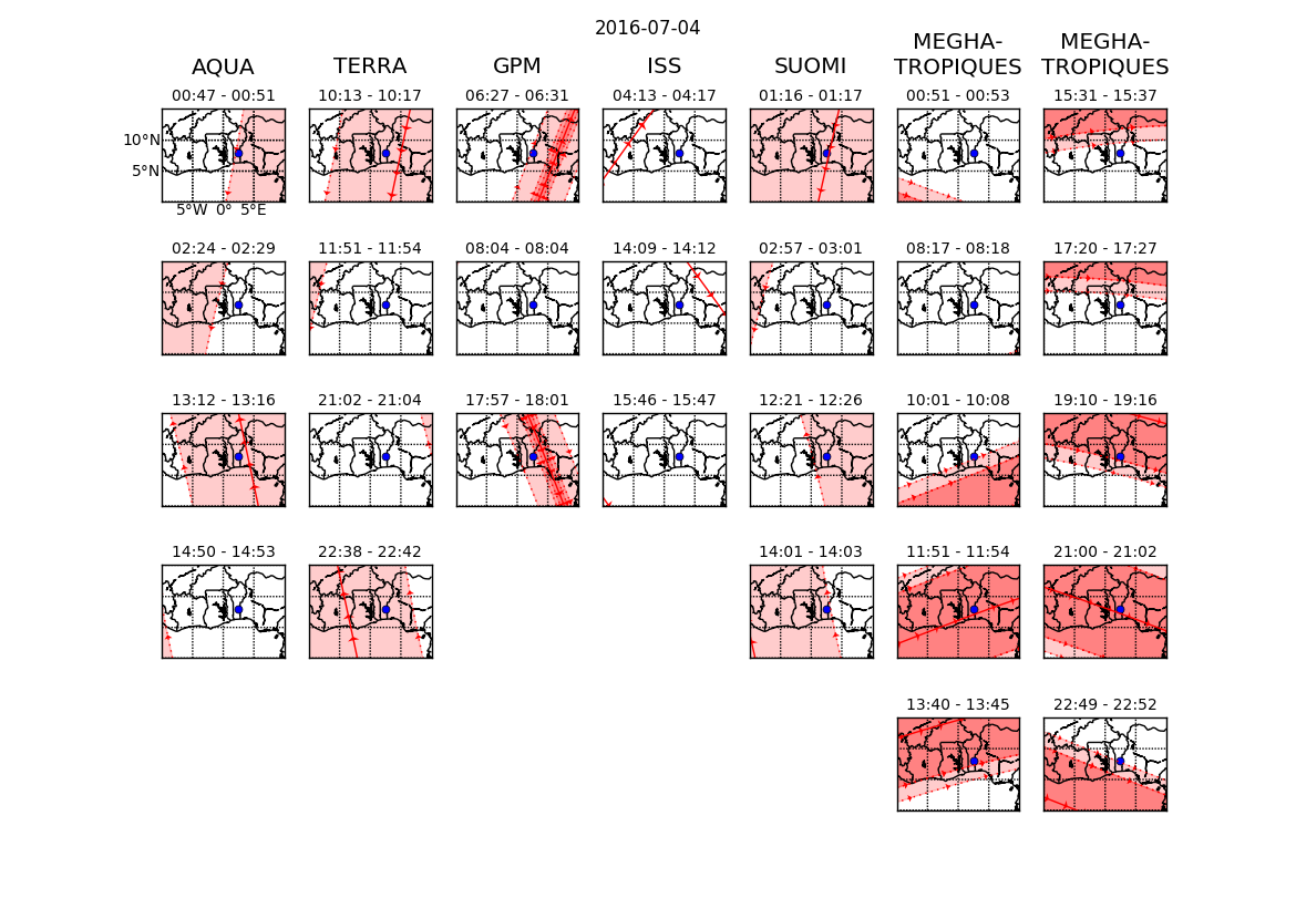
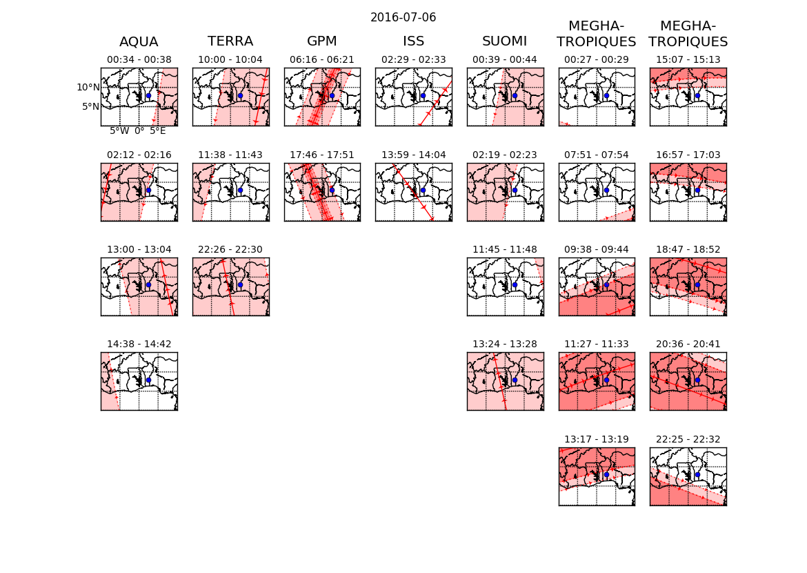
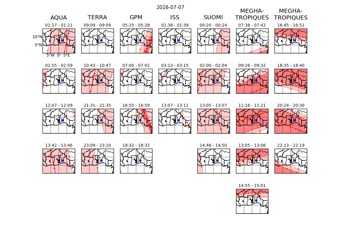
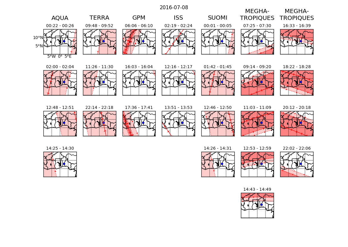
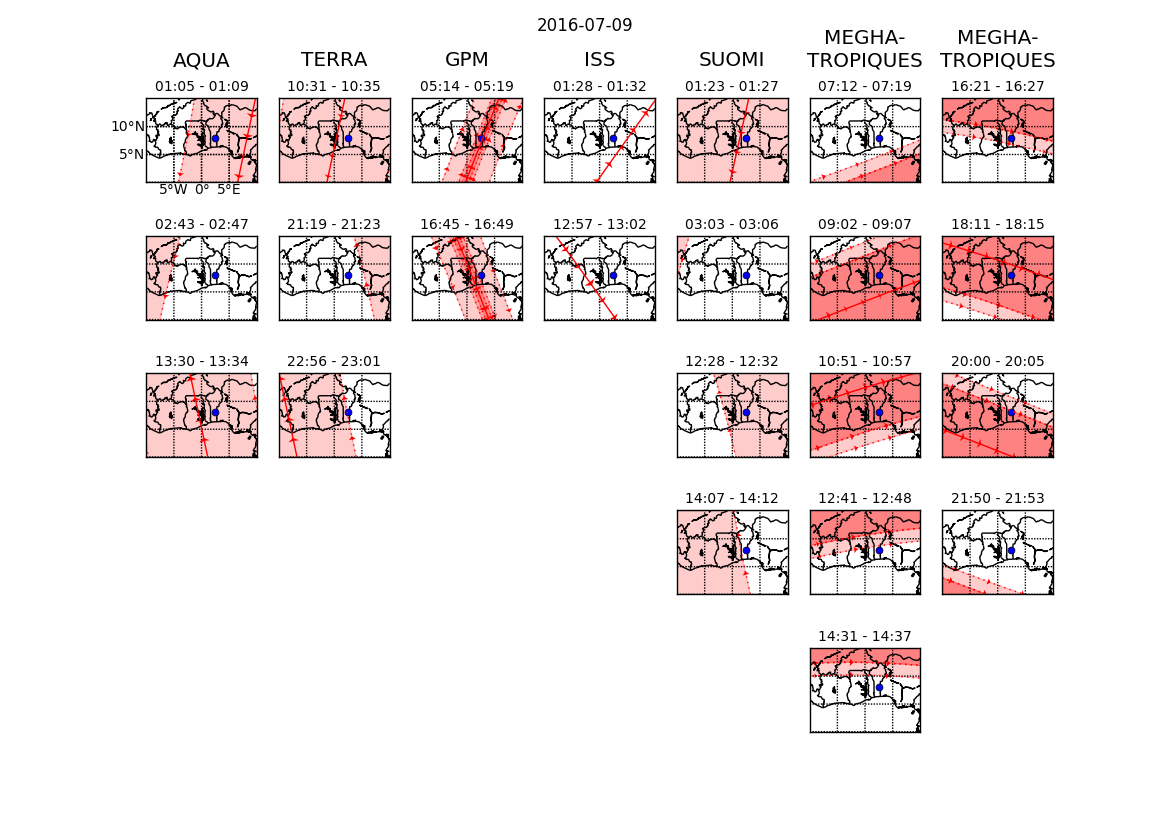
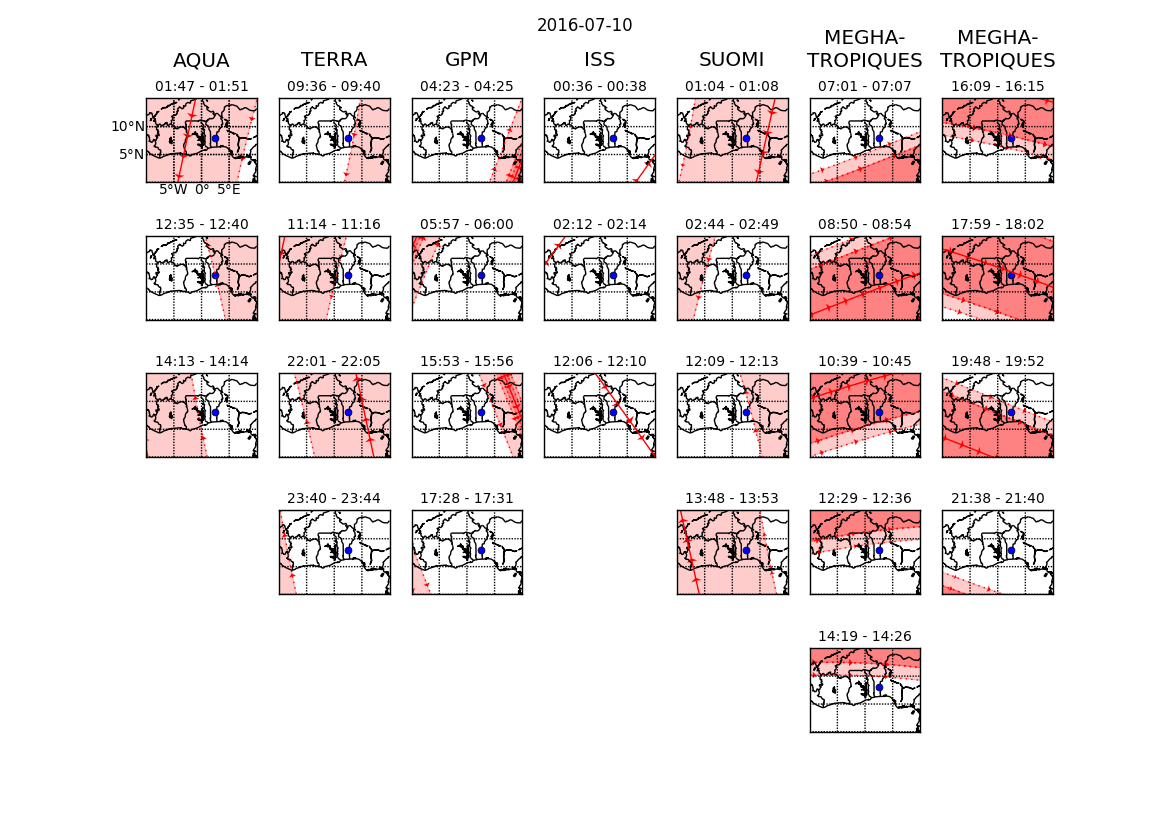
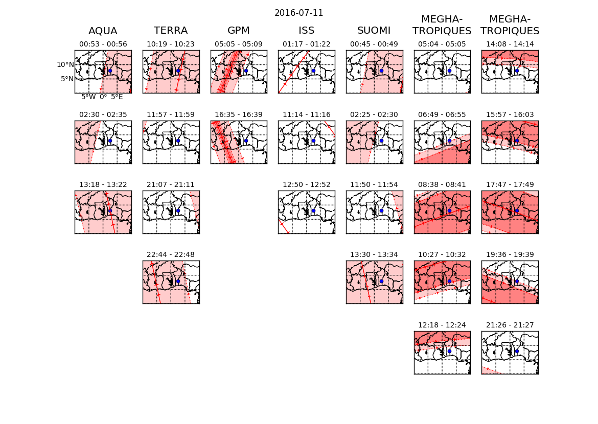
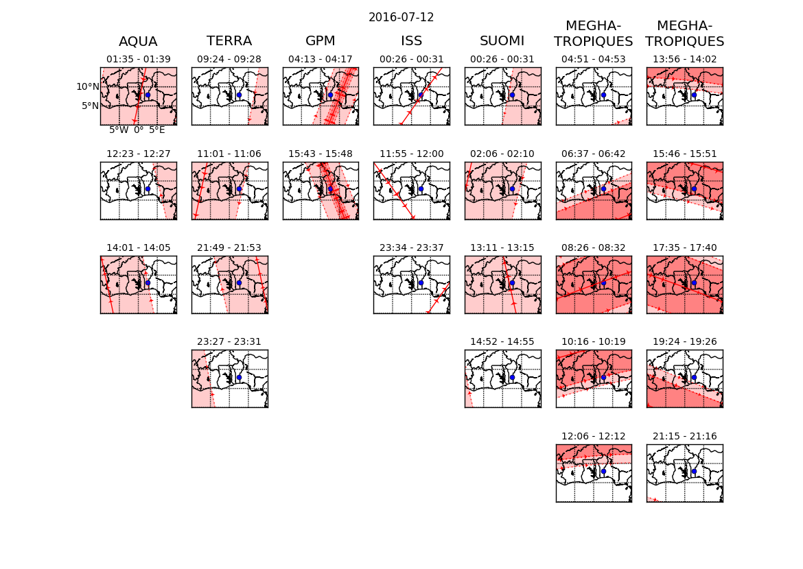
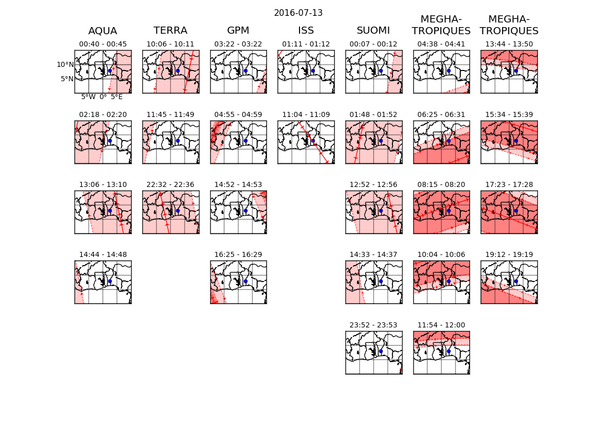
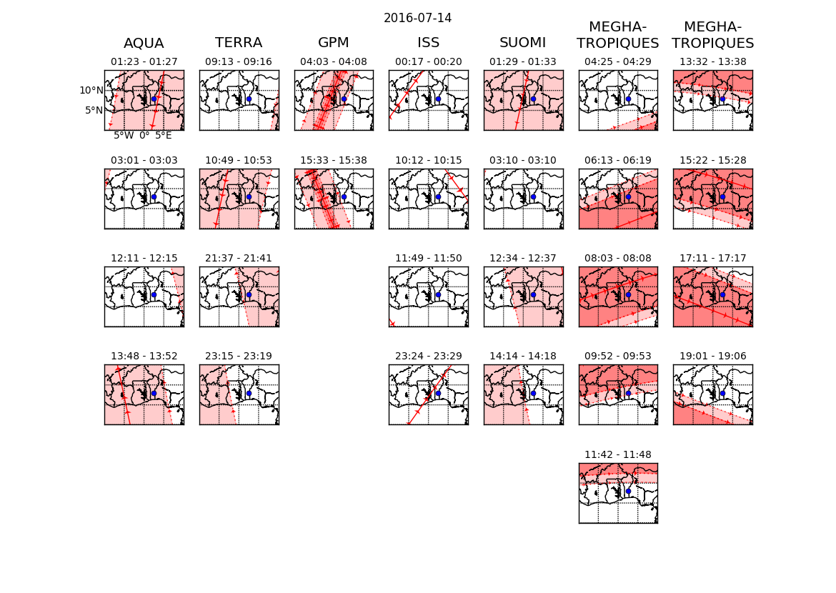
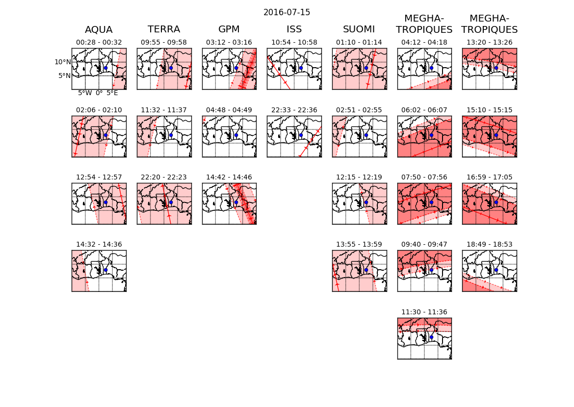
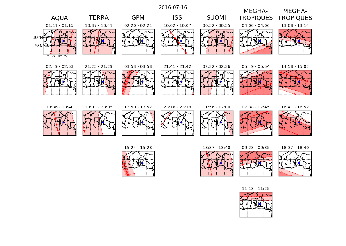
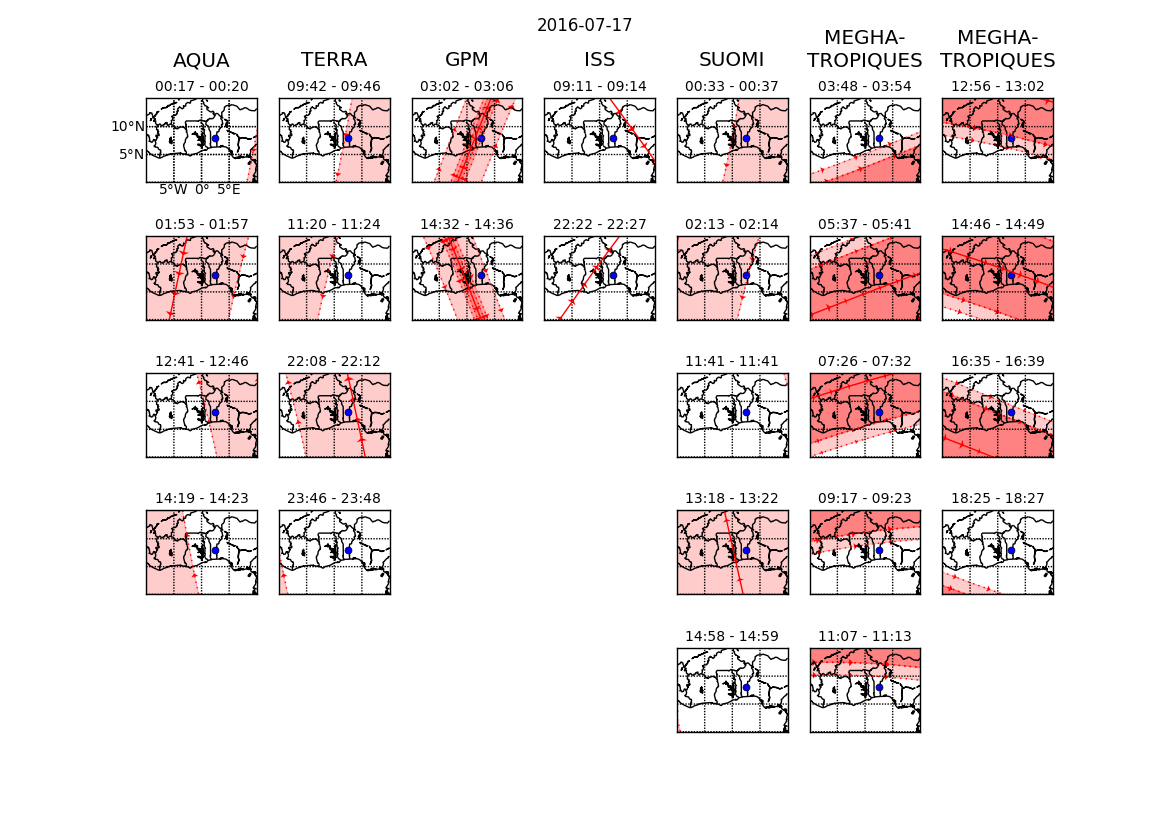
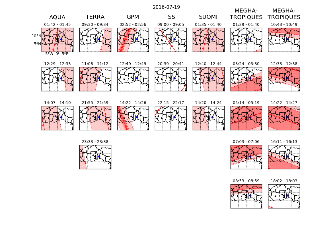
This page links to plots showing satellite overpasses during the DACCIWA aircraft campaign. For each satellite, the satellite ground track is shown by a thick red line, while instrument swaths are shown by red shading. The blue dot shows the location of the Savé supersite. Track data were obtained from the IPSL.
Satellites and the instrument swaths (from narrowest to widest) shown are:- AQUA: MODerate resolution Imaging Spectroradiometer (MODIS)
- TERRA: MODIS
- GPM CORE: Ka-band precipitation radar, Ku-band precipitation radar,Microwave Imager (GMI)
- ISS: Cloud-Aerosol Transport System (CATS)
- Suomi-NPP: Visible Infrared Imaging Radiometer Suite (VIIRS)
- MEHGA-TROPIQUES: Microwave Analysis and Detection of Rain and Atmospheric Systems (MADRAS), Sondeur Atmosphérique du Profil d'Humidité Intertropicale par Radiométrie (SAPHIR; swath width is the same as MADRAS), Scanner for Radiation Budget (ScaRaB)