Modelling
Key People:
Prof Sue Grimmond
Mariana Gouvea
Thomas
Loridan
Duick Young
Simone Kotthaus
NCAR Work
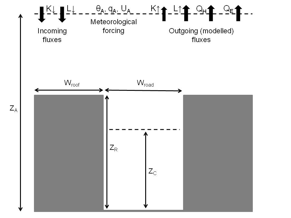
The focus of the project, funded by the US
National Science Foundation (NSF),
is the evaluation of the urban parameterization in the Weather Research
and Forecasting model (WRF). The Land Surface Model integrated in WRF
was recently coupled to an Urban Canopy Model (UCM) which represents
cities using a generic 2-dimensional canyon (see figure). We here
propose to validate the scheme with meteorological and energy flux data
obtained from urban field campaigns. Model weaknesses should be
investigated in order to improve the current modelling system in
cooperation with the National Center of Atmospheric Research (NCAR).
Developed as an open-source package, the WRF model is used for a wide
range of applications, ranging from operational meteorological and air
quality forecasting to emergency response. It also has great potential
as an assessment tool for climate change mitigation strategies or urban
planning.
JULES
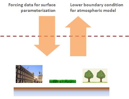
The Joint UK Land Environment Simulator (JULES) uses a simple approach
to represent the surface-atmosphere exchanges, having a low
computational cost and parameters requirement. It is currently being
evaluated in off-line mode through the simulation of a variety of urban
environments and the comparison of modelled results against local
measurements of the surface energy balance components. The urban sites
analysed in this project are representative of diverse surface
characteristics (thermal, aerodynamic and fraction of vegetation
cover), in view of a broad application of the model in heterogeneous
urban areas.
LUMPS
The Local-scale Urban Meteorological Parameterization Scheme (LUMPSv5)
is a surface flux model that utilises standard meteorological
observations and land cover characteristics. The model has the
capability to model variability in fluxes both spatially and
temporally. The LUMPS model has been coupled with a number of process
related sub-models to improve the parameterization of fluxes over urban
areas.
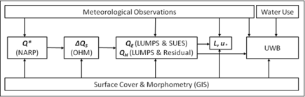
The sub-models implemented (see figure right) within LUMPS model; a)
the net all-wave radiation, Q*,
using NARP (Net All-wave
Radiation Parameterization); b) the storage heat flux, ∆QS,
using an Objective Hysteresis Model (OHM); c) the latent heat flux, QE,
using LUMPS and SUES (Single-source Urban
Evapotranspiration-interception Scheme); d) the sensible heat flux, QH,
using LUMPS and a residual model (using the surface energy balance). In
addition to these sub-models the Urban Water Balance (UWB) is currently
being added to LUMPS to model the urban hydrologic cycle (which impacts
on QE
and thus QH)
and assess the effectiveness of urban water management techniques.
Urban Water Balance (UWB)
The monitoring and modelling of the UWB is important in order to
investigate the effects of urban areas on the water cycle, the
effectiveness of water management techniques (e.g. rain water
collection and grey water recycling) and potential urban climate change
mitigation (e.g. green roofs and urban vegetation/trees).
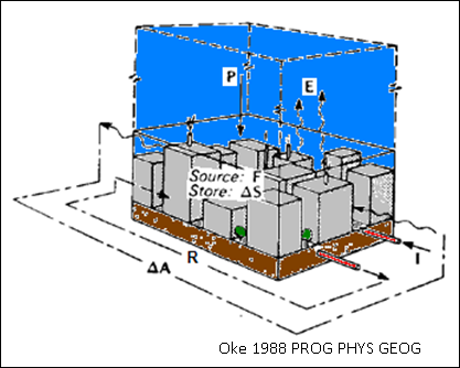
The UWB is modelled (see equation below) using a mass balance approach
applied to the transfer of water through a specified area or
catchment (a schematic of the UWB applied to a neighbourhood catchment
is shown left). The UWB model can be linked to surface energy based
models and parameterizations (e.g. LUMPS, UCM) due to a link to the
surface energy balance by the evaporation term, E.
P + I + F = E + R + ∆S +
∆A
Precipitation + Piped
Water Supply + Anthropogenic Water Release = Evapotranspiration +
Runoff + Net Change in Storage + Net Moisture Advection