Ice formation in supercooled clouds
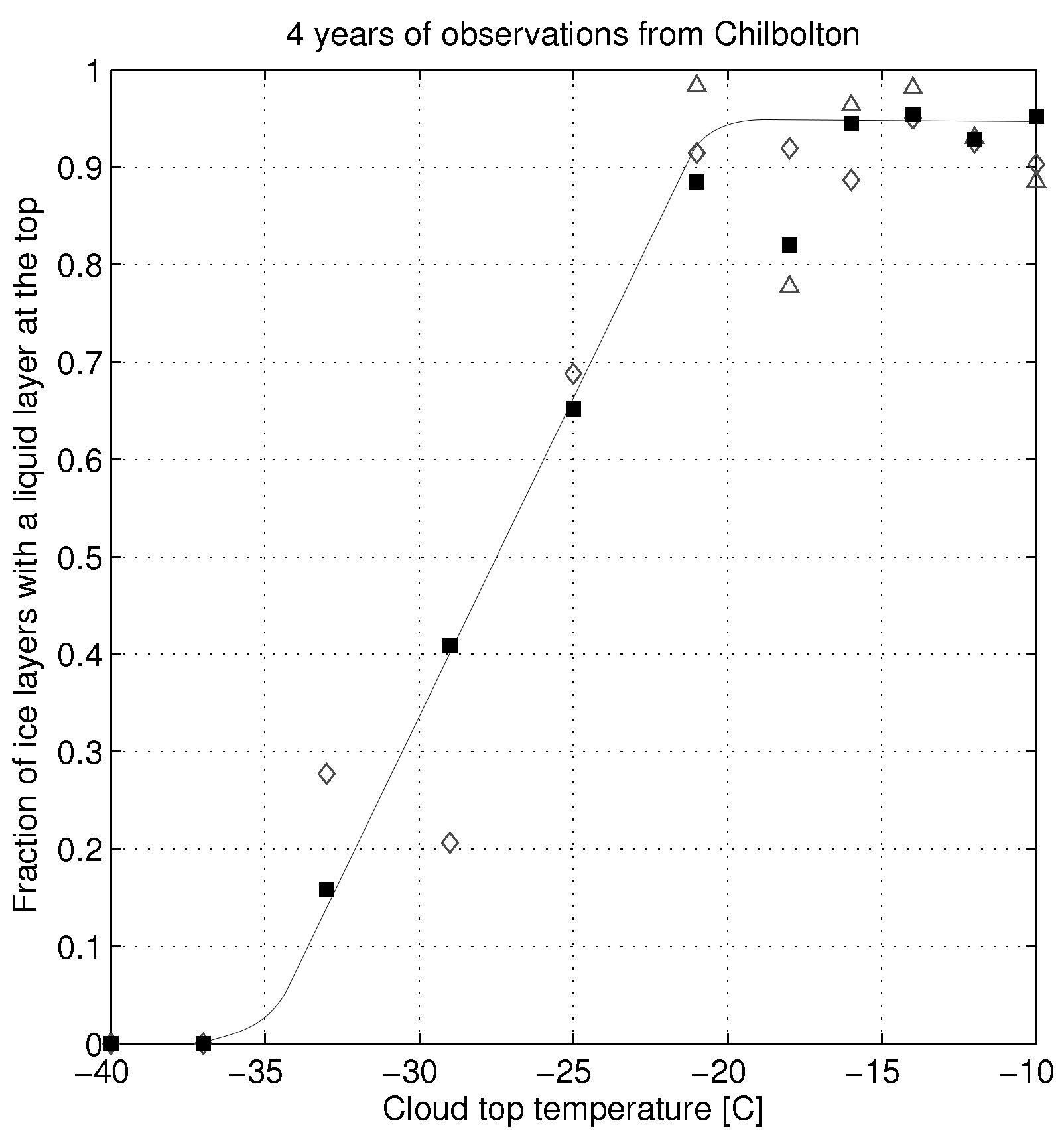
The way that ice crystals form in the atmosphere is not very well understood. We quantified how often liquid water is present at the top of ice cloud layers using the radars and lidars at Chilbolton: see the plot below. You can see that at temperatures > -22C or so, almost all ice particles seem to originate from a liquid layer. This is evidence that ice is formed primarily via freezing of liquid droplets at these temperatures, and the plot indicates that this is the primary nucleation pathway even in quite cold clouds. For more info, see our paper in GRL.
Time-dependent freezing of droplets in persistent supercooled clouds
In 2009 we sampled a persistent supercooled layer cloud which was quasi-stationary and present over the Chilbolton Observatory for approximately a day. During this time the cloud produced ice particles continuously - aircraft measurements in the cloud suggest that this flux of ice was about 100 crystals per square metre per second. This raises the question: how does this continuous supply of particles occur, when our current understanding of ice nucleation is that IN are rare and activated on very short timescales (the 'singular' model of nucleation)?
It also begs the question of how the droplets persist, despite the loss of water vapour to the ice crystals.
Our conclusion was that the observations could not be reconciled with the singular model of ice nucleation. We propose that freezing is actually a time-dependent process: this time-dependence is irrelevant in a cumulus cloud, but for layer clouds where the rate of cooling is much slower, the slow activation of nuclei is crucial.
We also estimated the vapour flux from the droplets to the ice crystals using the aircraft observations. This showed that the loss of water vapour was actually rather modest, because the crystals were quite small. The loss rate could be explained quite easily by a small long wave radiative cooling of the cloud.
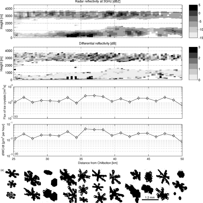
Co-located radar and in-situ measurements from the supercooled cloud layer, including derived fluxes
More details are in our QJ paper.
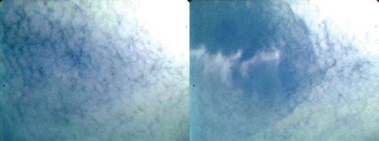
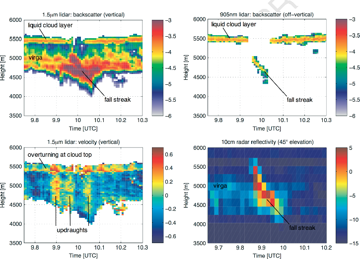
Observations of a glaciating 'hole-punch' cloud
We were lucky enough to make some remarkable remote sensing observations of a fallstreak hole or holepunch cloud. These are produced when an aircraft penetrates a supercooled liquid cloud layer. More details can be found in our paper.