
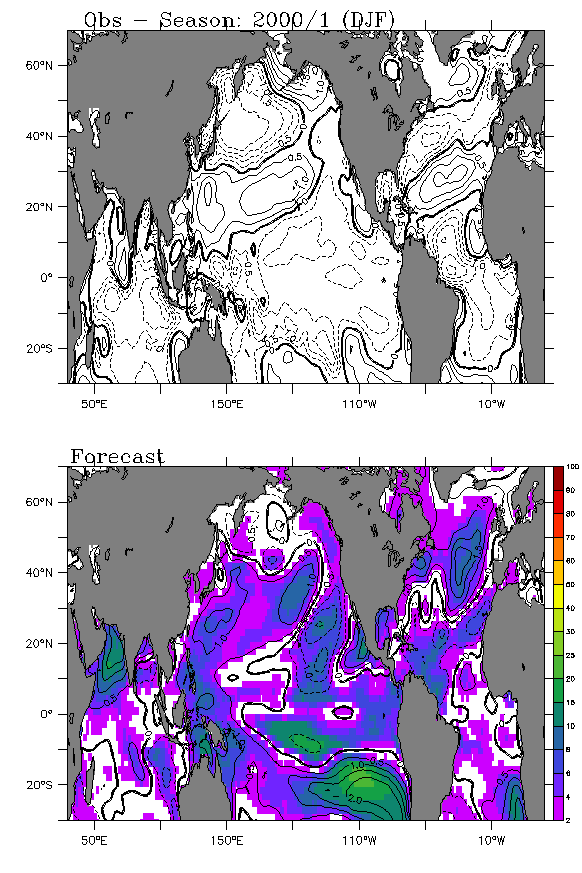
Click here for SysII paper info.
Click here for model forcing background.
|
|
Click here for main page. Click here for SysII paper info. Click here for model forcing background. |
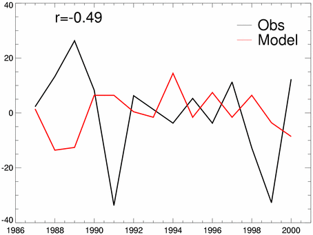
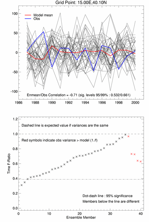
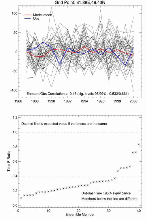
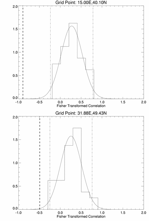
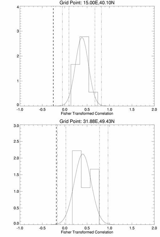
A further plot looking at these two regions. Here, ensemble member correlations with their mean are calculated and their distribution fitted. Dot/dash lines represent +/- 2 dtandard deviations, and the thick dashed line represents the correlation of the observation with the ensemble mean.
The same plot using the 9-ensemble DEMETER runs.
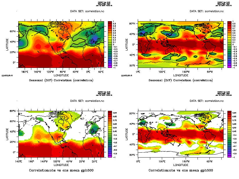
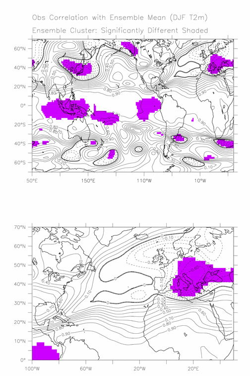
Extending this analysis to a global sense. Shaded regions indicate correlations significantly (99%) outside the ensemble correlation cluster. Differences can be explained by:
The final season problems seem to be due to a generally bad simulation, coupled to a high predictability suggested in the South Pacific.
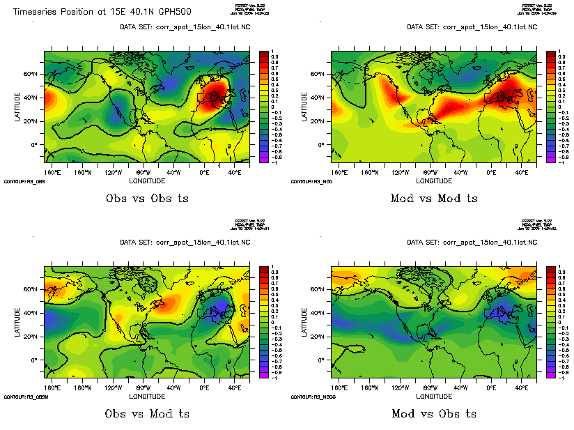
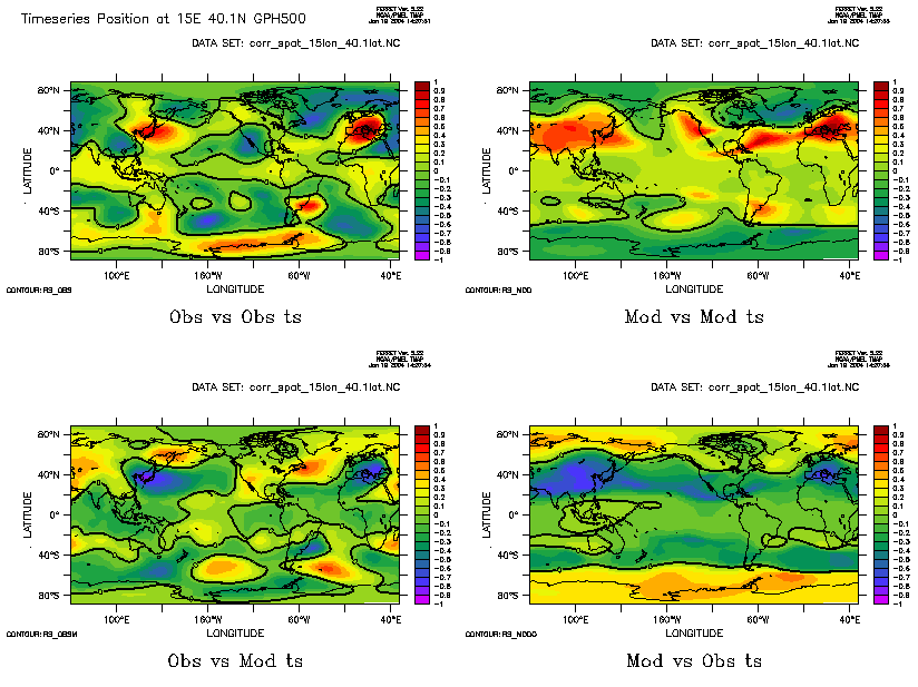
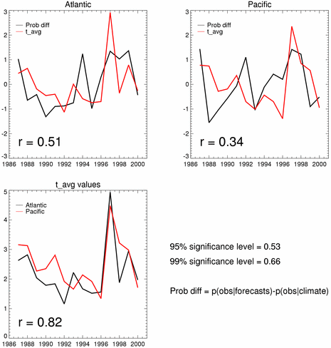
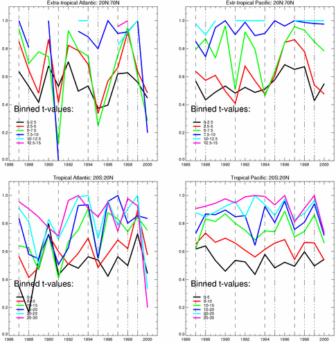
Breaking the regions down and applying the same analysis leads to this. The longitude extents are 260W:110W (Pacific) and 110W:35E(Atlantic). Latitude bands (tropical and extra-tropical) are indicated in the plot titles. El Nino years are indicated by overplotted dashed line, La Nina by dot/dashed lines.
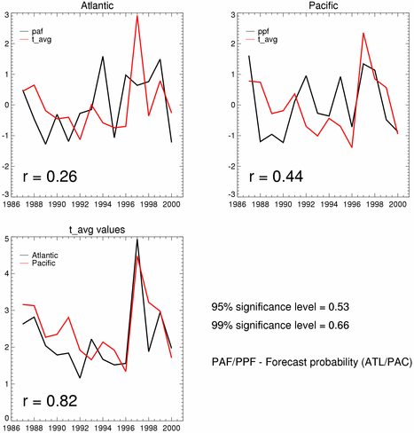
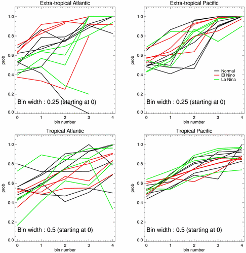
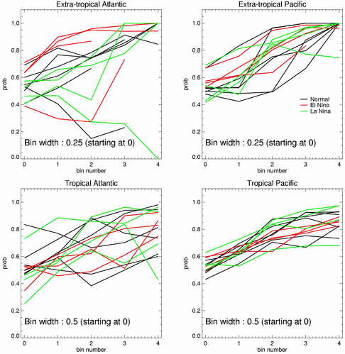
Same data plotted again, this time with rval vs probability (each year represented by one line).
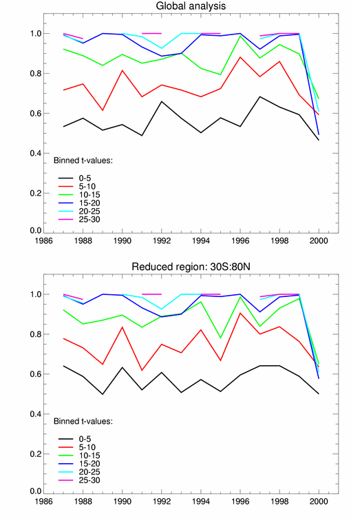
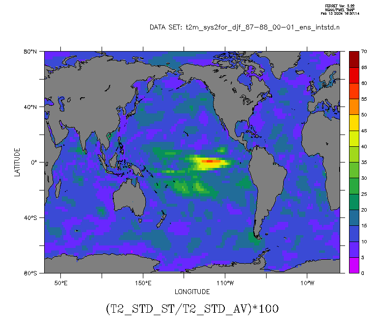
The above results calculate a t-val using a time averaged intra-ensemble standard deviation in the demoninator. Producing the same plot again with a time varying demoninator produces only small differences. Thus, the temporal variability of the variability is much less than the intra-ensemble variance. This can further be illustrated by a plot of the t2m (stdev(stdev_i)/avg(stdev_i))*100 (giving a percentage). It can be seen that there are areas of significance in the tropical Pacific.
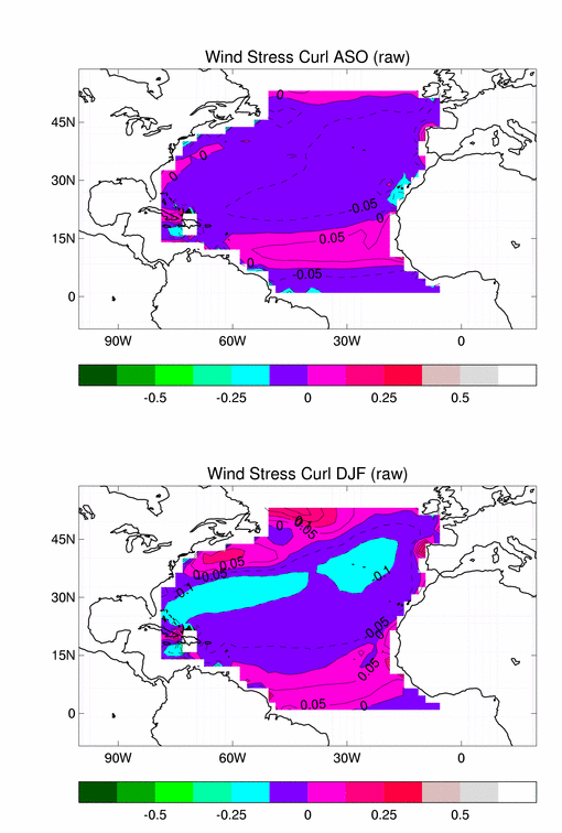
Click here to compare ASO wind stress patterns
with DJF.
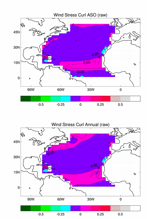
Click here to compare ASO wind stress patterns
with mean annual field.