British Isles weather diary
- January 2000
- February 2000
- March 2000
- April 2000
- May 2000
- June 2000
- July 2000
- August 2000
- September 2000
- October 2000
- November 2000
- December 2000
(Note: figures in parentheses give an indication, from first reports, of the spread of daily max and min temperatures, min daytime temperatures (occasionally), rainfall and sunshine in the 24 hours ending 1800 GMT.)
Rain cleared SE England during the morning of the 1st while in Scotland and parts of N England clearing skies led to an early air frost. Fog patches lingered for much of the day in parts of England and S Scotland, with another area of rain affecting W Ireland and Scotland during the afternoon and evening. Parts of N England had a very sunny day. (Guernsey 12C, Topcliffe -4C, Aultbea 28mm, Beverley 7.1h.)
The 2nd dawned mainly cloudy; wintry showers in N Scotland during the morning were accompanied by gusts to 50kn. It remained cloudy in most places, with damp, drizzly conditions in S England, and fog in SW England for much of the day. During the evening gales spread to exposed parts of N Ireland and W Scotland with Malin Head reporting 58kn gusts at midnight. (Guernsey 12C, Shrewsbury -1C, Loch Glascarnoch 29mm, Colwyn Bay 4.8h.)
The 3rd began with windy conditions over the entire British Isles, especially over N Scotland. Reports included: 0300GMT Stornoway 58kn gusts to 82kn; 0600GMT Kirkwall 53kn gusting to 80kn; 0900GMT Lerwick 63kn gusting to 89kn). At 1100GMT Lerwick was reporting 92kn gusts. Thousands of homes were without power in N Scotland, and all ferries were cancelled in the Northern Isles. This gale was of exceptional severity in the Western Isles, peaking at 0400GMT. Some islanders describe it as the worst in living memory. 4,700 houses without power in Western Isles, most had power restored by 2000hrs. At Stornoway airport 13 vehicles had their windows smashed by flying debris and a gust of 92kn was recorded at 0400GMT (resulting in the issuing of an emergency FLASH weather message). At Ness (Isle of Lewis) there was considerable structural damage to many buildings; Cross Free church roof was badly damaged, and a number of caravans and sheds were completely destroyed. On the Isle of North Rona a gust of 125mph was recorded. Conditions over Cent. Scotland and S'wards were much less severe, although the ski slopes in the Cairngorms were closed due to blizzard conditions; however, many people braved 60mph winds on the slopes at Glenshee and the Lecht. 600 construction workers at the oil rig at Nigg on the Cromarty Firth, working on the largest steel structure ever made for the North Sea, were sent home as winds gusted to 80mph. Over S counties of England it remained damp with rain and drizzle for much of the day, this spreading to parts of the Midlands and east Anglia for a while; further N it was generally brighter with showers, these being of hail and snow over parts of Scotland. (Guernsey and Culdrose 12C, Fylingdales and Aviemore 3C, Bournemouth 22mm, Scarborough 4.1h.)
The 4th again dawned dull over S England, with drizzle and fog patches, the latter extending into the Midlands during the morning. There was some flooding in SW and Cent. S England. Further N it was a showery day, with snow and hail in Scotland, N England and N Ireland. During the afternoon and evening skies cleared in all areas, with the exception of a few wintry showers over W coasts and on high ground in Scotland. A tornado was reported from the village of Wideopen, about 12km N of Newcastle upon Tyne, at approximately 1400GMT, and thunder was reported from Anglesey around midday. (Guernsey 12C, Aboyne -3C, Eskdalemuir 16mm, Jersey 4.4h.)
The 5th clouded over before dawn in most areas and temperatures rose, but in the extreme SE there was still a ground frost by 0600GMT. It was a mild day everywhere, with bands of rain and strong S winds moving SE across the British Isles; the rain was heavy in parts of Scotland and was followed by showers in the W later with skies clearing over Ireland. Gusts to 60kn were widely reported during the morning over exposed N and W coasts. (Falmouth 12C, Tulloch Bridge 8C max, Redhill -3C min, Tulloch Bridge 49mm, Guernsey 4.2h.)
SW winds (with gusts over 40kn in the NW) brought a mild start everywhere on the 6th, although these turned to a more NW direction in all places during the day as an area of rain moved S. Skies cleared after the rain, although only temporarily over Ireland and Scotland as further rain and gales extended to many araes there by midnight. (Falmouth 15C, Loch Glascarnoch 1C, Loch Glascarnoch 23mm, Scarborough 6.2h.)
Northern parts of the British Isles began the 7th with rain and strong winds, which resulted in several bridges being closed to high-sided vehicles. Over S England clear skies led to an air frost in places, before skies clouded over as the rain moved slowly SE, reaching the Midlands and SW England by midnight. Strongest gusts included 68kn at Stornoway (0000GMT), 66kn at Belmullet (0600GMT) and 48kn at Valley (1500GMT). The clearance of the rain was floowed by showers of rain and hail in W Scotland and W Ireland. (Rosehearty and Penzance 12C, Redhill -3C, Stornoway 35mm, Bognor Regis 3.9h.)
The cloud and rain cleared SE England by mid-morning on the 8th, with the British Isles then having a sunny day. There were showers of hail (13mm diameter reported from Fair Isle) and rain on W coasts of Ireland and Scotland (with stong gusts in the N including 69kn at Lerwick at 0600GMT), with snow showers over high ground in Scotland (and later N England) and thunder in the Northern Isles. (Torquay 12C, Fylingdales 1C, Shap Fell 20mm, Folkestone 6.7h.)
The 9th dawned frosty over much of England, and with snow showers in parts of Northern Ireland, Scotland and NW England. These showers gradually died out as pressure built everywhere although by midnight the wind had backed to the SW in NW areas of Scotland and Ireland, gusting to 45kn at Stornoway at midnight, and cloud pushed E there. (Penzance 11C, Chipstead Valley -7.4C, Folkestone 7.1h.)
England, Wales and S Scotland woke to a widespread air frost on the 10th; over N Scotland and Ireland cloud and rain moved E during the early hours with gusts to 60kn in the W. The cloud spread SE during the morning to affect all but the extreme SE corner of England. The rain lessened as it spread SE, giving only light falls in the Midlands and East Anglia by midnight, while a clearance behind the rain over N and W districts was followed by rain showers. (Falmouth 11C, Holbeach 3C min, Redhill -6C, Lusa 28mm, Herne Bay 6.4h.)
Early on the 11th partly-clear skies led to a few ice patches on untreated roads in Scotland. However skies soon clouded over and the day was a cloudy one over all of the British Isles, with spells of rain or drizzle in most places. Falls were very light in the S, but heavier during the afternoon over N Ireland, N Wales, NW England and S Scotland. (Hawarden 13C. Aboyne 0C, Capel Curig 62mm, Jersey 2.7h.)
The 12th was another cloudy day almost everywhere, with rain and drizzle in most areas at some time. Many roads in Cumbria were flooded by dawn after recent heavy falls, while there were reports of sleet in NW Scotland. 54.6mm fell in the previous 24 hours in Brampton, NE Cumbria; river Eden burst its banks in Carlisle and Haltwhistle to the E was under 4ft of Water after the River South Tyne had burst its banks. During the late afternoon and evening the cloud cleared partially over Ireland and W Scotland, with scattered showers. Over Ireland rainfall amounts rainged from 40mm in the SW to about 20mm in the E. Heavy rain that had affected North Wales since the 10th cleared today; in the period 0900 on the 10th to 1800 on the 12th, Capel Curig (Gwynedd) recorded 163 mm and Llansadwrn 86 mm rain. The 24-h fall at Llansadwrn ending 0900GMT today was 40.6 mm - the largest fall since 8.12.1983. Many roads and some houses were flooded in Anglesey; at Beaumaris the moat at the Castle overflowed and flooded the main street. In Gwynedd the A55 Expressway was flooded as was the A498 at Nant Gwynant. Later in the evening rain turned to sleet/snow in NW Wales and parts of NW England and Staffordshire. (Falmouth 11C, Kinloss 3.5h.)
Overnight rain over much of England moved steadily SE during the 13th, finally clearing E Kent by mid-afternoon. Clear skies led to a widespread ground frost in Ireland and a sharp air frost in parts of Scotland. Showers affected Scotland and W parts of Ireland and Britain, with snow falling on high ground in Wales and Scotland, and N gusts to 50kn reported from NW coastal areas. The summits of Snowdon and the Carneddau mountains were this morning covered with a moderate fall of snow, this extending with slight covering down to 300 m in the Nant Ffrancon Pass and elsewhere. There was a snow cover above 250m over Birdlip and the north Cotswolds, and some sleet fell in the early hours in Cirencester. In Aberdeen surface glaze was observed in the afternoon. A lack of heavy snow over recent days, however, meant that most snow cover was restricted to the high ground of the Highlands, with a few patches in S Scotland and N England. (Exmouth 9C, Spadeadam 1C max, Aboyne -6C min, Scarborough 16mm, Leeds 5.9h.)
A clear start to the 14th led to air frost in many places in England, although cloud over Scotland and in the E produced light snow as far S as Hampshire and freezing drizzle during early morning in East Sussex. Light precipitation continued to fall at times over E parts of Scotland and England during the day, this being wintry in places. Ireland, Wales and W areas of England had a mostly sunny day. (Penzance 8C, Benson -6C, Scarborough 17mm, Penzance 7.3h.)
The 15th saw a continuation of dull weather over E and S England, although East Anglia brightened up later. Precipitation fell here as light rain, and rain also fell in N Scotland. W districts again had a mainly fine day, after a cold start, under the influence of a building anticyclone. (Guernsey 9C, Machrihanish -5C, Scarborough 15mm, Ronaldsway 7.1h.)
The 16th was mainly dry everywhere as pressure continued to rise. Parts of S Scotland had a cold start to the day, and cloud cover was extensive in some areas of the British Isles during the day. The MSl pressure reached 1047.2mb at Belmullet at 1200GMT. (Aboyne 11C, Eskdalemuir -5C, Folkestone 2mm, Penzance 6.4h.)
The northerly flow around the large anticyclone to the W continued on the 17th. Clear skies brought early fog patches to parts of S England and freezing fog to parts of S Scotland. The fog clearance was followed by sunny spells over much of Scotland and N England but by cloudy conditions (with some light precipitation) over much of Ireland and parts of S England. Fog reformed by midnight in many places from Hampshire to S Scotland. (Boulmer 12C, Morecambe 3C mx, Eskdalemuir -6C min, Kirkwall 1.5mm, Leeds 7.4h.)
The 18th was a rather cloudy day in many areas, a notable exception being parts of S Wales and SW England. Mist and fog was reported intermittently thoughout the day in parts of NW England, the Midlands, S England and S Wales - being particularly persistent at Ringway. Light rain and drizzle fell from the cloud over Ireland and Scotland, and down the E coast of England. Fog during the evening led to the cancellation of the Carlisle-Wigan football match. (Leuchars 12C, Redhill -3C, Loch Glascarnoch 5mm, Teignmouth 7.8h.)
With pressure remaining close to 1040mb over the British Isles, 19th was another quite day. Most araes were cloudy, with light falls of precipitation over E coast districts and in SE England. Even Valentia was reporting recent drizzle at 0900 GMT with MSL pressure of 1040.3mb. Fog and mist affected parts of England and S Scotland during the morning, and later in the evening. (Guernsey 9C, Saughall -1C, Clacton 3mm, Leeds 5.1h.)
Clear skies away from the coast over England led to a frost in places by dawn on the 20th, and early fog was reported widely over Cent. S England as anticyclonic conditions persisted. The fog soon cleared as a cloud cover developed with most of the British Isles then having a mainly cloudy day. There was rain or drizzle at times over many parts of the British isles, although SE Scotland remained mainly sunny once pre-dawn cloud had cleared. It was noticeably cold in SE England. (Strathallan 9C, Kenley and Herstmonceux 3C max, Benson -6C min, Loch Glascarnoch 6mm, Leuchars 5.8h.)
The 21st began with some fog patches in the Midlands and N England, and an air frost in S Scotland and parts of N England. Light precipitation over W Scotland and W ireland around dawn extended to Wales and S England during the morning while mist and fog reformed during the afternoon over N England and S Scotland. Most other parts of E England had a mainly sunny day, while over N Scotland a cold front introduced wintry showers and gusts to 40kn. (Penzance 10C, Eskdalemuir -4C, Baltasound 8mm, Leeds 7.6h.)
The cold front moved S over the entire British Isles on the 22nd, introduced a cool N airflow. Gusts to 50kn were recorded in N scotland and on the E coast of England and there were snow showers over the Northern isles and on high ground in Cent. Scotland. Hail fell as far S as SE England with thunder in S London, and slight snow showers also fell down the E coast of England. (Penzance 10C, Lerwick 0C, Loch Glascarnoch 17mm, Bournemouth 6.2h.)
An air frost occurred on the 23rd in S Scotland and N England as the N airflow continued. Wintry showers fell over Scotland and snow pellets fell as far S as S England. During the afternoon cloud moved E across Scotland, introducing milder air and rain to many areas by midnight. (Guernsey 10C, Saughall -5C, Newcastle-upon-Tyne 3mm, Bognor Regis 8.0h.)
Skies clouded over from the E over Ireland and Wales before dawn on the 24th, with sleet reported from Dorset and snow in the Midlands by dawn. Light rain over Scotland moved S to N England and Ireland during the morning, later reaching N Wales. Inland parts of S England cleared during the late afternoon and evening (following some light snowfall in Hampshire), to give a widespread air frost by midnight. (Strathallan 10C, Buxton (Derbyshire) 3C max, Loch Glascarnoch 14mm, Leuchars 7.3h.)
The 25th dawned with a patchy cloud cover over the British Isles; a widespread air frost occurred where the cloud failed to form, and there were freezing fog patches in parts of the Midlands, East Anglia and S England. Light snow fell around the Cotswolds before dawn. It remained dull and turned increasingly misty over S and E England during the day (becoming foggy in S England during the evening), while in Cent. Ireland many places had thick fog from mid-morning onwards. Some light rain and drizzle fell in parts of N Scotland and NE England. (Red Wharf Bay 9.3C, Redhill -7C, Loftus and Bedford 1.2mm, Jersey 8.2h.)
The 26th started with clear skies in most parts of the British Isles, and a widespread air frost except in N Scotland and in coastal areas. Freezing fog affected parts of the Midlands, S England and E Ireland around dawn, and this fog persisted for much of the day in parts of Ireland, S Midlands and Cent. S England with temperatures hovering around freezing point in places. N and W parts of Scotland reported some light precipitation but most other places had a sunny day, although during the evening cloud and light precipitation did spread to S Scotland and N Ireland. At Dun Laoghaire fog persisted all day, having started on the 25th, being thick at times with a maximum temperature of 2.7C (the coldest day for 3 years). (Guernsey 9C, Brize Norton 0C min, Larkhill -8C, Aultbea 2mm, Jersey 8.7h.)
Clear skies brought another cold start to S England and S Wales on the 27th with patches of thick freezing fog. Cloud and light precipitation over Scotland and N Ireland spread S, finally clearing the fog around Dublin and giving some light rain as far S as Wales and Cornwall by midnight. In the Norther Isles hail fell, while SE England remained clear and a widespread frost formed there after dark again. (Penzance 9C, Pershore 1C max, Chipstead Valley and Redhill -9C, Loch Glascarnoch 5mm, Teignmouth 8.6h.)
The 28th dawned wet in many areas of Ireland, Scotland, Wales and W England, while temperatures rose in SE England before dawn as cloud spread over the area. It remained cloudy across the British Isles with rain at times in most places, while over Scotland falling pressure later in the day was accompanied by an increase in wind speed and widespread gusts to 50kn. A warm sector moving NE over S Ireland and Wales after dark led to rising temperatures here. At Dun Laoghaire the 15 day anticyclonic spell (13th-27th) resulted in only 2mm of rain. (Aberdeen 9C, Lerwick 5C max, Lusa 24mm, Aberdeen 8.6h.)
Much of the British Isles (apart from N Scotland) had a mild night with temperatures up to 10-11C in many places by dawn on the 29th. It remained cloudy in most places during the day (NE England was an exception) with rain spreading SE. It was a windy day in all districts with gales at exposed sites, and gusts reaching 80kn in N Scotland. At 1200GMT Kirkwall reported 65kn mean speed with 87kn gusts and showers of hail and snow fell in N and Cent. Scotland as the rain moved SE. MSL pressure fell to 946.8mb at Lerwick at 1200GMT. Nacreous cloud was seen from Lincolnshire to Dundee around 1640GMT. (Marham 14C, Lerwick 1C, Loch Glascarnoch 26mm, Newcastle 6.1h.)
The 30th dawned frosty in parts of N and Cent. Scotland and cloudy elsewhere with some light precipitation, but cloud spread rapidly E across Scotland and there were some heavy falls of rain in parts of Scotland and Northern Ireland during the day. It was another blustery day everywhere with gales in N Scotland and gusts to 60kn here later in the day; warm conditions persisted everywhere except for N and Cent. Scotland. At Dun Laoghaire 13C was reported. (Hawarden 14C, Lerwick 2C max, Baltasound -3C min, Tyndrum 47mm, Oxford 4.9h.)
A warm night in S England, S wales, the Midlands and S Ireland resulted in an overnight minimum temperature on the 31st of 10.8C at Southend-on-Sea (the highest in 22 years of records for January). Other minima included 10.3C at Heathrow and 10.6C at Valentia. It was cloudy day in most places, with rain or drizzle at times S of a line from Tiree-Dundee, and showers to the N or here. These showers were of hail in the Northern Isles; during the late afternoon and evening an area of rain (heavy in places) pushed E across much of Scotland. (Great Malvern 14C, Lerwick -1C, Keswick 18mm, Poole 6.0h.)
The 1st began cloudy everywhere with rain over Cent. Scotland and W Ireland; this pushed SE during the day, introducing clearer, showery air in its wake. By midnight mild temperatures and the rain were confined to the SE quarter of England, SW England and S Wales, with hail showers being reported over N and W coasts of Scotland. |Pressure fell to 988.1 mb at Lerwick by 1200GMT. (Colwyn Bay 14C, Aboyne 1C, Eskdalemuir 34mm, Stornoway 4.5h.)
An area of rain cleared S England during mid-morning on the 2nd with much of England and Wales then having a sunny day. There were frequent showers over Scotland and N Ireland, these falling as snow over high ground and with hail in the Northern Isles (where snow and thunder were also observed). (Penzance 11C, Aboyne 0C, Clacton 19mm, Saunton Sands 8.2h.)
The 3rd dawned with patchy cloud cover over the British Isles; this increased in extent during the morning, followed by rain and rising temperatures, from the SW. During the evening. clearer, drier conditions reached SW England and parts of S Wales, with pressure rising to 1036mb in the Channel Islands by midnight. Guernsey 11C, Redhill 0C, Capel Curig 8mm, Herne Bay 5.7h.)
The 4th was a mild day across the British Isles, especially in the SW airflow to the leeside of mountains (Aberdeen reported 15C). Rain cleared SE England during the morning, while parts of Ireland and W Scotland had rain or drizzle for much of the day and frontal systems moved NE across N districts bringing gale force winds on exposed coasts. Yellow-orange dust was deposited at Llansadwrn (Anglesey), with similar reports from Lisburn (Co. Antrim), Brampton (Cumbria), Wigan and Leeds, suggesting a belt of deposition across northern parts, possibly of Saharan origin. At Dun Laoghaire 17.2C was measured, close to the record set in February 1998 of 17.5C (this was a fohn effect with a combination of warm moist SW air flowing off the Dublin mountains. (Dun Laoghaire 17.2C, Hemsby 5C, Lusa 36mm, Margate 4.8h.)
A cloudy start to the 5th led to some some overnight fog in S Scotland. There were falls of light rain and drizzle over parts of Scotland overnight. These intensified during the day as a complex low pressure area moved NE off NW Scotland, bringing rain to Scotland, Ireland, Wales and N England. Gusts to 60kn occurred in NW Scotland. With most of England having a cloudy day, it remained generally mild. (Kinloss 13C, Redhill 2C, Lusa 44mm, Folkestone 6.1h.)
The 6th was another cloudy day with rain falling everywhere at some time during the day. After a mild start everywhere, a cold front moving E across the British Isles was followed by a thinning of the cloud over Wales, S and Cent. England during the late afternoon and into the evening, leading to a noticeable fall in temperature here. Strong winds occurred over Norther Ireland during the afternoon. Pressure at 1800GMT was down to 978mb over the Hebrides. (Leeming 13C, Fyvie Castle 1C, Shap fell 13mm, Margate 4.8h.)
The 7th dawned free of air frost, with an area of rain advancing E across Ireland. By midday this had extended across most of England and Scotland, with showers breaking out over Ireland once the rain area had cleared. Gusts to 70kn were reported in the SW to W airflow, with 69kn at Malin Head at 1800GMT; later in the evening there was a 92mph gust at Leeds. (Penzance 13C, Wick and Loch Glascarnoch 1C, Capel Curig 24mm, Colwyn Bay 3.9h.)
Frontal rain areas crossed the British Isles during the 8th, accompanied by gusty winds and introducing cooler, showery conditions in their wake. However, very mild weather occurred over S England before the colder air advanced. Gusts recorded included 68kn at Belmullet at 0900GMT, while one of 80mph was reported from Macclesfield. Thunder accompanied the showers in W Scotland and in parts of N Ireland and N England during the afternoon and evening. The showers fell as snow and hail in these areas, with blowing snow causing traffic disruption in Cent. and S Scotland during the evening. (Southend-on-Sea 15.2C and Herne Bay 15C, Baltasound -1C, Cardinham 17mm, Isle of Man 6.8h.)
A brisk W to SW airflow dominated the weather on the 9th, with the result that there was a general lack of air frost despite clear skies before dawn over large parts of the British Isles. There were rain and showers over Scotland, falling as snow over high ground, during the morning, while cloud became more extensive everywhere. During the afternoon the wind increased in the W (Belmullet and Stornoway reporting gusts over 60kn) and during the evening mean speeds of 30kn were widespread over Scotland, Ireland, N and SW England and Wales. (Penzance 12C, Eskdalemuir 0C, Loch Glascarnoch 20mm, Herne Bay 7.2h.)
A cold front moved E across the British Isles on the 10th, accompanied by moderate to heavy rain in places, with hail and strong winds. The Liverpool Echo reported that a tornado swept through the Leasowe area of the Wirral causing thousands of pounds of damage around 0615GMT; this included several chimney stacks which where sent crashing through into living rooms and damage to roof tiles, guttering and walls at dozens of homes in the area. Heavy hail fell Cumbria and Wigan. Gales were recorded in exposed W and N coastal areas, with gusts over 60kn. Skies cleared following the passage of the front as dry air was advected across the British Isles; at 1500GMT dew points in the East Midlands were down to -4C with temperatures of +7C. Wintry showers fell over N and Cent. parts of Scotland during the afternoon and evening, with thunder heard in parts of N Scotland. (Culdrose 12C, North Rona 0C, Loch Glascarnoch 35mm, Isle of Man 7.3h.)
Clear skies overnight over most of the British Isles led to low temperatures by dawn on the 11th, with an air frost in parts of SE England. During the morning, cloud spread from the W to all but E England and SE England; light showers fell in W Scotland. During the evening, heavier rain fell in parts of Ireland and Scotland from a cold front, with gusts to 50kn in Scotland; thunder was heard in W Ireland. (Poole 12C, Redhill -5C, Loch Glascarnoch 15mm, Bognor Regis 8.8h.)
The cold front swept E over the British Isles during the morning of the 12th, giving a spell of rain (heavy in places) everywhere. Hail and snow showers fell over Scotland and N Ireland in the colder airmass at it's rear, with hail also falling in Wales. Isolated thunder was reported from N and W Scotland in some of these showers. During the evening, another area of cloud and rain pushed NE into SW England, before spreading slowly E. (Penzance 13C, Loch Glascarnoch -1C, Tulloch Bridge 24mm, Skegness 6.6h.)
There was patchy cloud overnight leading to a light air frost in NE England early on the 13th, with light rain and drizzle in S England that cleared SW during the morning. Most of the British Isles had a sunny day under a weak ridge of high pressure, although there were snow and hail showers over N and Cent. Scotland. Thunder was heard in N Scotland just after midnight. Aviemore was reporting 17cm of lying snow at 0600GMT, while much of inland Scotland, away from the E and SW, had an extensive snow cover; cover over N Ireland and N England was rather more patchy. (Lee-on-Solent 12C, Fylingdales -1C, Tulloch Bridge 11mm, Scarborough 9.0h.)
Although E areas of England and Scotland remained largely clear of cloud until dawn on the 14th, resulting in a widespread air frost (and freezing fog in Yorkshire), cloud and rain pushed rapidly E over Ireland and W areas before dawn. This frontal rain continued to move E during the day, introducing a colder airmass to the British Isles. It was followed by another band of rain that affected many areas briefly. In the colder airflow there were showers of rain and hail in Scotland and W ireland, with snow showers on high ground in Scotland. (Torquay 13C, Aboyne -6C, Capel Curig 13mm, Fishguard 3.7h.)
Overnight rain cleared SE England before dawn on the 15th; otheriwse most areas had a dry and clear night with frost in places, except in SW Scotland and parts of W Ireland and W Scotland where there was some rain. Cloud rapidly spread from the W across all parts after dawn, bringing rain. Once the rain cleared, there were snow showers on the Scottish mountains and in N Scotland, with hail in many W coastal districts. There was a sharp frost after dark in parts of inland Scotland. (Guernsey 11C, Aboyne -2C, Lusa 18mm, Clacton 5.5h.)
Clear skies overnight led to a frosty start on the 16th in many places. Many areas then had a sunny day, although meandering troughs led to cloud and precipitation in places. There were showers of hail in SW England and snow/sleet in Hampshire and Dorset; hail and snow showers also fell over many parts of Ireland and N Wales, Scotland and N England (heavy in places), while sleet and fell in the Midlands and East Anglia during the afternoon and evening (around 2230GMT South Nottinghamshire received 2 cm of snow in 30 minutes, which still lay the following morning) with the snowfall reducing visibility to below 1000m in places. Snow (10 to 15cm) fell early in the day in W Scotland, causing rush hour traffic chaos for commuters, especially in Ayrshire. Motorists were forced to abandon their cars on the M74 road to England at Beattock Summit. This caused a spate of accidents which caused further delays. The Automobile Association employee who gives the morning road report on radio, was one of those stranded in a snowdrift until rescued by a gritter lorry. Thunder was heard in parts of NW Britain and N England during the day. (Penzance 10C, Spadeadam 0C max, Stornoway -4C min, Buxton (Derbys) 21mm, Folkestone 8.8h.)
Following the overnight snowfall, 0600 GMT snow depths on the 17th included 18cm at Eskdalemuir and 12cm at Aviemore. Morning images from Meteosat 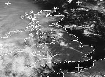 clearly showed a line of lying snow from Lancashire to Essex. Clear skies resulted in a frosty start over much of E England and SE Scotland, although cloud rapidly pushed E over the British Isles as bands of precipitation moved across Ireland in the morning, and later across most of the rest of the rest of the British Isles, falling as snow on the high ground of N England and Scotland. (Penzance 11C, Loch Glascarnoch 0C max, Redesdale -8C min, Stornoway 13mm, Lerwick 8.5h.)
Cloud and rain continued to push E, clearing E England by dawn on the 18th, to be followed by rain showers in W districts during the day. The rain lingered over N Scotland, before pushing S to affect S Scotland and N England during the afternoon and evening. The was some sleet over Scotland before dawn, while pressure fell to 989mb at Stornoway as low pressure slowly crossed Scotland. (Poole 13C, Baltasound -3C, Buxton (Derbys) 18mm, Cardiff 8.1h.)
Overnight rain over S Scotland and N England gradually faded as it moved SE during the morning of the 19th and a N airflow was introduced over the British Isles as a weak ridge became established. There were a few showers, especially over Scotland, where hail and light snow fell. Temperatures fell everywhere during the evening under clearing skies. (Teignmouth 11C, Saughall and Biggar -2C, Sennybridge 6mm, Valley 9.2h.)
The 20th dawned with a widespread air frost over inland areas (except for Ireland), although by mid-morning cloud had spread to most of Ireland and W Britain as S winds there heralded more wet weather. Widespread wave clouds (ac lenticularis) were observed over E Ireland in watery sunshine ahead of the fronts. By evening rain was affecting all of Ireland and parts of W Scotland, although in parts of East Anglia there was an air frost before midnight as clear skies persisted. (Falmouth 12C, Kinbrace -7C, South Uist 8mm, Jersey 9.3h.)
The cloud and rain continued to move E overnight, clearing Britain by late moring on the 21st, with much of the British Isles then having a sunny day under a weak ridge of high pressure. There were, however, a few showers in N Scotland. During the late afternoon and into the evening pressure then fell slowly as another band of cloud pushed E over Ireland and W Scotland, with patchy rain in W Ireland. (Cardiff 13C, Redhill -3C, Buxton (Derbys) 17mm, Prestatyn 9.2h.)
Skies clouded over during the morning of the 22nd, but not before many parts of inland Britain had experienced an air frost. Light rain falling over Ireland during the night pushed slowly E during the day, affecting W districts of England, Wales and Scotland by evening. However, in many places in Wales and SW England the precipitation feel mainly as drizzle. (Scilly 13C, Shawbury -5C, South Uist 5mm, Clacton 8.9h.)
Cloudy conditions overnight prevented an air frost in most places by dawn on the 23rd; there was early rain over Scotland and drizzle/fog in S England. It remained mild and cloudy all day in most areas, with light rain or drizzle and poor visibility in places. During the afternoon a general clearance of the cloud occurred over N Scotland (apart from some wintry showers), the clearance spreading to the rest of Scotland and much of Ireland by midnight. It was a mild day over much of Ireland and S England, with 14.5C at Dun Laoghaire and 14.2C at Kilkenny. (St Angelo 14C, Cranwell -1C, Eskdalemuir 10mm, Kinloss 3.6h.)
Overnight precipitation in the S had cleared by 0600GMT on the 24th, although hail and snow showers fell over N and W Scotland, and in N Ireland. Showers continued in these areas for much of the day, with some reports of thunder over W and N Scotland; 7cm of lying snow was reported at Aviemore. Rain fell during the afternoon and evening over S parts of Ireland and Britain, with gusts to 40kn as a depression passed over the area. Around midday a waterspout was observed coming ashore with a "swishing sound" as a small tornado at Burra on the west side of Shetland. In Lerwick a short while later a possible (small) tornado uprooted several small trees. Thunder, violent hail and ball lighting accompanied the passage of the possible tornado through Lerwick. (Guernsey 13C, Waterstein 0C, Lerwick 10mm, Newcastle 8.0h.)
Rain and drizzle cleared S England before dawn on the 25th as pressure rose from the W. There were showers of snow and hail over Scotland overnight, while parts of N and Cent. England and inland Ireland had a touch of air frost in places. Showery conditions persisted over Scotland and Ireland for the remainder of the day (with sferics during the evening), while England and Wales had a very sunny day. MSL pressure rose to 1033mb in the Channel Islands during the afternoon. (Penzance 12C, Barbourne -2C, Herne Bay 20mm, Beverley 10.0h.)
There was an air frost in parts of E England under clear skies by dawn on the 26th, as patchy cloud spread to many W parts of the British Isles. A shallow low brought further cloud and rain during the morning to S Ireland and SW England; this spread to N to reach Scotland by midnight, with heavy falls over Scotland, Northern Ireland and N parts of Wales and England. (Prestatyn 13C, Redhill -4C, Penzance 9mm, Norwich 8.8h.)
The 27th was mild and cloudy in all areas, with heavy rain at first in N and W districts. During the morning a cold front crossed E across Ireland and Scotland, before pushing E to lie from SW England to NE England by midnight. In the clearance behind the front, there were showers of hail and snow in N Scotland, with thunder reported in W Scotland. (Poole 14C, Tulloch Bridge 1C, Capel Curig 70mm, Stornoway 3.4h.)
The 28th dawned cloudy and wet over the SE half of England and Wales, while showers fell overnight over W districts of Ireland and Scotland. The rain cleared the SE during the morning and most of England and Wales then had a sunny day, with showers in the SW. Showers continued to fall over Ireland and Scotland, with snow over the higher ground and reports of thunder from W and N Scotland (and from Wallsend during the evening). Just before midnight another area of rain pushed into Ireland, and SW parts of England and Wales. (Poole 12C, Sennybridge 0C, Buxton (Derbys) 23mm, Fishguard 8.9h.)
On the 29th rain spread across much of S districts of the British Isles, accompanied by gales in the English Channel and gusts to 50kn along the coasts there. The rain cleared SE England during the afternoon. The remainder of the British Isles, and the S after the rain had cleared, had showery day, with snow and hail in the Northern Isles; thunder was also reported from here. (Penzance 13C, Aviemore 0C, Cardiff 23mm, Penzance 6.3h.)
The 1st was a showery day across the British Isles, the showers being of snow and hail over Scotland and N England, and accompanied by gusts to 40kn in many places. Hail was also reported in the Birmingham area. During the evning the wind backed from NW to SW over Ireland and more general rain fell in W Ireland by midnight. (Southsea 11C, Kinbrace -1C, Loch Glascarnoch 11mm, Teignmouth 10.1h.)
Clear skies over England and Wales, that led to a slight frost in places early on2nd, soon clouded over as the rain in Ireland pushed E to affect the rest of the British Isles by mid-morning. Falls were heavy over high ground (at Windermere 45.8mm fell between 0300 and 2240GMT), and were accompanied by gusts to 50kn in Scotland, N England and around coasts. During the afternoon the rain turned to showers over N Scotland, these falling as hail and snow as the temperature fell. Over much of England and Wales, however, rain continued on-and-off for much of the day, some of it mixed with hail. Stornoway reported a thunderstorm just before midnight. (Colwyn Bay 12C, Topcliffe -3C, Capel Curig 43mm, Stornoway 3.0h.)
Wet and cloudy weather overnight in S Britain and Ireland cleared to the SE during the morning of the 3rd, with the observer at Dun Laoghaire reported a feint covering of very fine dust over cars, windows, etc, once the rain had stopped. The rain was followed by a showery NW airstream, with snow and hail over Scotland and N England, where gusts to 40kn were recorded. Snow showers were also reported as far S as Suffolk. (Gosport 12C, Altnaharra -2C, Capel Curig 37mm, Isle of Man 9.2h.)
Clear skies overnight (apart from N Scotland where wintry showers continued to fall) resulted in a widespread air frost by dawn on the 4th. In Kyle of Sutherland, 15cm of snow fell overnight, on top of yesterday's 7cm. It remained below freezing in parts of N Scotland during the day, and some Scottish League football matches were postponed due to frozen pitches. Wintry showers continued to fall over Scotland, N England and N Ireland, but these were less frequent that on the 3rd as pressure built from the W. reaching 1033.3mb at Valentia at 1200GMT and 1036.3mb at Guernsey at midnight. (Solent 10C, Lerwick -1C max, Biggar -5C min, Lerwick 17mm, Margate 10.4h.)
Patchy overnight cloud in places meant that air frost was not quite so widespread early on the 5th, despite pressure rising to 1036.1mb at Jersey at 1200GMT. More extensive cloud over Scotland and Ireland brought rain from the W, that affected most of Scotland and parts of Wales and N England by midnight. (Falmouth 12C, Redhill -6C, Lusa 36mm, Guernsey 9.8h.)
Cloudy, and in places damp, conditions continued overnight leading to very little air frost by dawn on the 6th. Over NW Ireland and NW Wales there was patchy fog around dawn; this persisted for much of the morning in parts of NW Wales and formed over S wales and coasts of the Bristol Channel during the afternoon. It was a mild day with SW winds everywhere, except in the Northern Isles were temperatures hovered around 5-7C for much of the day; patchy rain and drizzle affected many parts during the day, the rain being more persistent N and Cent. Scotland. (Colwyn Bay and Kilkenny 16C, Redhill -1C, Loch Glascarnoch 14mm, Cromer 8.5h.)
The 7th was a mild day everywhere, except in N Scotland, N of a warm front that migrated N across this area during the evening. At 1800GMT, for example, the temperature at Aberdeen was 5C, while that at Leuchars was 12C. Bands of precipitation swept the British Isles during the day, the precipitation being heavy over Scotland and mainly of drizzle in S England. To the N of the warm front there were falls of sleet and snow. (Herne Bay 16C, Wick 4C max, Kirkwall 0C min, Altnaharra 31mm, Guernsey 8.9h.)
The 8th was a mild day, albeit generally cloudy, in most places. After a cloudy start with rain and drizzle in most places (and with fog around the coasts of Wales) temperatures climbed steadily. At Dun Laoghaire the minimum of 12.4C was the highest in March since before 1976, and by the afternoon temperatures in many places had risen to 15C. It was windy over Scotland and N England with gusts including 66kn at Kirkwall at 1200GMT. At Rossendale 28.6mm fell in 13 hours to 0800GMT, and the River Irwell was on red flood alert in Ramsbottom. (Hawarden 18C, Lerwick 2C min, Lerwick 20mm, Jersey 9.4h.)
Cloudy warm sector conditions led to a mild night over the British Isles, with minima of 10C widespread from S Scotland southwards on the 9th. At Keyworth the minimum temperature of 11.5C was the highest in March on record, as was the reading of 11.9C at Southend. It was very warm again over S England during the day; maxima at unofficial sites included 17.8C at Maidenhead. There was fog around Bristol Channel coasts and in the Channel Islands, with some drizzle in S England. N England, N Ireland and Scotland had rain during the day (hail fell in the Northern Isles), heavy in places, with gusty conditions leading to traffic restrictions on some exposed routes. However, at midnight the pressure had risen to 1034.9mb at Scilly. (Brize Norton 17C, Lerwick 4C max, Lerwick 2C min, Rosehearty 21mm, Cromer 6.7h.)
The 10th began cloudy with rain over Scotland and N England, and drizzle in parts of S and SE England. This was slow-moving, and in the afternoon another band of rain, associated with a cold front, pushed across Scotland and N England. It was windy for much of the day over Scotland, with widespread gusts to 50kn in the N. At Coleraine light rain and drizzle around 1400GMT produced falls of pink/orange dust. Dust also fell later in Anglesey. (Poole 17C, Lerwick 0C, Aultbea 23mm, Exmouth 9.1h.)
Overnight precipitation from the cold front was mainly light, and the 11th dawned mainly cloudy, except in parts of the NE. Rain crossed N Scotland during the day, with sunny spells over much of the remainder of the British Isles. (Lee-on-Solent 16C, Bournemouth 3C, Lerwick 4mm, Leeds 9.5h.)
Clearing skies overnight over much of England, Wales and E Ireland led to a light air frost in places by dawn on the 12th, with fog patches in Ireland. There was light rain over N Ireland and Scotland during the day, with long sunny spells over England and Wales, before cloud spread SE as far as the Midlands, and SW England during the evening. Two bands of rain moving W-E over the northern parts of Ireland and into brought very noticeable amounts of desert dust to Coleraine, and later to the Wirral. (Aboyne 16C, Topcliffe -2C, Lusa 5mm, Newquay 10.6h.)
Skies clouded over during the night in SE England, resulting in a lifting of temperatures by dawn on the 13th, but not before there had been a light ground frost in places. Further N there was occasional light rain or drizzle, while early morning fog occurred in places along the coasts of the Channel Islands, S Wales and SW England - later spreading inland in Cent. S England. It remained cloudy during the day in many places, with light precipitation in N areas and over Ireland, and became quite warm in SW England. At Keyworth, after a period of light rain from 0900-1400GMT there was an obvious dust deposit on windows and cars by late afternoon/evening, the colour and texture resembling fine grey (volcanic?) ash; pale orange dust in light rain was also seen in Bracknell. (Torquay 20C, Redhill -1C, Barra 7mm, Poole 9.1h.)
There was a light frost in parts of N Scotland on the 14th, althoiugh in most parts of the British Isles the day began rather cloudy. Showers of hail and snow affected the Northern Isles for much of the day, these eventually as far S as Aberdeen. The veered to NW over the British Isles during the morning, and it felt quite cold in N Scotland due to the wind chill. Ireland and Scotland had sunny spells and a few showers, while elsewhere it remained generally cloudy until after sunset, with light rain showers in S England. (Penzance 15C, Lerwick -1C, Loch Glascarnoch 11mm, Aberdeen 6.8h.)
The 15th was another dry day in many S parts of the British Isles, as high pressure to the SW continued to make itself felt. Pressure rose to 1039.7mb by 1200GMT at Valentia. Light rain and drizzle fell over Scotland and parts of N Ireland at times during the day, while much of S England had a sunny day although it clouded over from the W here during the evening. (Torquay 14C, Coningsby -1C, Loch Glascarnoch 4mm, Eastbourne 10.3h.)
The 16th was a dry, if rather cloudy, day in most places as the anticyclone extended its influence further N. Clear skies for a while in E England before dawn led to a ground frost in places, but cloud soon reached these parts after dawn. Some light rain and drizzle fell in Shetland during the morning, and in SW Ireland during the afternoon. MSL pressure reached 1038.6mb at Scilly at 1200GMT. (Boulmer 15C, Topcliffe -1C, Lerwick 1mm, Herne Bay 6.4h.)
After a generally mild night, the 17th was a rather cloudy day across the British Isles, with light rain and drizzle across Scotland and N Ireland. Cloud began clearing from Scotland during the evening and a few places there reported an air frost by midnight. (Aboyne 14C, Aboyne -3C, Aultbea 4mm, Stornoway 3.5h.)
Clearing skies over Scotland led to an air frost in places by dawn on the 18th; the clearance spread to much of England and Wales during the day but Ireland remainded generally cloudy with light rain and drizzle which also spread to W Wales. However, MSL pressure rose to 1040.7mb at Valentia at 2100GMT, and at Dun Laoghaire four days of anticyclonic gloom finally ended during the afternoon as the cloud base rose. (Saunton Sands 15C, Loch Glascarnoch -4C, Anglesey 2mm, Aspatria 10.5h.)
The 19th dawned with around the coasts of S Wales and SW England, and around Manchester and the SW Midlands. There was some overnight drizzle in W Scotland and a frosty start in parts of E England. Ireland and Scotland had a generally cloudy day with further light precipitation in Scotland, elsewhere there were sunny spells. (Aberdeen 16C, Topcliffe -6C, Machrihanish 1mm, Oxford 10.6h.)
Clearing skies led to a frosty start in parts of SE England on the 20th, with fog patches extending from N Yorkshire to S England, which were slow to clear in parts of Cent. S England. It turned cloudy during the day in most areas away from E Scotland and NE England, with light rainfall in N and W Scotland, with pressure falling throughout the day. (Aboyne 17C, Redhill -3C, Baltasound 3mm, Newcastle 9.9h.)
The 21st dawned with a slight air frost in a few pockets in SE England and East Anglia, and with fog patches in parts of S England. An area of rain over Scotland moved slowly S during the day, to affect parts of N Ireland and N England by midnight, to be followed by hail showers over the Northern Isles. Southern England had a mainly sunny day under high cloud, with low cloud elsewhere. (Saunton Sands 16C, Redhill -3C, Aultbea 12mm, Clacton 10.3h.)
Clear skies over the S half of England led to fog by dawn on the 22nd from the N Midlands to Hampshire, and E into East Anglia. This morning was one of the few mornings this last winter with fog at all the London airports (except City). Runway visual ranges were down to around 200m at most. Several Virgin B747-200s were diverted out of Gatwick (they still need 600m). The fog cleared during the morning to give a sunny day in most S areas, including Wales. Ireland and N England were cloudy with an area of slow-moving light rain. Scotland had a day of sunshine and a few showers, these falling as hail in the N. At Chipstead Valley a minimum temperature of -3.9C was followed by a maximum of 15.9C making a range of 19.8C. (Saunton Sands 18C, Tulloch Bridge -4C, Leuchars 6mm, Anglesey 9.5h.)
Parts of Scotland experienced a sharp frost under clear skies on the 23rd, while over other parts of the British Isles cloud spread overnight with light rain in S England and Ireland by dawn. In some parts of SE England this was the first measureable rain for three weeks, while dust was observed to be washed out by the rain in Coleraine, Cirencester, Royston and Southend. Cloud soon spread to most areas as several troughts and fronts affected the British Isles, the rain being heavy in parts of N England and S Scotland, also heavy in parts of S Wales and SW England during the afternoon. Over E Ireland the pressure had fallen 40mb over the past 4 days by evening; however, just 0.9mm was recorded at dun Laoghaire in the 24 hours from 0800GMT, after 20 days with only 0.7mm. (Farnborough 15C, Altnaharra -7C, Mumbles 19C, Lerwick 9.7h.)
The 24th started cloudy almost everywhere, with fog in Cent. S England and bands of light rain and drizzle in many places. These bands gradually moved E during the day with showers spreading from the W as a cold front cleared the British Isles. Showers fell as hail over parts of Ireland and there were outbreaks of thunder during the afternoon and evening over parts of W Scotland, E Ireland and England. (Herne Bay 16C, Aboyne 1C, Aberdeen 20mm, Falmouth 8.8h.)
Clearing skies overnight led to an air frost in places by dawn on the 25th, ahead of an advancing low and trough that brought showers from the W. The showers were heavy and wintry in places, with thunder in parts of S and E England during the afternoon and evening. A heavy shower of hail at 1200GMT in NW suburbs of Nottingham turned the ground white for a while. A funnel cloud was observed near Felixstowe Ferry at 1250GMT; it lasted about one minute shortly before dissipating, then fairly heavy rain and hail fell in a shower. (Gravesend 13C, Aboyne, Aberdeenshire -3C, Sella Ness 14mm, Aspatria 10.8h.)
There was a widespread frost on the 26th, with freezing fog in parts of E Scotland and the S Midlands at 0600GMT. Further showers (heavy in places) affected many places during the day and freshening winds from a NW direction brought gusts to 30kn over Ireland and W Britain. There were a few reports of thunder over Scotland and England, while a tornado reported at Brandsby (50 miles N of York), carried a cat 10 yards into air. (Guernsey 13C, Glenlivet -5C, Trawscoed 17mm, Falmouth 10.7h.)
During the 27th the wind gradually veered to a NE direction over the British Isles, as pressure rose from the N. There was an early air frost over parts of Ireland and W Britain, while in the E the day began cloudy and showery. These showers spread W to the Midlands and S England, with hail and sleet in places and with gusts to 40kn in the E coast, although it was sunnier over much of Scotland and Ireland, and in parts of W Wales. By midnight pressure had risen to 1029.6mb at Aviemore. (St. Angelo 12C, Saughall -3C, Jersey 10mm, Anglesey 11.4h.)
Cold NE winds continued to affect all but N Scotland on the 28th, with an air frost over parts of Ireland and Scotland before dawn. Much of Wales and England had a cloudy day with light rain and showers over England, and gusts to 40kn along the E coast. Pressure rose to around 1030mb over Scotland, with light rain in N parts, while Ireland had a mainly sunny day with frost in places by midnight. (Castledery 12C, Tulloch Bridge -3C, Marham 3mm, Belfast 9.0h.)
A clear night over Ireland, much of Wales and N England led to a frosty start on the 29th here; elsewhere there was low cloud and some light precipitation overnight, including light snow in Birmingham. This cloud distribution persisted for much of the day, resulting in a sunless day with low daytime maxima in S ( a cool NE wind here) and N parts, but warm sunshine in between. At Copley, 12.1h of sunshine betweens sunrise and sunset) was close to the maximum possible for March. (Altnaharra 13C, Crosby -3C, Hastings 13mm, Morecambe 10.6h.)
Clear skies over much of Ireland, Wales and NW England led to a sharp air frost in places here on the 30th; although cloud spread over Ireland during the day, most it remained clear and sunny over Wales and NW England during the day. Elsewhere the day was mainly cloudy, with light rain in the Channel Islands and parts of S Scotland and N Ireland. It was again cold in S Britain. (Cardiff 13C, High Wycombe 6C max, Shap Fell -6C min, Guernsey 4mm, Morecambe 12.2h.)
Apart from the Midlands, Wales and parts of NW England where the 31st began frosty, much of the British Isles had a cloudy start. Cloud soon spread to most areas with rain spreading to much of Scotland, Ireland and SW England by the end of the day. (Leeds 13C, Shawbury -5C, Lerwick 9mm, Scarborough 11.3h.)
The 1st began cloudy in most places, with rain in the N and W spreading gradually S and E. In N Scotland rain turned to sleet and snow, accompanied by winbds gusting to 40 kn in exposed places. Elsewhere, apart from parts of S Scotland and the extreme N of England, it was a mainly cloudy day with rain at times. (Jersey 13C, Shap Fell -4C, Altnaharra 19mm, Newcastle 8.0h.)
Rain, heavy in places, moved S over Scotland and into N England and Ireland on the 2nd, followed by snow over Scotland that caused whiteout conditions in a strong N wind. Gusts to 50kn were reported with the snow, and driving was difficult in the Highlands, Aberddenshire, Moray, Perthshire and Kinross. Rain also spread NE across S Ireland, S England, Wales and the Midlands later in the day, turning heavy in parts of the SW. A lively thunderstorm moved slowly NNE across west and north suburbs of Nottingham around 1500GMT; hail up to 12mm in diameter was observed. The maximum at Bollington (Cheshire) was just 1.7C. (London 14C, Loch Glascarnoch and Aviemore 1C max, Lerwick -1C min, Castlederg 37mm, Herne Bay 6.1h.)
The 3rd began mainly bright over Scotland and N Ireland with air frost and snow showers in places. Further S the day began with rain, heavy in places, and turning to snow from N England, through the Midlands. The A352 in Dorset between Wareham and Wool was flooded, and cross-Pennine routes were closed by snow. The area of rain moved slowly SE during the day, with snow on its northern edge spreading to Wales, SW England and parts of Cent. S England, settling in places, and followed by snow showers. N gusts to 60kn were recorded along the coasts of NE England and it was a windy day over much of England and Wales. Aviemore reported 10cm of lying snow at 0600GMT, and further snow and hail fell in showers over Scotland and Ireland during the day. In the 30 hours ending 1200GMT Wittering received 32mm of precipitation - the monthly mean for March is 34mm; 21mm fell in 6 hours. Over Ireland the air was quite dry, with Shannon reporting a temperature of 7C and a dew point of -7C at 1500GMT. At Dun Laoghaire 4.6C was the lowest April maximum for 11 years. At Cirencester 52.7mm was recorded 1st-3rd, with 35mm on the 3rd; there was snow cover over the Cotswolds where there was some drifting. At Carlton-in-Coverdale there was a snow accumulation of 5cm and a maximum temperature of 1.1C. (Jersey 15C, Aviemore 1C max, Altnaharra -5C min, Wittering 41mm, Lerwick 10.7h.)
The 4th began with severe weather disruption in parts of the UK. Roads in Somerset were flooded, while snow blocked routes in Yorkshire, Durham, Derbyshire and Aberdeenshire. Luton Airport was closed after snow-clearing equipment was unable to clear the runways (depths of 8.5cm were reported in Luton) , and a speed limit was imposed on the Severn Bridge due to high winds. By dawn cloud and precipitation was confined SE of a line from Newcastle - Cornwall, with snow in places on the N edge of the line and some heavy snow falling in Hampshire, West Sussex and the Isle of Wight (many other places in the SE had some snowfall overnight). The precipitation gradually lessened and moved SE although many places had showers of sleet and snow oncde the rain cleared; elsewhere a clear and frosty start was followed sunshine and showers, some wintry. Later in the day, following recent large precipitation totals, flood alerts were also issued in parts of Kent and East Anglia. The river Loddon in Reading has flooded leaving the showcase cinema next door and the Reading Park and Ride scheme unable to open for the foreseeable future. Rainfall total at Chalfont St. Giles for the 24 hours to 0900GMT was 35.9 mm - a 48 hour total of 59.7 mm. At Forest Hill (London) 3.9C was the lowest April maximum since 1989 (and the second lowest since 1975). (Crosby 9C, Baltasound 3C max, Glenlivet -8C min, Manston 57mm, Belfast 10.9h.)
A clear start to the 5th over most of Scotland, Ireland and NW parts of England and Wales resulted in a widespread frost in these areas, which was followed by a generally dry day with sunshine. Other parts of England and Wales had a cloudy start with a few showers; a snow shower was reported from Guernsey at 0300GMT and snow also fell in North Yorkshire). The cloud and showers gradually moved SE to clear most areas by midnight. (Glasgow 12C, West Freugh -5C, Dunkeswell 6mm, Colwyn Bay 11.9h.)
With high pressure developing over the British Isles on the 6th most places had a dry and sunny day. A clear start almost everywhere led to a widespread inland air frost, except over S Ireland, where cloud cover was more extensive during the morning. Pressure rose steadily in most areas during the day, with 1035.3mb reported in Norfolk at midnight. Snow drifts were still up to 30cm deep in the shade at Birdlip (Cotswolds) late in the morning. During the late evening and into the early hours of the 7th the aurora borealis was observed under clear skies as far south as Hereford and Norfolk. -3.1C at Ballywatticock (Co. Down) was the lowest April reading since records started in 1976. (Leuchars 14C, West Freugh -5C, Herne Bay 2mm, Scarborough 12.0h)
The 7th dawned cloudless almost everywhere, with a widespread air frost awy from the coasts. During the morning cloud spread from the W across Ireland and Scotland, extending to N England and the Midlands during the afternoon and evening. Rain fell in W Scotland and NW Ireland, being heavy in parts of W Scotland. The remainder of England had a sunny day, under continuing high pressure. (Northolt 15C, Eskdalemuir and Redesdale -5C, Lusa 15mm, Hunstanton and Clacton 12.2h.)
Cloud lingered over much of Scotland, Ireland and N Wales and N England during the 8th, with high cloud spreading to S parts duyring the afternoon. However, rainfall amounts were generally small, and the much of S England reported another sunny day. At Chipstead valley the diurnal temperature exceeded 20C for the second successive day. (London 18C, Redhill -4C, Lusa 7mm, Eastbourne 12.3h.)
Cloud thickened overnight in the S as a weak cold front pushed S throughout the 9th, giving light falls orf rain and drizzle to S England during the morning. Cloud thinned in most places during the day to give sunny spells, although an exception was Cent. and S Scotland where an extensive veil of medium to high cloud tended to persist. (Lee-on-Solent 16C, Saughall -1C, Hayling Island 8mm, Eastbourne 11.0h.)
A mainly clear start to the 10th (except over Scotland) led to an air frost in places over England and Wales, while fog formed before dawn over North Yorkshire and parts of the N Midlands. Cloud pushed E over Ireland during the morning, extending across the whole of the UK by midnight, by which time rain was falling from NE Scotland to SW Wales and S Ireland. (Lee-on-Solent 15C, Shap Fell -4C, Aberdeen 3mm, Saunton Sands 13.0h.)
The 11th started cloudy in most places, and widespread rain affected England and Wales during the day. Over Ireland and W Scotland the precipitation was of a more showery nature, with reports of hail in S Ireland. These showers pushed into Wales during the evening, where some thunder and hail was also reported, but more continuous rain was continuing to fall over SE England by midnight. The rain turned to snow from Bristol eastwards along the M4 corridor during the evening, and in parts of Gloucestershire. Snow was also reported from Wigan in the evening at the tail-end of a shower. (Guernsey 11C, Loftus 3C max, Redhill -4C min, Trawscoed 23mm, Penzance 8.0h.)
Over parts of Cent. S England the rain turned to snow and sleet for a while before dawn on the 12th, as temperatures there fell close to freezing. In Gloucestershire up to 10cm fell in places. However, this was soon followed by further rain, with rain falling over much of the UK at times during the day and into the evening. In Scotland a N wind gusted to 50kn in places, with showers in the N and over the Highlands falling as sleet and snow during the evening. Thundery showers were reported over coastal counties of SE and Cent. S England during the evening, with large hail in Hampshire. (Poole 12C, High Wycombe 4C max, Lyneham 0C min, Brize Norton 23mm, Jersey 8.2h.)
The 13th began generally cloudy over the British Isles, although inland Ireland was mainly free of cloud. Rain over the UK was followed in most places later in the day by showery conditions, these showers being heavy in places. Hail showers were observed over Ireland and N Scotland, while sleet and snow fell over Cent. and N Scotland also. The rain was rather more persistent and prolonged in NE and E England, while thunder was reported in the Midlands during the afternoon. (Torquay 12C, Glenlivet and Benson 0C, Leeming 27mm, Cromer 10.5h.)
Cloudy conditions over much of England and Wales on the 14th persisted for much of the day, although rainfall became mainly confined to East Anglia and E England. Ireland and S Scotland had a mainly clear and sunny day, after an early air frost in places, while Scotland had a showery day, the showers being of snow over high ground and in the N, and hail occurred in the Midlands. (Penzance 12C, Lough Fea -3C, Clacton 10mm, Isle of Man 9.8h.)
An area of cloud and rain pushed N into S England overnight, the rain turning to sleet and snow for a while during the morning of the 15th over Cent. S England. The rain moved slowly N during the day, clearing S England by early evening and reaching NE England by midnight, with snow also falling over high ground in Yorkshire. After a mainly dry start, there were scattered showers, including falls of snow over N Wales, over the remainder of the British Isles, before more general rain spread to W Scotland and Ireland later in the day. Uplyme, East Devon escaped all snow during the winter until this morning. (Penzance 12C, High Wycombe 4C max, West Freugh -5C min, Bracknell 19mm, Aviemore 10.0h)
Skies cleared over S England by dawn on the 16th, with an air frost occurring in places inland; fog patches occurred in parts of the Midlands and Cent. S England. However, patchy cloud already affecting other areas by dawn soon spread E, bringing rain to much of Ireland (where it was followed by thundery showers). During the late afternoon another area of rain moved N to affect S England. Snow showers were reported over parts of Scotland during the day. (London 14C, Shap Fell -5C, St Angelo 30mm, Hunstanton 10.5h.)
A complex area of low pressure over S areas on the 17th resulted in a cloudy and wet day in many places. However, over N and Cent. Scotland clear skies before dawn led to a frosty start in places, followed by sunny spells before rain moved N to affect most places. Elsewhere the day began cloudy and wet, with the rain moving N, foloowed by sunny intervals and showers. Sleet was reported at Aberporth during the morning, and some of the showers were thundery with hail over S England and East Anglia during the afternoon. (Poole 14C, Aviemore -5C, Sennybridge 29mm, Norwich 9.6h.)
Rain continued to move N overnight, clearing most of N England by dawn on the 18th. Clear skies over much of England, Wales and Ireland led to a ground frost in many places, before another area of rain began to affect S England. The rain over Scotland largely cleared during the day, while the area of rain to the S moved E and N to affect most parts of England by midnight; thunder was reported in Lincolnshire during the afternoon. The best of the weather was over Ireland, where most places had a day of sunny spells and little cloud. (Herne Bay 16C, Castlederg -2C, Plymouth 20mm, Belfast 10.0h.)
The rain over England moved E during the night, clearing most places by dawn on the 19th, and followed by fog patches over the S Midlands and Cent. S England. Over Ireland and Scotland clear skies led to a ground frost in places, and there was early coastal fog around W Wales. While must of E England and Scotland had a sunny day, rain crossed Ireland during the afternoon, and moved E during the evening to affect the Wales and W parts of England and Scotland by midnight. (London 18C, West Freugh -4C, Buxton (Derbyshire) 23mm, Tiree 12.8h.)
Rain moved W to E overnight over the British Isles, clearing over Ireland by dawn on the 20th, and by midday over E parts of England (except for the SE where it lingered for most of the day). The rain was followed by showers, some of them heavy. By evening some rivers in Cent. S England and the Midlands were on amber flood alert. (Dishforth 18C, Fair Isle 4C, Southampton 21mm, Tiree 9.0h)
A fresh SW airflow on the 21st brought showers to many areas, these being heavy in Ireland, Wales and parts of SW England. Gusts to 40kn were reported in the SW. Thunder occurred across the N half of Ireland and in N England during the late afternoon and into the evening, by which time an area of heavy rain was pushing NE into SW England. Bristol has already recieved twice the long term average rainfall for the month - currently the 6th wettest April on record in 150 years of records. (Herne Bay 17C, Altnaharra 4C, Dunkeswell 15mm, Eastbourne 9.7h.)
The heavy rain in SW England during the early hours of the 22nd pushed NE across England and Wales during the day to be followed by further showers. Elsewhere, there were sunny intervals and showers, which were heavy in places and accompanied by thunder over E Ireland, parts of the Midlands and N England. River levels were high in Cambridgeshire and Warwickshire after the rain. Intense thundery activity with heavy rain and hail creating a hail covering for some time in the Irish Midlands (around 1300GMT), with roads were flooded locally. Several days of wet weather broughts chaos to the British Formula 1 Grand Prix at Silverstone, with police forced to turn away spectators as
car parks become unusable due to waterlogging. (Gravesend 19C, Loch Glascarnoch 0C, Linton-on-Ouse 20mm, Valley 11.7h.)
The 23rd began with fog patches in parts of N Yorkshire and the Midlands, which soon cleared as cloud developed over much of the British Isles. Showers affected many parts of the British Isles during the day, these being thundery over W and N England, Wales, Northern Ireland and parts of SE Scotland during the afternoon and evening. Two funnel clouds were seen about 8km W of Buxton (Norfolk), with another 2 reported from Southwold. In Northamptonshire, one local vicar was ferried by helicopter to conduct Easter Sunday services in surrounding villages as a result of traffic congestion and flooding around Silverstone. (Leeds Weather Centre 18C, Redesdale -1C, Weybourne 15mm, Tiree 11.9h.)
After a clearance overnight over central parts of England, Wales and Ireland, bands of cloud and rain spread N on the 24th to affect many parts of England, Wales and Ireland. More persistent rain over N Scotland extended SE into Cent. Scotland by the evening, while during the late afternoon and evening an area of pushed N across SW England, Wales and S Ireland. Thundery showers occurred across N Ireland, S Scotland and N England during the afternoon and evening, leading to some local flooding in S Scotland. (London Weather Centre 17C, Redhill 1C, Aboyne 17mm, Eastbourne 11.3h.)
Rain in the S and over N Scotland spread to affect most areas on the 25th. During the afternoon N winds gusted to 50 kn over W Ireland. Flooding occurred during the evening and into the night in Edinburgh, Lothian and Grampian regions.Some thunder was reported in N England. At Dun Laoghaire the morning was dull, cold, and misty at 8C. (Herne Bay 19C, Glenlivet 2C, Crosby 29mm, Stornoway 9.4h.)
The 26th began cloudy in most places with heavy rain falling in parts of E Scotland, and with another area of rain across S England. Three old people's homes and at least 40 houses were evacuated in Edinburgh overnight as flood waters rose by more than one metre. Horse racing was cancelled at Perth and Catterick. Rain affected most areas during the day, with thunder in the East Midlands during the afternoon. Gusts reached 50kn along exposed coasts of W Ireland and W Scotland. At Stratfield Mortimer the total rainfall for April 2000 is now 147.8 mm (0900GMT). This is 298% of the 1961-90 normal for April and already well above the previous April record total back to 1862 (114.3 mm in 1966). (London Weather Centre 16C, Loch Glascarnoch 3C, Inverbervie 44mm, Lerwick 9.2h.)
The rain gradually moved N and then W on the 27th, as the fronts responsible moved around a depression migrating N over Ireland, with showers over S Britain. Gusts to 50kn were reported before dawn over NW Scotland, although winds eased during the day. Horse racing was cancelled at Catterick and Perth due to waterlogged tracks, and the Murrayfield rugby stadium was flooded. Later in the evening an area of ligth rain began affecting E coast of SE England and East Anglia. (London Weather Centre 18C, Drumburgh 2C, Kinloss 23mm, Lerwick 9.2h.)
Rain over NW Ireland cleared during the 28th and much of NW Britain and N Ireland then had a day with sunny spells. England, and later Wales, was cloudier as frontal cloud and rain spread W during the day, reaching W wales by midnight. (Lusa 18C, Bognor Regis 11mm, Falmouth 11.8h.)
After a wet start to the 29th over S England, the rain here moved N/NW to affect much of Ireland before clearing to the NW. Clear skies before dawn over Scotland led to early morning fog in many places; fog patches and mist persisted for much of the day over the Northern Isles. It turned cloudy over Scotland with further light falls of rain. Flooding led to Camelot deciding to suspend ticket sales at about 6000 of its lottery outlets in Scotland. (London 20C, Loch Glascarnich 0C, Hastings 17mm, Jersey 12.5h.)
Most places had a clear start to the 30th, with a ground frost in some sheltered inland areas of Britain and Ireland, and fog for a while around dawn in parts of the NW Midlands and S Scotland. E England clouded over during the morning as an area of rain moved N across SE and E England; elsewhere it was a mainly dry and sunny day. (Cardiff 21C, Topcliffe 1C, Southend 8mm, Exmouth 14.0h.)
The 1st started clear over much of the British Isles, although minimum temperatures were generally high (except for parts of NW Scotland). Fog was slow to clear in parts of E Kent and the Channel Islands. Most of the British Isles had a dry and sunny day, although cloud spread W across parts of E and s England during the day before retreating back to the E coast in the evening. (Lee-on-Solent 21C, Altnaharra -1C, Southend 7mm, Tiree 14.3h.)
The 2nd dawned with cloud cover extending from the North Sea inland to the Pennines and Cent. S England; this cloud persisted for much of the day along the E coast of England, and during the afternoon spread to affect E Scotland. Elsewhere it was a generally dry day, with sunny spells (once the cloud cover in Cent S England had cleared). (Llanbedr 21C, Loch Glascarnoch 0C, Rosehearty 0.8mm, Stornoway 13.9h.)
E winds on the 3rd helped maintain a veil of low cloud over the E half of England and Scotland throughout the day; by the afternoon the cloud had spread to SW England. Drizzle fell in SE of a line from Whitby to Weymouth, and in parts of E and N Scotland during the morning. Most other places had a sunny day. (St. Angelo 18C, Scarborough 8C max, Shap Fell 1C min, Coltishall 2mm, Tiree 14.5h.)
The 4th was a cloudy day over much of E England, S Wales, SW England and the Channel Islands, with light drizzle in S areas (mainly during the morning). Mainly clear skies in other parts of the British Isles led to an air frost in parts of NW England and SW Scotland and a few early fog patches in Cent. Scotland, followed by warm and sunny weather (although S Ireland was rather cloudy during the morning). Later in the evening light drizzle and fog affected the Northern isles and N parts of the Outer Hebrides. (Tulloch Bridge 20C, Shap Fell -2C, Wattisham 0.8mm, Tiree 14.7h.)
Overnight cloud in E and Cent. S England largely cleared by midday on the 5th, exceptin NE England where it lingered all day in places. Elsewhere there was generally little cloud and sunny spells, apart from some light drizzle and fog in the extreme NW and N parts of Scotland during the morning, and for fog in the Channel Islands until lunchtime (which reformed again before midnight). During the late afternoon and into the evening there was some cloud and light rain over S Ireland. (Bournemouth 22C, Biggar -1C, Stornoway 0.5mm, Tiree 14.5h.)
The 6th dawned cloud with light rain over Ireland, where ir remained mainly cloudy (except in the E) for most of the day. Most of Britain had a warm and sunny day although by dawn thunderstorms were affecting the Channel Islands. These reached the S coast of England later in the morning. A thunderstorm caused flash floods at Wootton, Newport and Cowes on the Isle of Wight, with knee-deep water. The storms then moved generally NW to reach Avon and SW England by midnight. In N Scotland there was patchy cloud during the afternoon with fog forming along the E coast later in the evening. 13.5h of sunshine were measured at Beverley from sunrise to sunset. (London 26C, Altnaharra -1C, Jersey 6mm, Cromer 13.2h.)
Patchy cloud and sunny spells occurred over the British Isles on the 7th. In S England there were thunderstorms, the heaviest being during the evening in Cent. S England. A severe thunderstorm occurred at Bracknell 1845-2045GMT, with hail falling 1925-1950GMT, up to 15 mm diameter; 53.2mm fell in the 24h ending at 0900GMT on the 8th at one Bracknell site (the heaviest 24-hour total since before 1989), while Beaufort Park recorded 65mm in 3 hours. Localised flooding resulted and the Back Lake at South Hill Park burst its banks, with shoals of ornamental fish seen swimming across the car park. Elsewhere thunder was reported from S Wales and S Ireland, and also in parts of W Scotland. Coastal fog was a problem in N and NE Scotland until mid-morning, while light rain fell in parts of W Scotland during the day. Much of the Yorkshire coast was affected by fog before midnight. 14.1h of sunshine were measured at Beverley from sunrise to sunset, while at 1400GMT the temperature at Altnaharra was 23.5C, some 10C above the average. (Eskmeals 26C, Aboyne 2C, Manston 8mm, Scarborough 13.4h.)
S and E England had a cloudy start to the 8th, with patches of thick fog in NE and E England, and in E Scotland. The fog cleared during the morning but it remained generally cloudy SE of a line from Newcastle-Dorset with light rain in places in the S followed by thunderstorms in places. In Kent 30mm fell in one hour as Sevenoaks and Tnubridge experienced severe flooding after a heavy thunderstorm. Thunderstorms also occurred in S Ireland and SW England, while the remainder of the British Isles had a mainly dry and sunny day. (Shannon, Nantmor 25C, Aboyne, Strathallan, Leuchars 2C, Bracknell 66mm, Eskdalemuir 14.0h.)
The 9th dawn with cloud over much of E, Cent. and S parts of England, and with fog in many places from N Yorkshire to Dorset, over S Ireland and aorund some W and N coastal areas of Scotland. The fog was slow to clear in many places (300m visibility was reported from Malin Head at 1200GMT) and visibility remained poor to moderate in many places throughout the day. Once the low cloud cleared most places had a warm and sunny day (exceptin the extreme N of Scotland where it stayed cloudy with some light precipitation), although during the afternoon thunderstorms broke out over S England, East Anglia and S Ireland. A short-lived funnel cloud was seen near Chelmsford around 1730GMT; local flooding occurred in W Suffolk. A storm brought 51mm in 40 minutes to Diss (Norfolk), flooding the post office and resulting in staff having to dry out hundreds of bank notes, etc; the storm lasted about 75 minutes and gave a total of 56mm. In the Nottingham area, after two days of mist/poor air quality the sun burned off low cloud in the afternoon, then between 1600-1800 a thick bluish haze descended reducing visibility to 1000m; the haze smelled strongly of chemicals/ozone, and throughout the sun shone as a faint coppery disc. By nightfall thicker mist rolled in again from the east. (Dalmally, Shannon 25C, Fair Isle 10C max, Wick 3C, St. Peter Port 33mm, Damnally 13.3h.)
The 10th dawned cloudy over N Scotland and E England with fog patches over NE and E England, S Ireland, the Midlands and Cent. S England. The day was generally sunny over Ireland and W Wales once the fog had cleared, and after some light rain and drizzle over parts of scotland it beacme sunny there during the afternoon except in the NE. Over E wales and England cloud developed rapidly during the morning, with rain and thunderstorms during the afternoon and evening in S districts and the Channel Islands; the thunderstorms moved into East Anglia in the evening. In coastal Penzance the temperature had risen to a very warm 22C at 1030GMT, later rising to 24C before thunderstorms occurred; there was flash flooding at Redruth. There was also severe flooding in Mousehole; all roads through the village were closed for a time and people in the village reported never having seen rain so heavy. (Shannon, Penzance 24C, Strathallan 4C, Camborne 17mm, Tiree 12.8h.)
High pressure near the N of Scotland on the 11th resulted in many clear skies over N and W Scotland and NW Ireland, with pressure reaching 1033mb at Lerwick later in the day. Cloud soon formed over most other areas of the British Isles, with rain over S England during the morning spreading further W later. Thunderstorms occured in the Channel Islands and at some coastal places in SE England. After 11 mainly sunny days with no rain, Dun Laoghaire had its first sporadic rain this afternoon (1mm). and SW Ireland was much cooler than in recent days. (Lusa 22C, Wick 1C, Guernsey 25mm, Tiree 14.9h.)
The 12th started cloudy over S Ireland and all but the NW tips of England and Wales. Light rain fell in parts of S Ireland and S England during the morning, and later in N Ireland and the N Midlands as the cloud spread N. Most parts of Scotland and N England, however, has a dry and sunny day. (Lusa 24C, Aboyne 0C, Plymouth 14mm, Lerwick 15.4h.)
Most of Scotland had a sunny day on the 13th despite patchy cloud which developed during the afternoon in some places. Early cloud and light rain over Ireland gradually became confined to S districts there, while over England cloud in the S soon cleared to give most places a bright day, although coastal locations in NE England remained partially cloudy and much cooler than inland areas due to the E breeze. Parts of E Ireland had mist and fog patches during the morning which lingered all day in places. The early evening brought some thunderstorms to SE England, with 20mm in 1 hour falling at Redhill in one storm. (Heathrow 25C, Altnaharra 2C, Redhill 21mm, Lerwick 15.6h.)
The 14th was generally dry everywhere except over parts of Ireland and SW Scotland where it remained generally cloudy with light precipitation at times. Elsewhere, there was some early low cloud and fog in SW and Cent. S England and patchy cloudy in other areas at first which cleared (slowly in the case of the fog in the SW) to give a warm and sunny day in most places. During the afternoon further cloud developed in S and Cent. parts of England and across Wales and W Scotland, with light rain falling in SW England. 27.7C was recorded at Bristol (Totterdown) - an unofficial site. (Prestatyn 27C (possibly suspect), Altnaharra 4C, Tiree 0.5mm, Lerwick 15.0h.)
The 15th began cloudy in most places with rain and showers over N Ireland and SW Scotland; minimum temperatures were consequently quite high everywhere. Early fog patches in Cent. S, E and NE England soon cleared after dawn and cloud partially dissipated over most of England and Wales to give another warm day. During the afternoon frontal cloud spread E to Ireland and W Scotland followed by evening rain, while thundery outbreaks occurred from East Anglia to NE England in the evening. In Coleraine pink/grey dust fell during the early hours. (London 27.8C, Lerwick 13C max, Aberdeen 8C min, Isle of Man 8mm, Jersey 13.6h.)
Thunderstorms continued to affect parts of NE England early on the 16th; in most other places cloud spread from the W and SW during the night with winds gusting to 30kn in the SW. Rain crossed Ireland and Scotland during the day, followed by showers and cooler conditions, the rain spreading to Wales, SW and NE England by midnight. In East Anglia and parts of SE England cloud cleared during the day and there were warm, sunny spells - along with some thunderstorms in the afternoon. Light grey dust was observed in Bracknell after a trace of rain fell during the evening. (Coltishall 25C, Ballypatrick 10C max, Altnaharra 3C, West Freugh 15mm, Scarborough 14.5h.)
During the 17th the cooler airstream over W parts of the British Isles on the 16th finally reached E parts. Overnight rain over Scotland and N England moved E during the day, clearing most of the E coast by midnight, to be followed by showers. Slight rain in S England overnight wwas followed by showers during the day with more persistent rain affecting much of S England and the Midlands during the afternoon and evening. In most places the lower temperatures were accentuated by a fresh breeze, and showers were of hail in E Ireland, including a 3-minute fall at Dun Laoghaire. The rain that fell overnight on 16th/17th was the first to fall in Ferryhill (Durham) since the 29th April. (Holbeach 17C, Lerwick 8C max, Altnaharra -1C min, Eskdalemuir 22mm, Eastbourne 11.9h.)
The 18th began with a mixture of cloud and clear skies over the British Isles, allowing a groiund frost in some sheltered areas. The grass minimum temperature at Copley was -1.1C. Rain fell overnight for a while in parts of S England and East Anglia. Daytime weather was a mixture of sunny intervals and heavy showers, almost everywhere. Some of the showers were accompanied by hail, with thunderstorms in SE England and East Anglia during the afternoon and evening. (Lee-on-Solent 16C, Copley and Charterhall 2C, Buxton (Derbyshire) 31mm, Isle of Wight 10.4h.)
The 19th was a cloudy day over much of N and E Scotland, and in E and S parts of England. Rain followed by showers affected Scotland and Northern Ireland, and there were also showers over W and SW England, with pre-dawn rain in parts of N England. Thunderstorms broke out during the afternoon over the E Midlands and East Anglia, and hail was reported from the Midlands. Following the clearance of rain from Northern Ireland, much of Ireland and Wales had a bright day until light rain and drizzle reached SW Ireland during the evening. (Poole 17C, Kirkwall 4C, Buxton (Derbyshire) 21mm, Newquay 10.9h.)
This rain spread on the 20th across Ireland and into Cent. Scotland and across most of England and Wales, followed by showers over Ireland during the afternoon. The extreme N of Scotland remained generally dry, while before the cloud developed a ground frost was reported from Halesowen and Cirencester. (Gravesend 17C, Loch Glascarnoch 1C, Pembrey Sands 11mm, Bognor Regis 13.8h.)
Rain continued to push E across E England and into NE Scotland on the 21st, followed by heavy showers in many places. These showers turned thundery in parts of Cent. S England during the afternoon, and hail was reported in the Worthing area. (Great Malvern 17C, Machrihanish 4C, Hastings 19mm, Penzance 10.7h.)
Most areas except along the E coast of Britain had a mainly clear start to the 22nd, although by dawn cloud and light rain was pushing into SW England, S Wales and Ireland. While much of N Wales, N England and Scotland had a bright day, S England had extensive cloud for much of the day, while moderate rain spread to Ireland and W Scotland. (Poole 20C, Gloucester and Kinbrace 3C, Clacton 7mm, Isle of Man 14.0h.)
Rain over Ireland spread E and NE across the British Isles on the 23rd, clearing all but the extreme E of East Anglia by midnight. The rain was followed by showers, with a later general clearance of the cloud over scotland, N England and Wales during then evening. (Colwyn Bay 17C, Altnaharra 2C, Buxton (Derbyshire) 23mm, Lerwick 8.2h.)
After a mainly clear night (except in S England) the 24th dawned with a ground frost in places. At Copley (Durham) the grass minimum temperature was -2.7C. Cloud soon spread N to much of England during the morning as anoither area of rain pushed in SW England before spreading NE to affect much of S England, the E Midlands and East Anglia during the afternoon and evening. Much of the remainder of the British Isles had a day of sunshine and showers. These were heavy in places, with hail and thunder in parts of N Ireland and Scotland. (Gravesend 18C, Aboyne 0C, Jersey 12mm, Lerwick 14.4h.)
The rain in parts of S England and East Anglia cleared to the E by dawn on the 25th; the day was then generally bright in all areas aparts from bands of showers which affected many parts of the British Isles at some time. Many of the showers were light, although hail was reported in Cent. Scotland. Thunder accompanied the showers across parts of E Ireland, N England, the N Midlands and East Anglia during the afternoon and into the evening. During the evening more extensive cloud pushed NE into S Wales, SW and Cent. S England as another area of rain approached the UK. (London 17C, Altnaharra -1C, Capel Curig 16mm, Lerwick 14.4h.)
A mainly clear start to the 26th over most of Scotland and Ireland led to a ground frost in places, and a touch of air frost in N Scotland. In other parts the day began cloudy, with rain over Wales, Cent. and S England. The rain, heavy in places, spread N and E during the day, extending to S Scotland. Showers broke out Ireland and Scotland, with some thunder over E Scotland and E Ireland. Maximum temperatures were quite low in many areas, with 11-15C over Ireland. (Southend 16C, Aviemore -1C, Guernsey 37mm, Tiree 13.4h.)
Another clear start on the 27th over NW Scotland brought air frost to a few places. The rain area to the S continued to push E early n the day along the E coast, clearing NE England during the late morning but persisting over NE Scotland throughout the evening. In Aberdeenshire the River Keith burst its banks, and there was also some flooding in parts of Kent. Showers, heavy in places (and with some hail) affected much of the British Isles during the day, with widespread thunder over S Scotland and most of England, Wales and Ireland. During the evening another area of rain pushed NE into SW England and the Channel Islands. (Gravesend 16C, Altnaharra -1C, Cleethorpes 43mm, Tiree 14.3h.)
This rain spread NE on the 28th to reach NE England and East Anglia, before clearing to give another showery day over most of England and Wales. There wer reports of localised flooding across SE England and East Anglia, particularly in Essex. It was said that wet and windy weather had also prevented several small boats from making the reunion at Dover, prior to the crossing of the English Channel on the 1st June to commemorate the Dunkirk evacuation in 1940. Spells of rain over NE Scotland continued to fall for much of the day, while there was a ground frost early in the day over parts of N England and N Ireland; -4.0C was the grass minimum at Copley. There were again widespread showers over England, Wales and Ireland during the day, many of them thundery. Drifts of hail were observed lying like snow on the higher fells south of Kirkby Stephen (Northern Yorkshire Dales) in the evening. (Great Malvern 16C, Copley -0.2C, Clacton 40mm, Isle of Man 12.5h.)
The 29th began with clear skies over most of England, Wales and E Ireland and with showers in W districts. These showers spread to most places as cloud developed during the day, with some thunder in E parts of Scotland, England and Ireland; 8mm diameter hail feel at Pitroddie. Clouds mostly died down during the evening, although an area of frontal cloud pushed into SW England and S Wales by midnight. (Poole 18C, Eskdalemuir 3C, Clacton 21mm, Anglesey 14.4h.)
Apart from N Scotland where there were some overnight showers, and S England, the 30th again began clear, with air frost in parts of S Scotland and inland Ireland. Early cloud and rain in S England and the Channel Islands finally cleared to the S during the afternoon; elsewhere it was a generally mild day, but with showers over E England, Scotland and NW Ireland. Thunder was reported in places from Aberdeen to Norfolk during the showers. (Manchester 18C, Sella Ness 11C max, Eskdalemuir -1C min, Jersey 19mm, Tiree 14.6h.)
The was some fog in the early hours of the 31st around Aberporth and in parts of Norfolk and Lincolnshire; in most other areas the night was mainly clear with an air frost in parts of S Scotland, until cloud pushed NE acdross Britain and Ireland followed by rain over Ireland by midday. This rain continued to move E, affecting most of Scotland and parts of E England by midnight. (Gravesend 20C, Eskdalemuir -1C, Milford Haven 6mm, Cromer 10.7h.)
The 1st was a mainly cloudy day across the British Isles. Rain affected most areas during the day, with heavy falls in parts of N Wales, NW England and SW Scotland. Visibility was often poor in drizzle around Irish Sea coasts, with fog at Ronaldsway for several hours before dawn. A SW wind, force 5 to 6 in the English Channel, prevented the Dunkirk armada from sailing. (Leconfield 21C, Lerwick 5C, Capel Curig 41mm, Clacton 6.1h.)
Frontal systems straddling the British Isles led to a cloudy start on the 2nd; cloud over W Scotland cleared during the morning although most other places had rain or drizzle at times during the day. By evening the clearance had reached most of Scotland, where a N to NE wind had been introduced, but thunderstorms occurred over SW Ireland. At Dun Laoghaire fog was reported with drizzle until the afternoon; the maximum temperature was just 12.6C, about 4C below average. (Herne Bay 21C, Stornoway 4C, Fishguard 17mm, Tiree 12.9h.)
Clear skies over Scotland early on the 3rd resulted in a ground frost in places. At Aberdeen Dyce, -0.3C was the lowest air temperature on record for June (records started in 1941). Elsewhere, the day began cloudy with rain over N Wales, N England and the Midlands and with fog patches along Irish Sea coasts. 33.4mm fell in the 24 hours ending 0800GMT at Penistone (S Yorkshire). The rain areas hardly moved during the day, and by the evening cloudy conditions had again spread N to affect all the NW Scotland and the Northern Isles. Light rain also fell over S Ireland and SW England. There was quite a contrast in temperatures during the afternoon; at 1500GMT it was 22C at Heathrow, 8-9C over N Yorkshire and 13-17C in SW Scotland. In Nottinghamshire, a heavy thunderstorm moved N between 2130GMT and midnight; two houses were struck by lightning in Ruddington at 2200GMT, and 6.3mm of rain fell in 10 minutes at Keyworth. (London 25C, Glenlivet -1C, Scarborough 33mm, Aberdeen 16.9h.)
The 4th dawned cloudy except in NW and N Scotland, and with heavy rain still falling over N Yorkshire. N Scotland clouded over during the day, and although there was a clearance over central parts of England for a while, it remained generally cloudy in most areas during the day. Rain continued to affect N England, N Ireland and parts of Scotland, while cloud cleared from SW Ireland shortly before midnight. 24-hour rainfall totals reported this morning included 65.2mm at Copley ending 0900GMT, and 72.8mm at Carlton in Coverdale ending 0700GMT (after 18.6mm in the previous 24h). East Scrafton recorded 77.5mm during the 24 hours to morning. Flooded roads were reported widely in West Yorkshire, North Yorkshire, Teeside and Tyne and Wear. About 700 people were evacuated as houses in Bishop Auckland and Todmorden were flooded, the Calder Valley being particularly affected. East coast mainline train services were subject to delays. (Pershore 20C, Lybster 3C, Newcastle 41mm, Stornoway 14.2h.)
The 5th dawned mainly cloudy across the British Isles, with fog patches over parts of Cent. S England and light rain over N England. It remained cloudy all day in most places, except for NW Scotland where the cloud cleared during the morning. Scattered showers affected Ireland and parts of Britain, with more general rain for a while along the English Channel. During the evening, frontal rain pushed in W Ireland, and a funnel cloud was seen between Allonby and Maryport (Cumbria) at about 1830GMT. (Bournemouth 20C, Baltasound 4C, Hayling Island 7mm, Lerwick 12.4h.)
Overnight rain in Ireland spread to Scotland and NW England by dawn on the 6th, with lighter falls across Wales and SW England. Early morning fog patches were observed in places across S England. The rain was followed by showers during the afternoon, with a fresh W wind across all by N Scotland. Later in the afternoon and into the evening there was a general clearance of cloud over all of the British Isles, except for the N half of Scotland and for some coastal area of NE England. Thunderstorms were reported from Kent to North Yorkshire during the afternoon. A funnel cloud occurred at Great Wakering, Essex, and reportedly lasted about 45 minutes from approx. 1045GMT, but never touched the ground. (Herne Bay and Holbeach 19C, Wick 1C, Kenley 13mm, Jersey 11.1h.)
The 7th started dry, apart from some showers over Scotland and light rain over W Ireland. This rain lingered for much of the day, spreading to S Scotland and N England during the evening. Elsewhere, cloud tended to thicken during the day. A spell of torrential rain in Leeds from 1850 to 1915GMT caused local, short-lived flooding. (London 23C, Baltasound 4C, Tynemouth 12mm, Southend 14.1h.)
Low pressure to the W of Ireland brought a warm S airflow across the British Isles on the 8th, but with rain over Ireland and W Scotland that also affected W parts of England and Wales from time to time. E England and the Channel Islands were mainly sunny, however. (Jersey 25C, Altnaharra 3C, Machrihanish 13mm, Jersey 14.9h.)
The 9th dawned with light rain over SW and Centn S England associated with a shallow low. During the day this rain spread and affected most of England and Wales (thunder was heard in parts of Hampshire and Sussex). Cloud also thickened over Scotland and light rain fell here, although during the afternoon it turned showery over Ireland and W Scotland. At Dun Laoghaire persistent altostratus opacus on the 8th and 9th resulted in maxima of 14C on both days. (Norwich 24C, Eskdalemuir 4C, Carlisle 18mm, Folkestone 11.6h.)
Although cloud cleared overnight in many areas, dawn on the 10th saw further frontal rain falling over W Ireland. This moved slowly E reaching W Scotland by early afternoon, and extending to E Scotland and SW England by midnight. Despite this, many parts of England had long, sunny spells. (London 21C, Shawbury 5C, South Uist 15mm, Southport 14.2h.)
Cloud and lessening amounts of rain pushed E before dawn on the 11th, being followed by further rain and drizzle over Ireland during the morning. Most areas of Britain had some sunny spells, especially the Channel Islands and parts of S England, although rain and showers spread to NW England and W Scotland during the afternoon, and to SW England by midnight. (Folkestone 20C, Glenlivet 5C, Stornoway 11mm, Guernsey 14.7h.)
A generally cloudy night meant that minimum temperatures were not anywhere on the 12th; SW winds blowing around a low to the W of Scotland brought rain to W districts. This rain spread to most of Scotland during the day, and although N and SW England remained cloudy (rain here was light and acompanied by fog in places), cloud largely cleared from much of E and SE England and the Midlands to give a warm sunny day here. Pressure had fallen to 999mb by midnight in N and NW Scotland, and gusts over 50kn were reported in W Scotland during the afternoon and evening. 25.1C at Dun Laoghaire was the highest June temperature there since 1995, although at nearby Dublin mist and cloud kept the temperature down to 24C. (Coltishall 26C, Kirkwall 8C, Lusa 25mm, Herne Bay 11.0h.)
The 13th dawned mainly cloudy with SW winds and rain over N England and W Scotland. The wind was gusty over W Scotland during the morning, with 87kn at North Rona at 0400GMT, and gales over the N half of Scotland. At Lerwick the pressure fell to 989.8mb at 0900GMT, due to a reportedly record-breaking low pressure for June of 966mb near the Faeroes. (The lowest June pressure recorded in the British Isles since 1870 was 976.8mb at Wick on 4-5 June 1944.) At Fair Isle a gust of 68 kn at 0930GMT and a 10-min mean wind of 54kn were both a new June record. Two people were killed when a boat overturned in high winds in Irvine harbour. There was also light rain over S England and the Midlands during the morning, which became confined to SW England in the afternoon. Winds eased and cloud cleared gradually over Scotland during the late morning, and much of the British isles (apart from S England) then had a sunny day. (Herne Bay 24C, Lochcarron 5C, Loch Glascarnoch 32mm, Aberdeen 15.1h.)
It was cloudy on the 14th over much of England, Wales, Ireland and S Scotland due to a frontal system that ran through this area from W to E. Spells of light rain and drizzle occurred in places, with fog forming around the coasts of S Wales and parts of SW England. Heavier rain fell in parts of N Wales and the N Midlands, while during the evening a S movement of the system led to clearing skies over N England and in parts of Northern Ireland. Scotland had a generally brighter, if cooler, day. (Gravesend 23C, Aboyne 5C, Trawscoed 20mm, Aberdeen 13.2h.)
The 15th began cloudy over much of England, Wales and Ireland with coastal fog in Wales and SW England, and light rain or drizzle in places. This dull weather persisted in most areas, with fog lingering in a few places. The precipitation did mainly clear, however, and there was a partial clearance of cloud by midnight over England, before more widespread fog formed in SW England and S Wales. Over Scotland the weather was much brighter with sunny spells, although some showers were reported. (Southampton 22C, Aboyne 2C, Loch Glascarnoch 6mm, Leuchars 15.2h.)
Fog formed before dawn on the 16th over SW and Cent. S England and S Wales. However, this soon cleared along with cloud cover over E areas of Britain to give a mainly sunny day. Parts of Kent and East Anglia remained cloudy, however, until the evening, and some coastal fog reformed in SW England before midnight. Warm weather reached S Ireland and the Channel Islands. (Jersey 26C, Altnaharra 0C, Sennybridge 0.2mm, Morecambe 14.9h.)
A warm S airflow brought summery weather to much of England on the 17th. However, bands of cloud and rain spread across Ireland and Scotland during the day, although precipitation amounts were generally small. Fog patches were observed during the day around Irish Sea coasts with more extensive and thicker fog in the Northern Isles later in the evening. (Leeds 29C, Lerwick 6C, Stornoway 5mm, Southend 16.0h.)
Fog patches again lingered in the Northern Isles and around Irish Sea coasts on the 18th, which was cloudy over Ireland and Scotland with light rain. Much of England and Wales had an almost cloudfree day with many reports of temperatures reaching 30C. During the afternoon the humidity fell sharply in a line from London to Bristol, with Heathrow reporting a temperature of 30C and a dew point of 1C at 1500GMT; in contrast, dew points were closer to 10-13C along the S coast and in the Midlands. At Bristol Totterdown 31.9C was the highest reading since 31 July 1999, while in Maidenhead there had only been one warmer day (in 1996) this early in the summer since at least 1953. 28C was reported from Shannon Airport. Thunder occurred over parts of W Ireland and W Scotland during the late evening. (Barbourne 33C, Aboyne 7C, Stornoway 10mm, Bristol 15.5h.)
The 19th started clear over much of the British Isles, although by dawn fog was pushing E into the English Channel and affecting Cornwall and the Channel Islands. The minimum temperature at Bracknell (Roman Wood) was 18.7C, which was 2.3C warmer than any previous June night since records began in 1989. Early cloud over Scotland and W Ireland spread to affect N England with some light rain in places, especially in S Scotland during the evening. There also were scattered thunderstorms over W parts of scotland during the morning. Parts of the W end of the English Channel remained foggy for much of the day; elsewhere over England and Wales there were increasing amounts of cloud during the day, with high temperatures from NE England to the Midlands and SE England. At Torteval (Guernsey) the temperature at 1400GMT was 14C in sea fog - 24 hours previously the reading had been 29C. Central London had it's warmest June night since 1976. (Coltishall 33C, Waterstein 7C, Baltasound 17mm, Cleethorpes 16.1h.)
Fog in SW England cleared as light rain over Scotland and rain over SW England overnight spread to affect most parts of the British Isles during the 20th, as a sequence of troughs crossed S Britain in particular. The rain was thundery in parts of Cent. S England during the morning, over Northern Ireland and W Scotland during the afternoon, and in SE England during the late afternoon and evening. One person was struck by lightning atop the roof of Watford Boys Grammar School during the late morning. According to London Electricity the power cut that affected west London (and indirectly affected many BBC programmes) was caused by a lightning bolt at 1720GMT. In parts of S England there was little sunshine and much of the day was dull with poor visibility. (Herne Bay 27C, Lerwick 7C, Swanage 14mm, Margate 11.7h.)
The 21st dawned cloudy in most parts with light rain in W England, Wales and SW Scotland. The precipitation turned showery as the day progressed, and was accompanied by a fresh S to SW wind in many places, gusting to over 30kn around S coasts. (Lowestoft 21C, Kirkwall 9C, Capel Curig 17mm, Tiree 8.4h.)
Low pressure over N parts and associated fronts and troughs brought spells of rain and showers to most districts on the 22nd. Winds gradually veered to the W and NW as pressure rose later in the day. During the late afternoon there were thunderstorms over E Scotland, and there were reports of a tornado at Strichen and a waterspout off the north east coast of Aberdeen, spawned by these storms. (Lowestoft 20C, Atnaharra 5C, Capel Curig 47mm, Folkestone 12.9h.)
Low pressure of N Scotland on the 23rd gave Scotland a mainly cloudy day with spells of rain. Elsewhere the day was generally cloudy with some light rain or showers, especially over Ireland, and few sunny intervals. Winds became generally NW during the day with gusts to 40kn in parts of the NW, while rising pressure led to a temporary clearance of the cloud across parts of E Ireland, Wales and S England during the evening. At Dun Laoghaire pressure rose 20mb in the 36hours to 1700GMT. (Southampton 21C, Fair Isle 8C, Kirkwall 8mm, Newcastle 6.4h.)
The 24th dawned cloudy over much of Scotland and E England; elsewhere it clouded over during the morning and there were spells of light rain or showers in many parts of the British Isles during the day. During the evening there was a general clearance of cloud over Ireland, W Scotland and Wales - this lasted until around dawn. (Poole 20C, Drumalbin 6C, Leuchars 10mm, Tenby 8.4h.)
Despite the presence of high pressure over most areas on the 25th, parts of E Scotland and E and NW England were affected by frontal cloud and rain; at 0900GMT Manchester Airport was reporting continuous moderate rain and a pressure of 1022.4mb. Cloud cleared over W Scotland later in the morning, and the clearance spread to S Scotland and NW England during the day. as pressure rose to 1025.8mb at Stornoway by midnight. In most other parts of the British isles, cloud amounts were genarlly variable. (Poole 21C, Tulloch Bridge 2C, Southport 12mm, Leuchars 12.7h.)
High pressure continued to extend S during the 26th, with the result that precipitation amounts were small everywhere; MSL pressure rose to almost 1027mb over parts of E Scotland and E England. Despite the presence of high pressure cloud was still quite persistent over parts of E and SE England until late afternoon, although most areas has sunny spells, with little cloud over parts of Wales and NW England. (Jersey 22C, Loch Glascarnoch 1C, Spadeadam 2mm, Morecambe 15.2h.)
Much of England, Wales and Ireland had clear skies before dawn on the 27th, and fog patches formed in parts of E England. Scotland was generally cloudy throughout the day, with light rain over NE parts during the evening. High cloud spread over S England and Ireland during the morning, with low cloud forming later as winds turned to a generally SE/E direction during the day; this reduced sunshine amounts in all but some parts of W Wales and NW England. A 30cm-square block of ice that crashed through the roof of a house in Loughton (Essex) is believed to have fallen from a passing aircraft. Thunderstorms moved E into the Channel Islands during the evening. (Cardiff 24C, Redesdale 2C, Isle of Portland 0.5mm, Anglesey 16.2h.)
There were mainly clear skies at first on the 28th over Ireland, Wales, SW England and NW England, while much of Scotland and E parts of England had a cloudy start in the E airflow; the Channel Islands reported some overnight rain. Cloud over N Scotland cleared gradually during the day, although it remained cloudy (and cool) in much of the E half of England and SE Scotland, where low cloud was thick enough to spawn some light drizzle. Elsewhere cloud amounts were variable with warm conditions in NW England and Wales. (Cardiff 24C, Aberdeen 4C, Jersey 5mm, Anglesey 13.9h.)
Cloud cover across the British Isles generally increased overnight with the 29th dawning cloudy in most parts except NW Scotland, where it remained bright for most of the day. There were light amounts of rain in some E and N parts of England during the day, although during the evening there was some heavier rain with a thunderstorm in the Heathrow/E Berkshire area. Coastal fog formed around parts of Cornwall and SW Ireland during the afternoon and evening. Low cloud and an E wind made for a cool day in NE England, with 11.1C being the maximum at Farsley (Leeds). (Cardiff 25C, Glenlivet 3C, Ross-on-Wye 8mm, Stornoway 15.5h.)
The 30th had a cool start in parts of N England, with the grass minimum temperature at Copley falling to -2.3C. Much of England, S Ireland and parts of Scotland had a mainly cloudy day, with rain in N Scotland and across the central area of England. Rain fell during the evening in SW England and S Ireland. There were sunny spells across Wales, NW England and SW Scotland. (Cardiff 25C, Copley and Spadeadam 3C, Church Lawford 19mm, Tenby 11.5h.)
The 1st dawned mainly cloudy except in S Scotland and NW England. Rain over SW England and S Ireland pushed slowly N during the day, with the cloud partially clearing in parts of S England during the evening. While most of the rain was light, there were a few heavy bursts, with a report of some 30mm in 10-15 minutes just S of Cambridge during the evening. At Dun Laoghaire the day was foggy with rain and drizzle amounting to 10mm, almost half the total fall during June. (Jersey 23C, Eskdalemuir 2C, Scilly 12mm, Aspatria 14.5h.)
The 2nd started mainly cloudy in all areas, except for the extreme SE corner of England. Slow-moving fronts over N England led to flash floods with parts of N England receiving their usual July rainfall in a few hours. At Walney Island (Cumbria) 46mm fell between 0600 and 1200GMT. Thunderstorms were reported over the Midlands and in parts of NW England; a storm lasting a matter of minutes over Chester left more than 50 offices under two or three feet of water. In NE England, residents at Skinningrove (Cleveland) had to be rescued from their bedroom windows after torrential rain caused flooding. Rain and showers also fell in N Scotland and in parts of Ireland. Two thunderstorms moving very slowly north around 1600-2130GMT gave over 30mm of rain in the western half of Nottingham with flooding in places. At Weston Coyney (Stoke) 44.7mm fell from 0900-2100GMT, the wettest July day since at least 1930, while at Chaddesden (Derbyshire) 64mm fell (including a fall of 55mm in an hour). (Gravesend 24C, Redhill 7C, Buxton 59mm, Folkestone 10.6h.)
Cloudy overnight conditions were accompanied by rain in parts of E and NE England, and the 3rd dawned with fog patches in parts of Cent. S England the E Midlands and E Scotland. Clear skies over W Ireland soon clouded over as light showers developed during the morning. Light rain and drizzle continued to fall over parts of N England and N Ireland until the evening, while further S over England, Wales and Ireland there were rain showers, some heavy and thundery, especially during the late afternoon and into the evening. In Leamington Spa a thunderstorm around 1300GMT gave about 25mm in 90 minutes and lightning knocked out power supplies; some roads were flooded to a depth of 15cm. Roads were also reported flooded in the Wirral during early evening after a heavy thunderstorm. At Moel-y-Crio a heavy thunderstorm resulted in a tropical downpour with 28.7 mm of rain in 35mins (a return period of once in 35 years); another 25.3mm fell by 0900GMT on the 6th, and considerable flooding occurred in Flint and Holywell - the storm was the worst at Moel-y-Crio since June 1983. Possible funnel clouds were observed at Swaffham (Norfolk) during thunderstorms in the afternoon, and people had to 'dig' the hail from their driveways near Watton. At Ipswich about 75mm reportedly fell in a very short time. (Gravesend 26C, Glenlivet 3C, Chivenor 25mm, Folkestone 13.8h.)
The 4th was a cloudy day over much of England and Wales, with early fog patches in the S followed by rain or drizzle in many places. Some of the rain in S England was heavy at times, with 22mm falling in 1 hour at Chivenor and flooded roads reported from Hampshire. Near Bristol a landslide caused by rain resulted in 200 people being stranded in a railway tunnel for two hours on the Bristol-London mainline. There were some bright spells over parts of NW England and S Scotland, while rain fell in parts of N Scotland and rain showers fell over Ireland. Thunderstorms occurred over SW Ireland and parts of the S coast of England during the afternoon; storms in Sussex produced torrential rain during early evening and heavy rain affected many parts of SE and Cent. S England around this time. 22C was recorded in W Ireland. (Jersey 22C, Biggar 4C, Chivenor 27mm, Aspatria 12.4h.)
The early hours of the 5th saw a continuation of heavy rainfall over parts of SE and Cent. S England and generally cloudy conditions elsewhere. Coulsdon (Surrey) recorded 37.7mm overnight (the heaviest July 24-hr fall in records back to 1980) while other known reports include 96mm at Midhurst, 47mm and 62mm at two sites in Birdham (the latter being the greatest 24-hr fall in 26 years), 62m at Cranleigh, 77.3mm at Reigate and 79.7mm at Hove. There are also reports of 69mm-77mm in the Reigate-Salfords area with one report just south of Reigate of 96mm. The rain area moved E away from SE England during the morning. Elsewhere there was morning fog around some coasts of SW England and Wales (Aberporth reporting below 100m visibility at 1200GMT); most of the British Isles except NW Scotland had a cloudy day with showers in places with thunderstorms during the afternoon and evening over SW England and over many parts of Ireland. A funnel cloud was observed just N of Belfast around 1300GMT, and there were also reports of a funnel cloud from Devon (exact location unknown). (Cardiff 22C, Lerwick 7C, Redhill 56mm, Stornoway 11.1h.)
The 6th dawned with fog over parts of Wales, S Ireland and Cent S England, and rain along the E coast of England and in S Scotland; Any clear sky over Ireland soon clouded. Although most places had a mainly cloudy day, there were sunny spells over Wales and W Scotland, while during the late afternoon and evening cloud also cleared from much of E Scotland and parts of Ireland. The early rain gradually became confined to E England during the day, although in the late afternooin and evening heavy, thundery rain fell in parts of E Wales and Cent. S England in particular. A heavy thunderstorm in S. Birmingham produced torrential rain which led to some flooding of the A441 at Stirchly and King's Norton. There were reports of '2 inches in 1 hour' in Wiltshire, and thundery rain also affected the Channel Islands. At Tilehurst (Reading) 50mm fell in two hours during a thunderstorm shortly before midnight. (Northolt 24C, Lybster 6C, Glenanne 25mm, Tiree 13.1h.)
A period of clear skies overnight over Scotland, Ireland and N England led to some low temperatures in places on the 7th. However, much of England and Wales remained cloudy with light drizzle in parts of S England overnight. Cloud soon spread to N parts and most areas then had a cloudy day, except for W parts of England and Wales (the clearance spreading to most of S England during the evening. Rain and drizzle affected most of N and Cent. Scotland and N Ireland during the day. (Leeds 21C, Redesdale 1C, Boscombe Down 15mm, Ronaldsway 12.7h.)
A cool W, showery airflow affected most parts on the 8th, with bands of rain and showers producing some heavy falls. More general, frontal, rain spread across Ireland and into W Scotland during the afternoon and evening, later affecting Wales and W and N parts of England. It was a generally cloudy day in most areas, with the rain and low cloud leading to mist and fog in parts of Scotland. There were reports of a funnel cloud just N of Wrexham at 1310GMT.
(Poole 21C, Redhill 6C, Capel Curig 14mm, Jersey 8.0h.)
The 9th was a cloudy day with rain showers affecting most places, these being heavy in places (eg. Rayleigh (Essex) where an estimated 35mm fell in about 50mins ending 1750GMT). An area of more persistent and heavier rain over Scotland during the morning moved slowly S, reaching N England by midnight and introducing a more northerly flow in its wake. Winds gusted to 30 or 40kn around some S coastal districts of England and Wales during the day. (Marham 21C, Aboyne 7C, Cardinham 27mm, Falmouth 6.0h.)
The 10th dawned generally cloudy, with an area of rain, heavy in places extending across N England and into N Wales. During the morning this moved steadily S, with some heavy falls in Wales, reaching S Wales and Suffolk around midday; by midnight rain was mainly confined to parts of E England from Yorkshire to Kent. To the N rain showers were accompanied by N winds gusting to 50kn in places, especially along the E coast. MSL pressure fell to 986mb along the E coast of Yorkshire before dawn, while 991.4 mbar at Wokingham at 0500 GMT was the lowest July value since 1988 (986.1mb), and the second lowest in the past 25 years. It was cool day, with the maximum of 12.9C at an unofficial station in Cheltenham being 1.3C below the previous coldest July maximum in 1988. Snow fell on Cairngorm - sufficient to make snowballs, while on Ben Macdui there were many drifts of fresh snow. (Herne Bay 20C, Loch Glascarnoch 8C, Capel Curig 46mm, Tiree 9.1h.)
Light rain fell overnight in parts of Cent. S England and along the E coast of England; elsewhere there were a few light rain showers in W districts but clearing cloud in many places then led to a cool start to the 11th. It remained cool all day over the British Isles, with a N airflow producing showers in many places. Winds again gusted to 40kn along the E coast of England, although the winds died down during the evening. Over Ireland increasing cloud during the afternoon was the forerunner of evening frontal rain in W areas. (Bournemouth 18C, Drumalbin 4C, Lowestoft 19mm, Eskdalemuir 14.1h.)
Overnight rain in Ireland weakened in intensity as it moved E, although some light precipitation fell in S Wales and S England during the afternoon and evening of the 12th, associated with some coastal fog. Clear skies before dawn in parts of inland England and Scotland led to a ground frost in places; the clearance migrated E to give a sunny day in some E coast areas of England, but further W cloud thickened ahead of the advancing precipitation. Another area of heavier rain reached NW Ireland during the late afternoon, and moved across W Scotland and into Wales by midnight, with only small falls in N England. In many places across England the mean maximum temperature during the first 12 days of the month was some 4C below average. (Herne Bay 20C, Tulloch Bridge 1C, Port Glenone 2mm, Skegness 11.9h.)
The 13th dawned cloudy; overnight light rain and drizzle had spread across most of England and N Scotland, finally clearing SE England by midday. In the following cloudy, NW airstream there were a few showers over Scotland and W parts of Britain, while another area of organised rain pushed SE across S Ireland during the afternoon, later clearing SW England in the evening. (Southsea 23C, Lerwick 9C, Trawscoed 8mm, Tenby 7.9h.)
After a mainly cloudy night the 14th was a mainly cloudy day with sunny spells in a few places. Rain showers affected most areas of the country, although rainfall amounts were generally small; however showers at Copley did result in 14mm of rain. During the afternoon an area of frontal drizzle and rain affected the S half of Ireland, with drizzle reaching Cornwall by midnight. (Bournemouth, Gogerbank 19C, Lybster 7C, Loch Glascarnoch 7mm, Jersey 7.7h.)
With pressure rising slowly, cloud cleared from a large swath of Ireland , SW Scotland, Wales and W England brfore dawn on the 15th, although light rain and drizzle continued to affect SW Ireland and Cornwall until midday in places. Cloud persisted over E coast of England for most of the day, with some light rain in places and a N wind gusting to 30kn along the coast. After some early light rain in E Scotland, much of Scotland and the the W half of the British Isles had a sunny day. During the evening the aurora was seen as far S as Wokingham. In Stoke just 26.1h of sunshine was recorded during the first 15 days of July. (Torquay 22C, Benson 4C, Topcliffe 7mm, Southport 13.9h.)
Despite high pressure (over 1020mb except in the extreme SE of England by 0600GMT) the 16th started off mainly cloudy except over W Scotland. The cloudy largely dissipated during the morning except in E England, where some places remained generally cloudy and cool all day, and in W Ireland where light drizzle fell at times during the day. The bulk of the British Isles then had a sunny day. (Glasgow 23C, Loch Glascarnoch 2C, Hemsby 3mm, Tiree 13.2h.)
Clear skies everywhere except alomg the E coast of England and in W Ireland led to some fog patches by dawn on the 17th in S Ireland, W Wales, Cent. Scotland and S England. Fog at Gatwick caused two diversions and some delays. Minimum temperatures were also quite low for the time of year, with an air frost at Aboyne, while at Stratfield Mortimer (Berkshire) 4.7C was the lowest recorded in July in the Mortimer area since 1973. Patchy cloud cover allowed sunny spells in most areas during the day, with the precipitation over W Ireland finally clearing by midday as pressure rose; the MSL pressure at Belmullet reached 1023.0mb at 2100GMT. N Scotland turned cloudy during the afternoon with some light drizzle before midnight. (Bristol 24C, Aboyne -1.2C, Hemsby 2mm, Ronaldsway 15.7h.)
Apart from cloud over Scotland and N England, with overnight drizzle in Aberdeen, the 18th dawned almost cloudless everywhere. Fog and low cloud developed over Ireland around dawn although the fog generally dispersed quickly except in some S and E coastal areas, the low cloud remained in many areas. Most of the Britain had a sunny day, except for Scotland and E coast districts of England; some light rain or drizzle fell in parts of N Scotland. (Northolt, Southampton 25C, Sennybridge 4C, Milford Haven 0.8mm, Valley 15.4h)
Cloud that remained for much of the day over Scotland and Northern Ireland on the 19th was associated with light rain and drizzle over the Northern and Western Isles. Elsewhere cloud amounts were patchy and variable, tending to develop during the morning and diminish in the evening away from the coasts, as most of the British Isles experienced a day of warm weather. A few fog patches were reported around the coasts of S Wales and SW England during the day. (Poole 27C, Pembrey Sands 6C, Kirkwall 2mm, Isle of Wight 14.7h.)
With high pressure continuing to dominate, the 20th was a dry day almost everywhere. MSL pressure rose during the day, reaching 1027.9mb at Malin Head at midnight. There was some overnight cloud with light precipitation in the Northern Isles and in NW Ireland, while fog occurred around dawn in parts of S Ireland and SW England. However, cloud and fog soon cleared (except in the Northern Isles where drizzle occurred during the day) and most areas had a sunny day; winds veered to a more NE or E direction as the centre of the anticyclone migrated to Northern Ireland during the day. resulting in cooler conditions along the E coast than inland. (London 26C, Redhill 7C, Lerwick 0.8mm, Scarborough 14.2h.)
Apart from drizzle in the Northern Isles and patchy cloudy over parts of N Scotland, the 21st dawned almost cloudless, but with fog patches in some E parts of England and Scotland. Cloud amounts remained generally low, although later in the afternoon cloud spread W over East Anglia and E England. It did remain cloudy in N Scotland with further light precipitation over the Northern Isles despite the continuing anticyclone with MSL pressure close to 1029mb over N Scotland during the afternoon, reaching 1029.7mb at Aberdeen at 2100GMT. (Barbourne 28C, Kinbrace 5C, Lerwick 0.2mm, Cleethorpes 16.2h.)
As the centre of the anticylone moved N on the 22nd, the E airflow became more pronunced over most of the British Isles; overnight low cloud spread W to cover most of E Scotland, E England, the Midlands and Cent. S England by dawn. The cloud retreated E a little during the day, remaining thick enough to produce light precipitation in NE England, before again spreading W during the evening. The best of the warmth and sunshine was, consequently, to be found in the W half of the British Isles. (Llanbedr 27C, Altnaharra 4C, Castlederg 0.5mm, Tiree 15.7h.)
Much of E England, E Scotland and parts of E Ireland were affected by low cloud on the 23rd for most of the day, with light precipitation during the morning in many places. The persistence of this cloud was aided by the continuing E wind, while in N Scotland low cloud, drizzle and early fog was caused by a weak front. W districts were, again, the sunniest and warmest places. Thunderstorms moved N to affect the Channel Islands in the evening. (Keswick 25C, Shap Fell 7C, Wattisham 0.8mm, Anglesey 14.7h.)
Cloud again spread W overnight to cover much of E England and E Scotland by dawn on the 24th, with mist and light precipitation in places. Overnight rain continued in the Channel Islands until midday. Cloud continued to extend W during the morning and most of the British Isles, except for a few W coastal districts in both Britain and Ireland, had a rather cloudy and dull day. Temperatures in parts of E England failed to reach 15C, and light drizzle continued to fall in parts of NE England, N and E Scotland for much of the day. (Castlederg 23C, West Freugh 7C, Jersey 41mm, Saunton Sands 11.2h.)
The 25th was another cloudy day over most of the British Isles. There was some light rain and drizzle early in the morning over parts of England, especially in the NE, and over S Scotland. More persistent rain and drizzle occurred for much of the day over NE Scotland with fog for much of the day around the Northern Isles. (Torquay 25C, Bingley 7C, Lossiemouth 4mm, Tiree 8.3h.)
The 26th dawned generally cloudy, with fog patches around the Northern Isles that persisted until mid-morning in places. There was scattered rain and drizzle during the morning over parts of W and N Scotland, Ireland, N Wales and N England. Cloud cleared partially during the morning and early afternoon over parts of S England and Wales before further rain affected parts of Northern Ireland, Wales and N England during the afternoon and evening. (Cardiff 24C, Topcliffe 7C, Shawbury 6mm, Weymouth 13.4h.)
After early overnight fog in parts of N Scotland, the 27th was an unsettled day. There were bands of showers and thunderstorms, moving roughly NE, that affected many parts of England and Wales, particularly SW England, S Wales, parts of SE England and East Anglia, NE England, and W Ireland, at various times during the day. Known, heavy falls include 27mm at Shannon between 0600 and 1800GMT, while there was some flooding in Wigan after an evening thunderstorm. Torrential rain in Edinburgh for less than an hour caused chaos in the city, turning roads into rivers, as the drainage systems failed to cope. (Heathrow 25C, Glenlivet and Aberdeen 6C, St Mary's 35mm, Leuchars 12.5h.)
Low pressure over the British Isles on the 28th led to an unsettled day everywhere. There was some overnight fog in NE and Cent. Scotland and in Yorkshire with early showers in parts of the SW. Convective cloud developed over most of England, Wales and Ireland during the morning, later spreading to Scotland, and heavy showers were widespread for the remainder of the day. Thunderstorms were reported from SE and Cent. S England, northwards to the Inverness area, and in parts of E Ireland, from late morning onwards. Some of these showers were heavy with downpours causing localised, temporary flooding. At Knaphill (Surrey) 45mm fell in about one hour, with 33mm in N Guildford, during one thunderstorm. Fog and drizzle continued to affect the Northern Isles for most of the day. (Shobden 25C, Redesdale 8C, Exmouth 43mm, Isle of Wight 13.2h.)
The 29th was again an unsettled day with thunderstorms affecting England and Wales (except for SW districts) and parts of S Scotland. In Scotland overnight fog and drizzle spread to many E and Cent. parts; this persisted until midday after which it was generally dry but cloudy. Over Ireland there were showers and sunny spells once early fog had cleared. It was reported that water was being shipped to the island of Tiree following a shortfall in precipitation during the past 13 weeks. The neighbouring island of Coll has also been without significant rain for three months and is suffering its worst water shortage for 20 years. Those without mains water supply who rely on local wells and streams are being forced to travel to the island's main village - or travel for three hours on the ferry to Oban to stock up with water. As a precaution, a water tanker has started a regular delivery of 36,000 litres to top up dwindling water supplies. (Northolt 25C, Redesdale 9C, Lough Fea 19mm, Littlehampton 12.4h.)
Slack pressure gradient meant light winds overnight with fog forming before dawn on the 30th over parts of Ireland, Cent. and S Scotland and NE England. Rain and showers fell during the day across S and E Ireland, N Wales and parts of NE England and E Scotland. Elsewhere, it was generally dry but with increasing cloud amounts. (Poole 26C, Shobden 8C, Lough Fea 19mm, Jersey 13.7h.)
After a mild night in most areas, the 31st saw an area of heavy rain move NE across Ireland, Wales into N England and Scotland, with falls also in the Midlands and Lincolnshire. During the afternoon and evening a following line of frontal rain crossed slowly from Ireland through Wales and SW England, into the Midlands and NE England, gradually weakening; thunder was reported from Wigan early in the evening. SE England had a dry and bright day, with sunny spells in the Channel Islands. Over Ireland there were showers of rain as the main rainbands cleared, with thunderstorms over N Ireland and W Scotland during the evening. (Jersey 27C, Tulloch Bridge 7C, Valley 35mm, Jersey 13.2h.)
Rain over England and Wales cleared up by dawn on the 1st, while a band of rain over Scotland continued to move slowly NE during the day, affecting the Northern Isles during the afternoon and evening. After a mainly clear start over Ireland, cloud developed during the morning with showers breaking out in the afternoon. These intensified and spread across much of Northern Ireland during the evening, with light showers over W Wales and SW England also. (London 26C, Redhill 9C, Eskdalemuir 14mm, Hastings 14.3h.)
Rain and showers over Ireland spread to SW Scotland, Wales and SW England by dawn on the 2nd. The rain was organised into a well-defined band that gave heavy falls, strong wind gusts and noticeable drops in temperature in places, with some thunder in E England. This line of rain cleared most of England by late afternoon, and faded over Cent. Scotland during the evening, being followed by heavy showers, which were also accompanied by thunder over E Ireland, S Scotland and SE England. 46mm of rain fell in Motherwell, while torrential rain caused flash floods affecting Glasgow, Kirkintilloch (where 24mm fell in 67 minutes starting 1445GMT) and Bishopbriggs. Maryhill Road in Glasgow was awash, water was spurting from overloaded storm drains in George Square and there were reports of lightning strikes causing damage. In Edinburgh homes were under three feet of water for a second time in Portobello, Gorgie and Juniper Green. Lightning also blew a hole in the roof of a house. (Marham 24C, Glenlivet 3C, Capel Curig 27mm, Skegness 12.0h.)
After the clearance of early fog over North Yorkshire, heavy, blustery showers affected much of England and Wales on the 3rd, these being accompanied by thunder during the afternoon over many areas of England and leading to localised flooding. There were some showers over Ireland during the morning, but these faded as clouds partially cleared during the afternoon under rising pressure. Showers also affected S Scotland, while in NE Scotland rain and drizzle during the morning gradually cleared in the early afternoon. Heavy rain over Shropshire gave 25mm in 2 hrs at Shawbury. At Pitsford Hall 6.7mm fell in just 15 minutes just after 1600GMT, while at Hockley Heath 8mm fell in 1 minute. (Bishopton 23C, Redesdale 7C, Herstmonceux 40mm, Tiree 10.2h.)
The 4th was a generally cloudy day across the British Isles with light, frontal rain over Scotland and Northern Ireland moving E. There was also light rain over W parts of Ireland, and in parts of S England, although most of England and Wales remained dry. (Lee-on-Solent 24C, Saughall 8C, Shrewsbury 26mm, Teignmouth 10.6h.)
Skies cleared over many parts of England, Wales, E Scotland and E Ireland by dawn on the 5th, but overnight rain and cloud in W districts spread E during the day, eventually affecting SW England, Wales and NE England. Low cloud affected parts of East Anglia and SE England for a while during the day, but once this cleared most of England had a day with sunny spells before cloud spread SE during the evening. (Great Malvern, Pershore 26C, Redesdale 4C, Lerwick 14mm, Oxford 11.9h.)
On the 6th it was a cloudy day over most of Britain, with some light precipitation over parts Ireland, Wales, N England and S Scotland. The best oif the sunshine occurred over E and NE Scotland. With warm temperatures and low cloud over most of England, it felt rather humid here. In Great Yarmouth a shoal of 5cm long sprats fell from the sky after apparently being lifted into the clouds by a waterspout out to sea. (Lee-on-Solent 26C, Redhill 9C, Trawscoed 4mm, Aberdeen 11.5h.)
After a mainly cloudy night in most areas (although parts of SE England and East Anglia were clear for a while), the 7th was a generally cloudy. Early rain over S and E ireland spread E across Wales, the Midland and East Anglia by midnight, with a few light falls in S England. Scotland also had a dull day with light rain and drizzle moving E, while fog over Cornwall and Devon lingered for much of the day in places. During the evening another area of rain affected S Ireland. It was a humid day over Ireland, England and Wales, with dew points at 1500GMT above 16C being widespread. (Cardiff 25C, Tyndrum 6C, Shawbury 9mm, Clacton 12.2h.)
The 8th started generally cloudy with rain over many parts of S Scotland, Ireland, Wales and W England, and with fog patches in SW and Cent. S England. This rain moved steadily E, being particularly heavy in some S counties of England, but turning to showers over Scotland. During the late afternoon and evening another band of heavy rain affected Ireland and W Scotland, as skies cleared over Cent. and E parts of England. Thunderstorms with heavy rain occurred in Sussex and Kent during the afternoon. (Leeds 25C, Kirkwall 6C, Herstmonceux 26mm, Aspatria 7.7h.)
Rain, heavy at first, continued to affect much of Scotland, Northern Ireland and N England on the 9th until early evening. Further S the day dawned generally cloudy with fog in Cent. S and SE England and light rain and drizzle over Wales and SW England. This area of precipitation moved slowly E in S England during the day, although the SE remained mainly dry. Ireland had a day of light rain and showers. (Weybourne 26C, Baltasound 8C, Tiree 27mm, London 8.7h.)
A cloudy night with a W airflow meant no low minimum temperatures on the 10th. There was light rain and drizzle over Ireland, SW Scotland and NW England overnight which gradually cleared except in the Northern Isles where it lingered for much of the day. After a cloudy morning there were sunny spells in the afternoon over Wales and Cent. and S England as cloud cleared. In Stoke the beginning of August has been very dull, with just 28 hours of bright sunshine in the first 10 days. (Heathrow 25C, Fair Isle 13C max, Fair Isle 11C min, Lerwick 20mm, Guernsey 11.9h.)
A weak ridge of high pressure meant that the 11th was a mainly dry day across the British Isles. There was some light precipitation in the Northern Isles, and a weak front gave some light rain to W Ireland in the afternoon. After patchy cloud in most other places during the day, there was a general clearance of cloud during the afternoon and evening over much of England and Wales. (London 27C, Aboyne 5C, Aultbea 2mm, Teignmouth 13.9h.)
Rain over Ireland continued to move slowly E on the 12th, and by late evening stretched from E Scotland through Wales to SW England. To the E of the rain it was another warm and humid day with sunny spells, with fresher conditons to the W. (London 28C, Redesdale 7C, Valley 16mm, Southend 14.5h.)
The rain area became slow-moving on the 13th, and it affected S Scotland, N England, Wales and SW England.
During the morning another area of heavy rain affected SW England and S Wales, spreading to SW Scotland and S England by midnight. Falls were heavy in the SW and S Wales: 24mm fell in 2 hours at Pembrey Sands. Ahead of this rain it was another warm day over East Anglia. (Norwich 28C, Loch Glascarnoch 8C, Cardinham 37mm, Cromer 9.6h.)
The diary from the 14th to 29th was compiled by Martin Rowley, with contributions from several other observers/reporters.
After a warm, humid night in SE Britain (minimum temperatures circa 17 or 18C), with fog and mist patches over SW England, the 14th started with two areas of heavy rain moving northwards: the first had given N England a wet night, and by dawn had produced some 15 mm or so across S, Cent. and E Scotland - some intense rainfall in the Highlands. The second pulse arrived over N Wales in the early hours, then onto NW England and Pennine regions during the morning rush-hour. By midday, the heavy/persistent rain was confined to Shetland and was just leaving the English NE coast - cloudy/increasingly bright and breezy weather elsewhere, with occasional rain or showers - warm/humid in central and eastern areas - cold far north of Scotland and Northern Isles. The muggy, locally quite dull weather over much of England and Wales made a gradual clearance during the day. There was some light showery rain at times, but many places received very little. The clearance to fresher weather reached Wales and the SW peninsula mid-afternoon and central/eastern England during early evening with often quite sunny skies by this time, reaching the rest of England later on. A much fresher night to follow. Gusty winds southern England/Channel areas. (Marham 26C, Loch Glascarnoch 10C, Crosby 30mm, Clacton 8.5h)
Still rather humid overnight in lowland southeastern Britain to lead
into the 15th, with minima no lower than 15C in many parts of inland SE England - misty with extensive low cloud around Shetland as well. Rain was already around (in showery form) over Ireland, much of Scotland, far western Wales and the SW of England, with a more organised band of rain (locally heavy) elsewhere over Wales. During the day, rain/heavy showers across Wales, the north and some south-western parts of England - moving unsteadily eastwards (the rain-bands tending to fragment), with heavy showers amongst brighter/sunnier skies (lower dewpoint air) for Northern Ireland (brief thunder reported at Lisburn) and Scotland. The SW 'quadrant' of England, (including many parts of the S and E Midlands and central southern England) was dry until well into the evening, with sunshine and reasonably high temperatures. In contrast, much
'fresher' weather to the N and W, with maxima 18 to 21C. Amounts of rain were relatively small across central and eastern parts when the rain eventually did arrive in the evening, and these showery conditions lasted well into the night in the southeast. (Wainfleet 25C, Sennybridge 7C, Capel Curig 21mm, Eastbourne 10.5h)
On the 16th, fresher air took the remainder of the night 15th/16th to arrive, the temperature in the London area at midnight was still up at 17C and dew-points in the southeast of England were still around 14 or 15C come the dawn. The last of the overnight rain slowly cleared southeastern counties of England - quite a narrow band by the time it did so. Minima elsewhere were considerably lower: generally 9 to 12C relative to 15 or 16C in the SE. Heavy showers continued to affect N and W Ireland, N and W Scotland through the night - overnight rain accumulations up to 7mm in places, and 10mm or so in W Ireland. Through the day, widespread/showery rain, often bringing thunder, affected many western and northern areas of these islands - some sharp thunderstorms over Ireland and parts of Scotland. Winds were quite gusty as well, especially W coastal/hilly regions with gusts up to or just above 30 kn at times. Meanwhile, few showers and often well-broken cloud further S and E, with temperatures up to 21 to 23C, compared with the invigorating 17 to 20C elsewhere. Some late showers in the south were heavy though, with thunder reported from the south Midlands. Different weather for Shetland and other Northern Isles, with E/NE wind and temperatures only 14C at best. (Herne Bay 25C, Kinbrace 5C, Lusa 16.5mm, Folkestone 12.2h)
The 17th saw the weather again in a showery mode across the British Isles, after another distinctly chilly night in Highland Scotland. Frequent/heavy and occasionally thundery showers were already affecting Ireland, much of Scotland, mid and S Wales and the West Country by mid-morning. Thunderstorms over Ireland, S and Cent. Scotland developed quite widely from early afternoon - sferic returns quite intense at times over Ireland, S Scotland and other upland western areas. Showers elsewhere rather hit and miss affairs during the morning. East Anglia, the Midlands and SE England again escaped the worst of the showers until mid-afternoon, when organised bands of showery rain developed. The Northern Isles again had a different day - an easterly or variable regime.
Torrential rain hail, ice and "snow" caused flash floods in Heylor at Hillswick (Shetland) leaving two families facing a mammoth clean-up operation to make their houses livable. Two roads were also washed out in the storm that lasted for about an hour-and-a-half. The rest of Shetland saw lightning and rain but nothing to compare with the cloudburst over Hillswick.
Temperatures up to 21 to 23C in the sunnier/mainly dry southeast, but held down to 16 or 17C in the showery north and west. Quite a brisk W'ly flow across much of Cent., S and E England - notable gusty winds over S and some Midland counties and along the English Channel - light winds further north, with some of the heavy showers/thunderstorms there slow-moving as a result. During the evening, somewhat clearer skies edged in across central and eastern England- but a few light showers lingered on for a time. (London 24C, Tulloch Bridge 4C, Mumbles 18.3mm, Bognor Regis 13.0h)
At first light on the 18th, there were patches of mist or fog about after another quite chilly August night across northern areas - minima
in the range 4 to 6C across Highland Scotland. Showery rain to start the
day for SW England, S Wales, S Scotland and N England - thunder as well (12mm in hour to 0600GMT at Carlisle), and by mid-morning, a more organised area of heavy rain, with isolated thunder, had
developed over S Wales and many southern counties of England - some
intense rainfall in places with 7 to 12 mm event-accumulations a typical
figure and 15 mm in 12hr at Yeovilton up to 1800GMT. Between 0800 and 0855BST in Uplyme, East Devon 17.6mm rain fell with
another 13mm in the following four hours. This heavy
rain missed west Cornwall completely. Instead it was a glorious day with
perfect beach weather. 21 degrees, virtually no wind, prolonged periods
of strong sunshine and excellent visibility (>40 miles). As this rain
transferred towards East Anglia by mid-afternoon, showers elsewhere
became widespread, and during the early evening, some intense rainfall
from slow-moving/heavy thunderstorms developed over N. Ireland: 19.8mm
fell in the hour up to 1900GMT at Aldergrove, out of a 24hr total for the
18th of 25.2mm. Tornadoes were reported to the Met Office from
Pembrokeshire, Carmarthenshire, Dorset and Northern Ireland. The event
in Pembrokeshire was reported as lasting for 30 minutes, and was
virtually stationary. (Margate 24C, Strathallan
4C, Ross-on-Wye 18mm, Aspatria 12.2h)
Some intense rainfall swept up from the SW in the early hours of
the 19th (torrential rain in Torquay caused some local flooding; 41.4mm
in the 24 hours to 0900 in Uplyme, Devon, to affect
many S and Midland areas of England, along with extreme SE Wales,
by dawn, and this rain carried on to run across Lincs/E.Yorks and East
Anglia by mid-morning - finally ending up giving NE England and SE
Scotland a side-swipe late morning/early afternoon (Gogarbank and Boulmer had 15mm 0600-1800GMT). High hourly rainfall returns e.g. London Weather Centre 17.1mm in the
hour to 06z, with isolated thunder (more intense thundery activity
earlier on a line extending south out into the western English Channel).
Further north, some active thundery cells N. England (lightning
suspended play at the Women's Golf Open at Birkdale). Once these intense
rain areas cleared, then it was back to 'sunshine & showers' for many,
with the showers again very heavy in a few spots e.g. at South Uist,
which had a reported very high short-period rainfall total: 62.8 mm in a
2hr period up to 1500GMT, with 23mm at Prestwick in the 12hr up to 1800GMT. Over
southern Britain, few if any showers and fine sunshine for many - Day
maxima quite respectable southern and eastern areas, even on the coast,
with 21 to 23C being reported quite widely. Temperatures further north
and west close to the average for second half of August. The wind became
quite gusty over eastern areas, particularly over England and SE
Scotland as a low pressure in the North Sea (spawned from the weakness
running over southern areas during the night) deepened sharply.
Liverpool CG reported several sitings of waterspouts over the sea
towards Colwyn Bay around mid-morning. Also, a tornado left a trail of
destruction across a camp site near Burham-on-Sea. A tornado/funnel cloud reported near
Bude, N. Cornwall. (Herne Bay 25C, West Freugh 4C, South Uist 67mm,
Tiree 12.6h)
Another cold August night for many to get the 20th underway: Minimum
temperatures inland over northern, central & western Britain, along with
N. Ireland easily down to 5degC, some places colder. (5C in NW Midlands
and down to 7C at Yeovilton in the West of England). Some of Saturday's
showers lingered well into the night over Northern and Highland Scotland
& parts of N. Ireland - still quite heavy in places: 7mm in 12hr up to
06z at Aviemore. Southeastern England cloudier with higher dawn
temperatures here (14C overnight min at Manston), but any showers very
hit & miss affairs. Late Sunday morning saw the heavy
showers/thunderstorms becoming frequent over N. Ireland, many parts of
Scotland, NW England & N. Wales - few if any elsewhere - strong sunshine
but with cloudier skies central southern and SE England - thick CiCs
streaming up from developments in Biscay & Brittany. By mid-afternoon,
rain from these developments, some of it in the 'moderate' category (Ac
Cast reported/thunderstorms spawned on northwestern flank) had broken
out from Sussex to Kent, streaming across to south Essex, clearing mid-
evening: not great quantities of rain but a 'different' day to further
north and west, where many parts of the Midlands, the West Country and
sheltered northern regions escaped virtually dry and fine until late in
the day. Elsewhere in the north, some (orographic/coastbreeze)
convergence-forced downpours, sharply active thunderstorms were reported from late-morning, and
towards evening, heavy thunderstorms edged southeast across remaining
southern areas of Britain - report of lightning damage to rail network
around Oxford late evening. Maxima 21-23C lowland/inland SE Britain, but
struggling at around 13-16C North of Scotland, North and Western Isles
with a lot of cloud here and a chilly northerly wind. (Torquay 23C,
Sennybridge 2C, Aviemore 10.9mm, Anglesey 14.1h)
General note last few days ... lots of 'Excellent visibility' being
reported and certainly most noticeable here (East Berkshire) today
(21st) with strong sunshine and well defined cloud edges ... the air
obviously very 'clean' with an ex-polar air-mass source and well-mixed
due to the vigorous convection occurring.
Heavy, showery rain/thunderstorms slowly cleared the SE of England in
the small hours of the 21st, but the rest of the UK had a relatively
quiet night, rather chilly with country mist and fog a fairly widespread
feature by dawn - however, this was the proverbial 'calm before the
storms!' The new day started out with largely clear skies but showers
quickly developed and soon reports of heavy rainstorms, hail, thunder
and tornadoes were forthcoming - all this *before* midday. Some
particularly intense activity affected the York & Hull areas, with notable hail, torrential rain,
lightning and one tornado/waterspout (off/near Humber estuary). There was also 6 inches of hail at Hedon, near Hull. Much damage was done, with disruption to railway
services on local and main-line rail links: York railway station having 4 direct hits apparently, putting out of action all the signals and track circuits.
UK radarnet showed
widespread heavy shower activity in the afternoon.....by 1600Z, intense
convection evident in many parts *except* the SE of England. Some
particularly nasty colours from the NE Midlands northwards to the
Southern Uplands of Scotland and also over N. Ireland. A fairly
organised band of heavy showers were noted to the north of Birmingham by
mid-evening, and these moved steadily north east during the evening.
Reports also of tornadoes and water-spouts in North Wales and N.
Ireland. Soft hail fell in East Yorkshire to a depth of several mm.
Pwllheli, Gwynedd reported flash floods after large hailstones fell. 30mm rain in 2 hours at Weybourne, Norfolk. It is important to note though that many south coastal areas and
some coastal areas elsewhere, plus the far north of Scotland escaped the
showers and enjoyed some *intense* sunshine in the very clear,
unpolluted air. (Gravesend 23C, Wick 3C, Weybourne 30mm, Stornoway
14.6h)
Another chilly night (mist/fog fairly widely reported), then a much
quieter day on the 22nd as pressure gently rose across many parts of the
country with none of the fierce activity of yesterday. Some showers
(moderate in category) did develop Yorkshire, NE England, East & SE
Scotland from late morning, and the N. Isles had a fairly cloudy, chilly
day with showers. Most other regions were dry with sunshine, but it was
cloudier over the SW of Britain, and in the far southwest, rain/heavy
showers flirted with the Isles of Scilly and Cornwall: 6mm of rain in
the 12hr up to 1800Z on St. Mary's, and this corner of the Kingdom was
plagued by a nagging, gusty east or southeast wind, and afternoon maxima
no higher than 17 or 18C. The North Isles also cold: Lerwick & Sella
Ness maxima 13C, Kirkwall (Orkney) 15C; elsewhere though, temperatures
not too bad given the situation and strong sunshine in many central,
eastern and northern areas of Britain, along with N. Ireland lifted
temperatures to around or above the late-August average. (London 24C,
Shap Fell 2C, Strathallan 18.5mm, Tiree 14.0h)
Fog (and a chilly start) again over eastern and northern England
around/just after dawn on the 23rd along with Northern Ireland & parts
of S & E Scotland - clearing fairly readily in the strong morning
sunshine. Over the far north of Scotland & the North Isles, thicker
cloud produced rain from time-to-time, which encroached southwards
towards NE Scotland during the afternoon & evening, though the rain
fragmented readily as it edged south. There was also showery rain in the
far SW of Cornwall & the Isles of Scilly. Otherwise, with a further
build of pressure, it was a very pleasant, warm & sunny day for the bulk
of the UK. There was a nagging and rather gusty east wind in southern
areas, and this was particularly strong across the SW peninsula (and
adjacent sea areas) with gusts in excess of 40 kt, with 47 kt at
Culdrose in the hour up to 15Z (Locally I would think even 'perkier'
gusts - and given the easterly type, quite turbulent over/downwind of
places like the Lizard and Cape Cornwall). Numerous rescues of yachts,
wind-surfers etc. in the area. Although visibilities were still very
good and skies in many areas clear of significant cloud, some reports of
pollutant build-up were made as sunshine acted upon exhaust detrius -
the horizon here in the south of England was notably hazier than over
recent days. (Birr, Southampton 25C, Loch Glascarnoch 2C, St. Mary's 3.3mm,
Anglesey 13.0h)
High pressure on the 24th was the dominant feature and for many places
inland it was another chilly night followed by a fine day. A few showers
in the SW of England (brief but intense thunderstorm reported from
extreme SW of Cornwall around 0030Z), and the SW of Britain was rather
cloudier at times than elsewhere. The wind was still gusty in the SW as
well, though not as strong as yesterday. Thicker cloud over N.
Scotland/N. Isles with occasional rain/drizzle - persistent & sometimes
heavier rain for the North Isles - but lee-wave motion (betrayed by
variable/gusty winds NE Scotland) led to fragmentation of the rain bands
as they edged south - coupled with weakening of the frontal link across
the north of Scotland. Largely dry/very warm or hot elsewhere -
temperatures well into the mid or upper 20's C in central southern,
southeastern, Midland and the East of England counties. Atmosphere
hazier generally now than for some days past especially in the south. A
calm, clear evening followed for most - markedly humid in the southwest
(dew-points 16C plus), chillier elsewhere. (Bournemouth 28C, Eskdalemuir
5C, Sella Ness 14.5mm, Southend 13.0h)
A warm night in the SW - minima here 16 to 18C and this humid plume
provided the focus for a thundery breakdown in the far southwest on the
25th, with increasing cloud cover/showers/thunderstorms etc., over
Wales, the West Country and other areas adjacent to the Irish & Celtic
Seas; no great amounts of rain (land areas) in the morning as much of
the activity was medium-level based with dry air underneath, but areas
of very heavy/intense rain (seen on UK Radarnet) flirted with the coasts
of Pembrokeshire and during the afternoon, ran north towards and over N.
Ireland.
Widespread thundery activity knocks out electricity in parts of SW Ireland and N Dublin in the afternoon and evening
Meanwhile, the SW peninsula cleared up for a few hours in the
afternoon, before more heavy rain/thunderstorms edged up from the
western English Channel. (In this second pulse, reports of HAIL with
diameters up to 2.5cm/damaging car windscreens at Sennen Cove). Also
some "Red-Dust" observed after falls of rain from SW England -
presumably from the earlier mid-level activity. Fine/very warm or hot
elsewhere after overnight mist/fog and some persistent low cloud cleared
from central and northern areas (some particularly 'sticky' thick
fog/low stratus in the western Clyde valley/Glasgow area .. still there
in Renfrewshire at 10Z at least!). A gusty, strong easterly wind over
many areas of southern England/south Wales with gusts at least 35kt ...
some isolated reports 43 kt exposed headlands and the east wind also
freshened in eastern England later with anticyclonic curvature enhancing
the flow-strength. During the evening, the heavy/intense rain &
thunderstorms moved/developed to affect many northern and western areas
of the UK, with 'fingers' of activity (mainly middle-level TS/low PPN
events) extending towards the southeast of England. (Jersey airport
31C, Castlederg 4C, Pembrey Sands, Glenanne 2mm, Folkestone 13.2hr)
Some intense rain/thunderstorms ran up across N. Wales, NW England,
parts of N. Ireland and much of Scotland in the small hours of the 26th-
rainfall totals in the 12hr period up to 06z/26th 24.2mm at Ronaldsway
(IoM), 12mm at Prestwick & Glasgow (Bishopton). Further east, over
England, very active electrical activity observed widely from late the
previous evening(on a humid night: minima no lower than 18C some spots
in the Home Counties) - but amounts of rain small and many eastern areas
of England remained dry overnight. By dawn, persistent/heavy rain was
falling over NE half of Scotland, with an intense line of
rainfall/thunderstorms extending north from the Isle of Wight to the
South Midlands. By midday, this had transferred slowly east, lying from
West Sussex, through the E. Midlands to NE England and SE Scotland. Not
particularly thundery, and rainfall totals decreasing in hourly amounts:
from circa 5 or 6 mm/hr over Salisbury Plain/CS England at 06z to around
2 or 3mm/hr by midday. Meanwhile, brighter/less humid conditions with
some sunshine moved into N. Ireland, Wales and SW England during the
afternoon. Across E. Anglia and extreme SE England, here the humid,
continental air held ground, with maxima 25 or 26C in places. Heavy
showers/thunderstorms into N. Ireland late afternoon/evening, and
thunderstorms broke out across the West of England and also the N.
Midlands during the evening, along with parts of central Scotland (this
latter becoming more intense and moving slowly north-northeast). Reports
of 'dust' rain from several locations across the country. (Norwich 26C,
Altnaharra 11C, Isle of Man 21.3mm, Torquay 8.3h)
In the early hours of the 27th, Heavy rain continued to move from
central Scotland towards the NNE, with some high rainfall totals in the
northeast, e.g. Aberdeen (Dyce) 22.8mm in 12 hr up to 06z, Wick 27.6mm
in same period. The rain moved onto the North Isles, finally clearing
Shetland around the middle of the day, though leaving a legacy of low
cloud, mist/fog and patchy drizzle. Meanwhile, the rest of the UK had a
'settling-down' night (after the previous active day), with areas of
mist over damp ground and a delayed eastward advection of lower dew-
point air, with fog reported from central southern & southeast England,
along with East Anglia and parts of the East Midlands. Showers also
continued in some western areas. By dawn, heavy, showery rain was
already turning thundery around the northern Irish coastline, and this
set the scene for the rest of the day across the UK - lots of heavy
showers, with thunderstorms and only some west and south coastal areas
having fine, uninterrupted sunshine. With failing mid-level flow, the
storms were slow-moving in the north. 15.6mm of rain in 12hr up to 18z
at Coltishall. With further vigorous activity late afternoon into the
evening over Scotland, it was no surprise to hear of FC being reported
from the Dundee area. On the English south coast, although resorts
easily achieved 10plus hr of strong sunshine, there was a stiff, gusty
west wind - gusts to at least 28kt noted. Temperatures close to or a
little above the late-August average. (Herne Bay 24C, West Freugh 7C,
Wick 27.6mm, Isle of Wight 11.9h)
Persistent rain (convective in origin) generated by convergence up the
Bristol Channel affected South Wales and the North Somerset/West Avon
areas by dawn on the 28th; 8mm at Cardiff W/C in the 12hr up to 06z.
Other intense rainfall (isolated thunder) was observed on radarnet over
Lancashire, Merseyside - heading inland slowly and decaying: some high
intensity rainfall for a time. Scattered showers elsewhere, but already
the first signs of the coming day's intense activity, with heavy rain
being reported in the Lothians/E. Border regions - rainfall total 7mm at
Gogarbank in the 12hr up to 06z (almost certainly not representative of
the high totals further south). (The main 'East Coast' railway line
north of Berwick upon Tweed was blocked from early in the day due to a
landslip after the heavy rain ... still causing disruption on the
morning of the 29th). During the first half of the morning, shower
activity if anything tended to fragment as the upper cold pool drifted
slowly east, but by 10Z heavy downpours were breaking out in many parts
of the country - becoming locally intense (for example, at Ferryhill,
Co. Durham between 1230 and 1300GMT on 28th August there was a hefty
thundery shower which yielded 12.0 mm of rain in 25 minutes), thundery
in a broad zone from West Highland Scotland, across the Central Belt,
the Southern Uplands, the North Country of England, the Midlands, East
Anglia and the Greater SE of England - mostly dying out by mid-evening,
but some activity lingering NE Midlands, Lincolnshire and East Anglia to
late evening (total rainfall Waddington, Lincs in 12hr to 18Z=13mm). The
far north and east of Scotland cloudy and mostly dry, whilst the best of
the day's weather was reserved for south coastal areas, the West of
England, much of Wales and N. Ireland. [ Residents of Llantwit Major in
south Wales and the Aberconwy area in north Wales reported seeing
tornadoes / waterspouts along the coast early on Monday. The tornado(?
waterspout) in north west Wales was described as being more than 70 feet
high. BBC Web site report ... time circa 09Z which ties in with brighter
echoes on radarnet.] (Poole 23C, Castlederg 5C, Southport 23.1mm, Tiree
13.6h)
The 29th was a quiet day as the upper cold pool finally cleared away
into the North Sea, and removed the threat of deep convection. Showery
rain was reported earlier in the night from the far West of England, and
a few showers developed over Scotland, N. Ireland and across some east
coastal counties of England during the afternoon as a chilly northerly
wind brought large areas of cloud southward during the day - maxima only
15C on the Aberdeenshire & Northumbrian coast. The preceeding night was
quite chilly - minima widely below 6 C in country areas with areas of
mist and some patchy fog, but there was some pleasant sunshine during
the day in the south and parts of the west, lifting values here to
around 21 or 22C. (Cardiff 23C, Sennybridge 3C, Gogarbank 7.1mm, Tenby
12.5h)
From hereon the diary is being compiled by Roger Brugge again.
The 30th began with patchy cloud in many areas and fog patches in parts of E Ireland, N England and the Midlands (where visibility fell to 100m in places). Thickening cloud over W Scotland and W Ireland heralded the arrival of rain over W Scotland in the late afternoon, and over W Ireland during the evening. Other parts of Ireland, Scotland and N England had a mainly cloudy day, but sunny spells occurred over the bulk of England and Wales. (Jersey 23C, Glenlivet 2C, Herne Bay 6mm, Isle of Man 13.2h.)
There were early fog patches in Cent. S England on the 31st, which soon cleared as cloud spread from the W. Rain moved E across Ireland and W Scotland overnight, being heavy in parts of SW Scotland. The rain lessened as it moved E, reaching Wales and the Channel Islands by late afternoon; by midnight generally light falls were being reported from E and SE England. The rain was followed by showers over W districts. (Jersey 23C, Redhill 4C, Eskdalemuir 30mm, Folkestone 12.2h.)
Light rain cleared E and SE England by dawn on the 1st, although further rain and drizzle fell over Ireland and W parts of Britain during the late morning, moving E and introducing a N airflow in it's wake. Gusts of 30kn were reported along the English Channel, and there were reports of thunder over N England and in parts of SE England later in the day. By midnight, rain and showers had cleared most of the British Isles except over Scotland, and skies were beginning to clear. A funnel cloud was sighted near Ponteland, Northumberland around 1220GMT, and also one at Princethorpe, Warwickshire at 1300GMT. (Herne bay 21C, Biggar 5C, Chivenor 24mm, Stornoway 9.9h.)
Cloud and rain moved gradually NE over Scotland overnight, although the 2nd dawned with widespread cloud and some showers elsewhere. There were a few, mainly light, rain showers during the day over England, with light precipitation in places over Scotland; elsewhere the day was mainly dry, with sunny spells (especially over Ireland and W Britain). (Lee-on-Solent 23C, Lerwick 7C, Hastings 29mm, Isle of Man 10.6h.)
Cloud cleared from most areas overnight to give the 3rd a cool start with ground frost in some sheltered places in Scotland. Thereafter the day was generally dry, except in parts of the SW and Northern Isles, and sunny. (Castledery 22C, Shap Fell 2C, Chivenor 5mm, Fishguard 11.9h.)
Clear skies across most of the British Isles until 0300GMT on the 4th meant a cold start to the day in some places, with an air frost in parts of Scotland and a ground frost on parts of E England; however, temperatures remained above 10C by this time in the W islands of Scotland and in most of Ireland. The air minimum at Stratfield Mortimer, Berkshire was 2.3C; this is the lowest so early in the year in the area since 1986. Cloud soon developed from the W and by mid-morning frontal rain was falling over W Ireland; this pushed slowly E during the day to reach most oof Scotland and W Wales by midnight. Over much of England, however, it was a warm day with sunny spells. (Poole, Torquay 22C, Kinbrace -1C, South Uist 8mm, Manchester 11.9h.)
Minimum temperatures were generally above average on the 5th as cloud and light rain pushed E across England, Wales and Scotland overnight, with rainfall amounts generally being low in the S. It remained mostly cloudy over England and Wales during the day, with further light rain and drizzle. Scotland and Ireland had a day of sunny spells and some rain showers, after the clearance of mist and fog in parts of Cent. Ireland and the Northern Isles; temperatures climbed to 20C in E Scotland. (Leuchars 22C, Redhill 4C, Dundrennan, Walney Island 13mm, Clacton 8.7h.)
Heavy rain crossed Scotland overnight, also reaching NW England and N Wales by dawn on the 6th. This cleared most N districts by lunchtime (except for the extreme E of Scotland) although a trailing band of rain failed to clear S England until early afternoon. The following W airstream brought a few showers to Ireland and W Scotland, although the passage of the rain was followed, in most places, by a clearance of the cloud and sunny spells. During the evening another area of cloud and rain affected Ireland and, later, W Scotland. (Thorney Island 21C, Lerwick 8C, Strathallan and Kinross 27mm, Anglesey 8.9h.)
Rain affected Ireland, W Wales and much of Scotland before dawn on the 7th; elsewhere, after a clear start in places, it rapidly clouded over. By 0600GMT gusts of 40kn were being reported over W parts of Ireland and Scotland and these windy conditions persisted through the morning, fading gradually in the afternoon, by when gusts to 60kn had occurred in some W parts of Scotland. At Aonach Mor a gust to 93mph was reported. The rain area had largely cleared Scotland and E England by midday, although in S England light rain and drizzle occurred intermittently for much of the day; it remained warm in SE England, with many places reporting 18-19C at midnight in the SE corner of England. Showers developed in the W as the rain passed. (Coningsby and Shawbury 23C, Benson and Redhill 5C, Tiree 18mm, Leuchars 5.6h.)
Minimum temperatures on the 8th showed quite a variation; it was generally a mild night, but parts of N England had a cold start - in parts of SE England minimumm temperatures remained above 17C. Cloud soon spread to all areas but N Scotland during the morning, and light precipitation fell over Ireland, W Scotland and in many parts of England and Wales. As the cloud and rain edged S, there were showers over Scotland before cloud cleared from all but S Ireland, Wales, and S counties of England by midnight. Some of the showers over NW Scotland were thundery during the afternoon. (Herne Bay and Exmouth 23C, Copley 6.3C, Newquay 13mm, Tiree 8.2h.)
Low cloud perssisted over S Ireland and S Britain throughout the night, and the 9th dawned with light dizzle in these areas, along with fog in parts of the M4 corridor. Clear skies further N soon clouded over although N districts remained mainly dry apart from a few showers, mainly in the W. Light rain and drizzle continued to affect S Ireland and parts of S England for most of the day, although the warm and sunny day once early cloud had cleared. (Jersey 26C, Aboyne 7C, Baltasound 8mm, Aberdeen 8.5h.)
The 10th dawned cloudy in most areas, although in S England clear skies led to the formation of some fog patches. These soon cleared, however, and the S half of England and Wales then had a warm and mainly sunny day. A band of cloud over much of Ireland, N England and S Scotland was accompanied by rain and drizzle, while N Scotland had sunny intervals and a few showers. In Copley (Durham) the temperature only reached 12.6C under fog and drizzle. Later in the evening rain began to effect W Scotland and N parts of Ireland. (Jersey 28C, Stornoway 6C, Capel Curig 22mm, Jersey 11.5h.)
Overnight rain in W Scotland and Northern Ireland spread to affect much of Cent. Scotland and parts of N England by dawn on the 11th. Over Scotland and later in N England the rain was heavy and thundery in places; it moved NE and almost cleared NE Scotland by midnight. The heavy rain in Scotland resulted in flash floods and road and rail closures. The road between Greenock and Port Glasgow was completely closed off with some parts under four feet of water. Trains stopped running between Girvan and Stranraer in the south-west due to flooding. Thunder was also reported from Northern Ireland and N England. N England had a cloudy start to the day, as did much of Ireland; elsewhere there was some medium- and high-level cloud over England and Wales. Light rain and drizzle affected S Ireland during the morning and afternoon; this also extended to SW England during the late afternoon and evening. Elsewhere over England and Wales it was generally a warm and sunny day, before cloud advanced into W districts later in the day. (Hawarden 29C, Sella Ness 6C, Strathallan 43mm, Isle of Wight 11.9h.)
There were reports of thunder in the early hours of the 12th over SE Scotland and NE England, along with overnight rain in parts of Scotland and N Ireland. By dawn light rain was also falling other parts of N and E England and N Wales, and rain in all these areas continued, albeit intermittently, until the evening. Further S, most of Cent. and S England had a dry day with sunny intervals, while the Channel Islands had another warm day. (Guernsey 25C, Baltasound 8C, Aberdeen 14mm, Swanage 9.2h.)
The 13th started cloudy over Ireland and most of N Britain, with rain over W Ireland and W Scotland by dawn. Elsewhere there were fog patches in Cent. S England and thickening cloud spread to most S districts during the morning. The rain in the W pushed E throughout the day (except in NW Scotland where it lingered) generally becoming patchier, but with some heavy rain over parts of NW England during the evening. (Southend 22C, Hillsborough 7C, Stornoway 5mm, Swanage 5.7h.)
Rain continued over parts of Scotland overnight, with falls also over N England and, later, S England and Wales before dawn on the 14th. Clear skies over inland Ireland led to some fog around dawn, but this soon cleared and most of the British Isles then had a cloudy day, as areas of rain moved NE across many areas. During the evening an area of heavy rain began to affect SW England and Wales. This was slow-moving in the SW, but soon extended to the Midlands and N England, before also affecting SE England. (Gravesend 23C, Invergordon 5C, Stornoway 17mm, Jersey 8.3h.)
A slow-moving moving on the 15th, accompanied by troughs and fronts, resulted in heavy rain in parts of S England. Overnight Penzance recorded 62mm of rain in 11 hours ending 0600, while around 45mm fell at Camborne and on Scilly. Floodwatches were issued early in the day in SW England and S Wales, and later in parts of SE England and NE London. In the Portsmouth area 60mm fell in 3 hours, leading to overflowing of the sewerage system. Clear skies in Cent. Scotland led to a ground frost in places there, before cloud developed during the morning; fog formed overnight in the Northern Isles and persisted until late morning in places. Rain fell in most parts of England and Ireland at some time during the day, although Scotland remained mostly dry apart from the NE. As the rain areas moved E there was a gradual clearance of the cloud over Ireland in the afternoon and evening. Thunder from heard during the mid-afternoon from S Wales and Somerset, and the thundery area appeared to track generally E during the evening to Kent and East Anglia. (Torquay 21C, Tulloch Bridge 2C, Walderton 84mm, Aberdeen 7.2h.)
The overnight clearance over Ireland, and later Wales, was shortlived on the 16th as further rain spread E across Ireland and W Scotland during the morning. Overnight rain in E England finally cleared Kent (where there was some thunder around midnight) early in the afternoon; there had been gusts to 40kn reported from coastal NE England until pressure started to rise. The E-moving rain in the W gradually faded over Ireland and N Wales, turning to drizzle, although another band of rain was beginning to affect W Ireland by midnight. (Falmouth 20C, Saughall 4C, Clacton 31mm, Teignmouth 7.2h.)
Rain in W Ireland pushed E overnight to reach SW England, the Midlands and much of Scotland by midday on the 17th, although amounts were generally small. Temperatures dipped to 6 or 7C in places ahead of the rain (7.1C at Copley) - the mildness reflecting the extensive cloud cover in many parts overnight. Apart from parts of coastal S England (and later parts of E Scotland) it remained a mainly cloudy day almost everywhere; light rain affected many areas during the day, with heavier rain pushing E across Ireland into SW Scotland and Wales by midnight. (Poole 22C, Loch Glascarnoch 6C, Tulloch Bridge 14mm, Bournemouth 9.3h.)
Rain continued to move E overnight and by mid-morning on the 18th had extended to most E parts of England, being followed by clearer, showery skies over Ireland, much of Scotland and W Wales. The rain was slow moving in the SE, and still falling over parts of East Anglia and SE England by midnight. Elsewhere, the day was mainly bright with a few showers, although fog patches formed in Cent. S England during the evening. (Torquay 19C, Stornoway 4C, Portland 32mm, Newquay 9.0h.)
Much of Scotland and Ireland remained largely clear overnight with a ground frost in places by dawn on the 19th, and even an air frost in a few sheltered glens. In SE England and East Anglia light rain and drizzle lingred overnight in places, and fog formed in the Midlands and Cent S England, clearing after dawn as most places in England and Wales turned cloudy. A complex area of low pressure, fronts and troughs led to a wet day in many parts of England and Wales, and this rain pushed N into E and Cent. Scotland later in the afternoon. In Leeds the temperature failed to rise above 12C (unofficial site). Three funnel clouds observed off the west coast of Guernsey at 1815h; at one point all three were visible at the same time although hanging from separate shower clouds in light winds and very good visibility. Thunderstorms occurred over Cornwall and the Channel Islands shortly before midnight. (Coltishall 20C, Aboyne -1C, Odiham 24mm, Stornoway 10.5h.)
Rain over Britain spread into E Ireland early on the 20th, with clearing skies in many parts of S and Cent. England before dawn. It turned showery in these S parts, while heavy rain fell during the day in N Wales and Northern Ireland. Thunderstorms were reported in SW England before dawn, and early in the day and during the evening over parts of N England. By evening most areas were dry; light rainfall remained over E parts of Scotland but over much of the British Isles skies were again clearing. There were gale force winds around Scotland with harbours around N Scotland, including Aberdeen, being forced to close. The ferry from Shetland was delayed as a result and had to wait outside the harbour until the winds died down sufficiently to allow a safe entrance to the docks. (Shoeburyness 19C, Dunkeswell 6C, Valley 44mm, Jersey 8.3h.)
Clear skies led to a sharp fall in temperature in N and E parts by dawn on the 21th; at Copley an air minimum of 2.9C was accompanied by a grass minimum temperature of -2.5C. However, cloud and rain pushed into Ireland and SW England overnight, extending to W Scotland and SE England by midday. This rain area largely died out over W Scotland and Wales around midday, to be followed by another area of rain (heavy in the SW for a while) which extended to SW England, Wales and W Scotland by midnight, followed by a clearance in the cloud over Ireland. (Jersey 22C, Redesdale 2C, St Bees Head 17mm, Cromer 7.6h.)
A cloudy start to the 22nd, except over parts of Ireland, led to relatively high minimum temperatures. Early rain over much of Britain gradually cleared to the N and E, to give a day with some late sunny spells. During the evening there was some further light rain in parts of S England, S Wales and parts of Ireland. (Gravesend 22C, Castlederg 9C, Lerwick 40mm, Falmouth 9.1h.)
Low pressure W or Ireland on the 23rd was associated with bands of cloud and rain that pushed N over the British Isles during the day. The rain was followed by a clearance of the cloud and warm air, especially over Wales and the S half of England; Ireland remained generally cloudy with light precipitation for much of the day, with thunderstorms reported from many places there during the evening. (Jersey 25C, Loch Glascarnoch 6C, Dundrennan 8mm, Folkestone 10.4h.)
Thundery activity continued over N Ireland and W Scotland until shortly after dawn on the 24th. In most other parts of the British Isles the day began with little cloud cover, although an E-moving front soon led to cloudy conditions followed by heavy bursts of rain in places. This rain was accompanied by thunderstorms in many parts of S England during the morning and early afternoon, and in the Channel Islands during the afternoon. In parts of SE England it became quite dark under the rain, and daytime temperatures after the rain were widely under 15C - much cooler than the previous day. Cloud cleared slowly from the SW during the afternoon and evening, following the clearance of a few showers over Ireland, and SW Britain; by midnight the rain was mainly confined to N Wales, NW England and S Scotland. (Herne Bay 22C, Cardinham 11C, Castlederg 28mm, Cromer 8.9h.)
Although much of Scotland had a cloudy night, most rain before dawn on the 25th was confined to S Scotland and N England; there were also a few showers around S Wales and thunder in Sussex. Elsewhere, skies were largely clear, although during the morning more rain pushed NE into SW England and S Ireland. During the afternoon and evening this continued to move NE to extend across N parts of Ireland and England by midnight, following some heavy falls in parts of Wales and SW England. The earlier rain over Scotland died out during the afternoon. (Margate 20C, Redhill 4C, Trawscoed 32mm, Morecambe 7.4h.)
26th, followed by showers in the S. Some of these showers were very heavy and blustery. After a generally dry start in Scotland, rain edged N into S districts later in the morning, eventually affecting most parts of the country by midnight, albeit with decreasing intensity. During the evening there was a clearing of the cloud over most parts of S England, S Wales and East Anglia, although some showers lingered over parts of the SW Midlands. Thunderstorms occurred over S Wales during the afternoon, and later over NW England. In Solihull 20mm of rain fell in about 6 hours. (Herne Bay 23C, Redesdale 6C, Birmingham 26mm, Stornoway 9.3h.)
Rain continued to fall over Scotland and N England before dawn on the 27th; over S England, the Midlands, Wales and S Ireland cloud cleared for a while during the night, although most areas soon clouded over as rain over W Ireland by daybreak pushed rapidly E during the morning. By early evening rain was falling over most of England, Scotland and Wales - falls during the day were locally heavy with gusty winds. The rain gave way to showers over Ireland, with hail and thunder in some of these, and by midnight the rainband was confined to the E half of England. 32mm of rain fell in SW Ireland as the occlusion moved E, but only 4-6mm fell around Dublin. (Pembrey Sands 20C, Redhill 6C, Capel Curig 37mm, Clacton 8.2h.)
Rain over E and some S parts of England had largely cleared the E coast by dawn on the 28th and many parts of E Ireland, N England and Scotland had a mainly clear night with some ground frost in Scotland. Further bands of rain, however, pushed NE across England, Wales and Ireland during the day giving localised heavy falls, associated with a depression that edged towards S Ireland - MSL pressure dropped to 980.4mb at Valentia at 1500GMT, with gusts to 40kn over S Ireland and SW England. (London 20C, Kinbrace 1C, Southampton 26mm, Newquay 8.7h.)
Although skies cleared overnight in many places (there was a ground frost in some sheltered parts of N England), there was some rain before dawn on the 29th in W and SW parts of the British Isles. Cloud soon formed in most areas as rain and showers occurred in many S and W parts of Britain and Ireland. These falls were heavy in places, and thunder occurred in coastal areas boardering the Irish Sea. At Dun Laoghaire rain had falled everyday since 12th September. (Jersey 20C, Redesdale 1C. Ballypatrick Forest 28mm, Jersey 9.5h.)
Clearing skies overnight led to fog patches in Cent. S England, the Midlands and NE England around dawn on the 30th. These persisted for a while in parts of the E Midlands. During the late morning and into the afternon there were showers from SE England to N England, these being thundery in places. Funnel clouds were observed in near Brighton and over Gosberton (Lincolnshire) during the day - the latter observation reportedly consisted of seven funnel clouds between 1200-1400h. A thunderstorm in Wrightington, SW Lancashire between 1350GMT and 1430GMT was accompanied by heavy rain throughout. Slow moving thunderstorm developed to the SE of Nottingham and extended slowly NW; there was torrential rain, especially in The Vale of Belvoir and East Nottingham with flooding reported. Most other parts of the British Isles had a bright day, and cloud cleared from most places during the evening, with the exception of NE and E England where it remained cloudy into the evening. Fog formed in parts of the E Midlands, Yorkshire and E Scotland during the evening. (Gravesend 20C, Loch Glascarnoch 3C, Skegness 15mm, Exmouth 9.9h.)
Fog became extensive in Cent. S England, the Midlands, East Anglia, NE England and parts of E Scotland before dawn on the 1st as skies remained clear in much of this area. By 0600GMT frontal rain had spread to W Ireland (where gusts were 50kn were reported during the morning and afternoon); the rain and associated cloud contined to move E during the day, extending the a line from SE Scotland to SE England by midnight, with some heavy falls in parts of S England and the Midlands. Parts of East Anglia and Kent, however, remained sunny for most of the day once any fog had cleared. (Herne Bay 19C, Altnaharra 2C. Baltasound 16mm, Clacton 10.7h.)
Overnight rain in S Scotland, N England, Northern Ireland and E England declined in intensity during the night, and resulting in fog patches around dawn on the 2nd. Over most of Ireland, and in Wales and W parts of England the day started with a strong to galeforce wind, with gusts to 60kn over W Ireland; these tended to decrease during the day, although it remained windy in W parts of Ireland throughout. There were light falls of rain in places, mostly showery in nature, although more extensive rain reached W Scotland and NW Ireland around midnight. (Charterhall, Linton-on-Ouse 18C, Copley 6C, Buxton (Derbys) 29mm, Teignmouth 7.5h.)
Rain over Ireland early on the 3rd spread E to affect many areas of the British Isles, although amounts were generally small; the rain areas were slow-moving over Scotland and was still falling over N Scotland by midnight. As pressure fell from the SW, the S wind picked up with gusts over 50kn becoming widespread over Ireland, Wales and W England. During the afternoon wind speeds decreased as pressure rose over Ireland and W Britain. At Valentia the MSL pressure had fallen to 990.3mb at 1200GMT, later rising to 1014.5mb by midnight under clearing skies. (Prestatyn 21C, Aboyne 2C, South Uist Range 22mm, Newcastle 5.5h.)
Cloud and rain over much of England and Scotland early on the 4th slowly pushed E, clearing all areas by 0900GMT. Clear skies followed in most parts, although cloud lingered over much of S England. Further rain and showers affected Ireland during the late morning, and later in the day these bands of precipitation crossed much of Scotland, reaching NE England and SW England, with skies again clearing as the rain passed. Many of the showers in the west were accompanied by gusts to 40kn. (Gravesend 17C, Sennybridge 5C, Stornoway 23mm, Scarborough 8.8h.)
Overnight cloud and rain lingered over S Scotland and N England until near dawn on the 5th; elsewhere skies cleared a little to give a touch of ground frost in sheltered inland parts of Scotland. There then followed a day of showers, many of them heavy and with thunder; hail was also reported in places. These showers died out during the early evening, and temperatures then fell sharply under a moderate NW airflow as pressure rose from the W. Valentia reported 1028.3mb at midnight. (Hastings 17C, Aviemore -0.3C, Aspatria 27mm, Hunstanton 8.5h.)
Skies cleared overnight with most places having a clear start to the 6th, under the influence of a ridge of high pressure extending NE across the British Isles; pressure reached 1030.8mb at Scilly at 1200GMT. By dawn, however, cloud had extended E across most of Ireland ahead of light frontal rain which fell in some W areas later in the afternoon and evening. Parts of East Anglia remained sunny for most of the day, however. (Falmouth 18C, Altnaharra 0C, Crosby 4mm, Hunstanton 11.3h.)
The 7th dawned cloudy in most areas and remainded so for most areas until the evening, when a slight clearance spread into Ireland and W areas of Britain. During the day numerous bands of rain crossed the British Isles, merging to give prolonged periods of rain in may parts of the area; falls were heavy in places. (Hawarden 17C, lowest max Loftus 9C, St Bees Head 28mm, Lerwick 4.2h.)
Rain over E parts of England early on the 8th cleared Essex by mid-morning; in Ireland and w parts of Britain the night was mainly clear although some showers did occur over Ireland and W Scotland from time to time. Cloud did develop during the day in all areas, although further showers were mostly confined to the Channel Islands, Ireland, and W districts of Britain. Some of these showers were heavy in SW England and the Channel Islands. The cloud then died back during the evening, with temperatures then falling sharply over many parts of Britain. (Torquay 18C, Shap Fell 2C, Jersey 12mm, Aberdeen 8.0h.)
Clear skies in E and NE areas of Britain overnight led to some local air frosts in Scotland and N England (the first of the season at Copley) on the 9th, although cloud developed over Ireland, Wales and W parts of England as further rain pushed E. This rain rapidly spread across England, Wales and S Scotland, reaching parts of N Scotland in the evening. Falls were very heavy in places, leading to river flood warnings in parts of the S. Coastal gales occurred, particularly in the S and E of England, with gusts to 60kn along the English Channel. This was associated with a depression that crossed N England and S Scotland - MSL pressure fell to 977.8mb at Eskdalemuir by midnight. Thunder was reported during the evening in Devon. On the Isle of Wight 56.6mm of raain fell at Wroxall. (Torquay 16C, Aboyne -2C, West Freugh 59mm, Lerwick 7.6h.)
Rain continued to affect N England and Scotland at first on the 10th, with E gales and gusts to 50kn in the Northern Isles; the depression became rather slack and slow-moving over Scotland during the day, with the associated rain continuing over Scotland for most of the day. Lightning was observed during the morning in Sussex, associated with a thundery area over the English Channel. MSL pressure fell to 965.5mb at Kinloss by midnight. After a mainly bright start over S parts of England, Wales and Ireland, falling pressure over SW Ireland heralded more rain which affected Ireland during the afternoon and most of S wales, the Midlands and S England in the evening. This rain was also heavy in places, and flood warnings were in force for 17 rivers across England. Homes in Bognor Regis had to be evacuated as drains failed to cope with standing water. There were further gales in SW England, and MSL pressure fell to 965mb over S England by midnight. (Poole 15C, Bastreet 4C, West freugh 66mm, Folkestone 7.1h.)
Above: 0000GMT analysis on the 11th.
Above: 0600GMT analysis on the 11th.
A complex area of quite deep low pressure centres dominated the weather on the 11th, with readings as low as 963mb over Lincolnshire around 0400GMT; the lows gradually filled during the day. The horizontal extent of the low pressure area meant that wind speeds were not noteworthy, although gales were reported around some of the coasts, with gusts to 50kn over Shetland and parts of S England; Guernsey was reporting 55kn gusts at 0300GMT. Although there were some clear skies overnight, particularly over Ireland and N England/S Scotland (the latter led to a slight air frost in sheltered places), cloud and spells of rain were the meain features of the day. Some falls were heavy, and in S England were accompanied by thunder in places. Two houses in Worthing were hit by lightning at around 1830GMT, while several rivers in S England were on flood alert by the end of the day after several days of heavy rain. According to the Met Office, at Herstmonceux in East Sussex 103.4 mm of rain fell in the 3 day period 9-11 October, a once in 48 year event. At Thorney Island 79.8 mm fell in the same period, a once in 23 year event. (London 15C, Shap Fell -1C, Cardiff 35mm, Southend 7.3h.)
While many parts of England and Wales became drier during the early hours of the 12th, rain continued to fall over N Scotland, while slow-moving, heavy rain fell in the extreme SE parts of England. The worst hit areas were East and West Sussex and north-west Kent. Severe flood warnings were issued for East Sussex and Kent, with warnings for many other rivers in S England. Insurance experts are warning that the floods could be the most expensive natural disaster yet to have hit the UK, with �4bn being an early estimate. Some houses were total submerged in water and were severely damaged, and low-lying areas of Lewes were evacuated. In Uckfield, over 150mm fell in a period of 12 hours. In East Sussex, in the 48 hours up to 1700h, Plumpton had totalled 171.2mm of rainfall, with Barcombe recording 140.8mm (114mmm having fallen in the last 24 hours). There were early mist and fog patches over the Midlands and Cent. S England around dawn, but these soon cleared. Most of the British Isles then had a bright day, with rain showers over Ireland and in other W districts; these also affected a few E areas, with thunder during the afternoon and evening in SE England and parts of East Anglia. Thunder was also heard in SW England during the morning, and in W Wales during the evening. (Southsea 16C, Sennybridge 1C, Plumpton 143.8mm, Bristol 7.5h.)
Clearing skies led to mist and fog patches by dawn over parts of England13th, although cloud spread to parts of England later in the night. Shortly after midnight there were some thundery boutbreaks in Sussex. There was some slight, mainly showery, rain over parts of Scotland before dawn, although an area of frontal rain spread across Ireland during the morning; this later affected most of Scotland, along with W Wales. After several days of exceptional heavy rain, the best of the warmth and sunshine occurred in Sussex and Kent, although severe flood warnings still persisted here. (Hastings 17C, Wainfleet 3C, Fishguard 14mm, Eastbourne 8.8h.)
The 14th dawned generally cloudy, the rain in the W having reachyed W and S England by dawn. During the morning the rain spread further E, giving England and Wales a generally cloudy and damp day. Skies cleared over Ireland, and to a lesser extent over Scotland, although W districts ncontinued to be affected by slight showers. Many homes in Kent remained under feet of water, but the Maidstone area escaped the predicted high tide floods which threatened to spread the chaos beyond the town centre. (Hillsborough 16C, Redhill 3C, Capel Curig 21mm, Leuchars 7.2h.)
The rain over England on the 15th became mainly light in nature, and was largely confined to an area from SW England to NE England. Places to the W of the rain had a mainly dry and bright day, as did SE England. However, during the late afternoon and evening an area of rain moved NE across Ireland giving slight to moderate falls. During the afternoon an interesting pressure jump was observed across E England, this not be associated with any precipation at the time; for example MSL pressure readings at Gatwick were 1012mb at 1220GMT, 1010mb at 1320GMT and 1012mb again at 1420GMT, while Birmingham and Newcastle showed changes of 1mb (the latter some 3 hours later). (Leeds 18C, Redesdale 1C, Cardinham 8mm, Aspatria 9.5h.)
Rain affected S England before dawn on the 16th, associated with a system to the E of England; this then moved slowly E during the day, extending N as it merged with rain moving E from Ireland and clearing the E coast by early evening. The rain was also associated with mist and fog patches in some E and s parts of England. Another band of rain crossed Northern Ireland, Scotland and N England, finally clearing all the Shetland Isles by midnight. Brighter, showery conditions followed the clearance of these rain areas over Ireland and W Britain. After rainfall in SE England earlier in the day, floodwatches remained on rivers in Hampshire, the Isle of Wight and Kent, with four flood warnings for rivers in Sussex. (Bournemouth 17C, Llanbedr 3C, Herstmonceux 17mm, Tenby 6.9h.)
Rain cleared the Shetland Isles shortly after midnight on the 17th; the British Isles then had a dry, clear night until cloud and rain edged into W Ireland before dawn. An early ground frost occurred in some sheltered parts of Britain. Cloud and rain spread E across the British Isles during the day; parts of E England remained sunny for much of the day. The rain did not reach parts of East Anglia by midnight, by which time skies were again clearing over W Ireland. The rain had been accompanied by gales around the coasts of W Ireland and Scotland; winds gusted to 50kn in places. (Poole 17C, Redhill -1C, Machrihanish 20mm, Cromer 9.0h.)
Rain continued moving E during the early hours of the 18th, finally clearing E England and E Scotland by mid-morning. Although skies cleared in W districts, there were rain showers in these areas that tended to move E during the day, accompanied by gusts to 50kn over W Ireland and W Scotland (where hail and thunder were also reported). These became mainly confined to SE England during the evening, with more general rain falling here for a while. By midnight, however, skies were clearing across most of the British Isles with temperatures falling sharply over some inland areas of Ireland and Scotland. (Herne Bay 17C, Loch Glascarnoch 5C, Eskdalemuir 22mm, Kinloss 8.4h.)
Cloud and some light rain in SE England cleared in the early hours of the 19th, most places across the British Isles then having a dry start to the day. There were, however, a early few showers over W Scotland, W Ireland and SW England - these continued for much of the day, becoming particularly widespread and heavy over W Scotland. SW winds, gusting to 40kn over W and N Scotland, eased duering the morning. Once early mist and fog patches had cleared from East Anglia, the Midlands and Cent. S England, much of Britain then had a mainly dry and sunny day. After a bright start over most of Ireland, frontal rain crossed S Ireland during the evening, later reaching SW England. (Falmouth 17C, Redhill 1C, Loch Glascarnoch 12mm, Anglesey 9.1h.)
Clear skies ahead of rain advancing from the W led to some ground frost early on the 20th in parts of E Scotland and E England. The rain reached SW Scotland and W parts of England by dawn, associated with a low pressure centre close to W Ireland; this centre led to gales in some W areas of Ireland and scotland, with gusts to 60kn over Northern Ireland during the morning. By midday the rain had reached most E areas of Britain, with almost clear skies following behind over S Ireland. This clearnce extended to much of Scotland and Ireland by midnight, with light rain continuing to fall over England and the Channel Islands. (Herne Bay 16C, Redesdale -1C, Plymouth 15mm, Belfast 8.2h.)
The 21st dawned with light rain and drizzle over most parts of England, an air frost in sheltered parts of inland Ireland and ground frost in Scotland. It remained generally clear over Scotland throughout the day, apart from some showers in N and NW districts, and although the rain and drizzle gradually cleared from the SE quarter of England this area remained cloudy throughout the day. In between these two wet areas, most of N England, Wales and Ireland had a bright and sunny day, with a few light showers over W Ireland, once cloud in N England and S Scotland had dispersed. MSL pressure rose to 1026.8mb at scilly by midnight, as a ridge developed from the SW. (Folkestone 16C, Castlederg -1C, Hunstanton 28mm, Stornoway 7.6h.)
Cloud lingered overnight in SE England; elsewhere the 22nd started generally bright, with fog patches in Cent. and NE England and an air frost in parts of E Scotland. During the morning cloud and light precipitation spread W over E and S England, while another area of rain spread E over Ireland. The rain in the W reached Scotland and SW England during the afternoon, while the light rain in the SE retreated E. In between, Wales and NW England had a mainly bright day until the rain in the W spread across Scotland and Wales during the evening, becoming gradually lighter as it did so. (Poole 17C, Aboyne -4C, Isle of Islay 8mm, Teignmouth 8.8h.)
Extensive cloud over much of Britain (associated with E-moving rain areas) and a mild S airflow over all of the British Isles meant a mild start to the 23rd. Rain cleared E Scotland around dawn, although it was not until early afternoon that S and E England began to brighten up. Once the frontal rain areas had cleared, most of the British Isles had a showery day, with winds gusting to 40 or 50kn along W coasts. (Gravesend 18C, Redesdale 7C, Shap Fell 34mm, Leeds 7.7h.)
A mild westerly airflow across the British Isles early on the 24th prevented any low temperatures overnight. There were a few showers in the W before dawn, but more organised rain areas crossed into SW Ireland around dawn, before extending to S Wales and moving NE to affect most of Scotland, Wales and N England, along with some parts of Cent. England during the day. The rain was accompanied by falling pressure, and increasing wind speeds in the W during the afternoon and evening. Gusts to 60kn were reported around S Wales during the evening, with gusts to 40kn being widespread in many W areas. (Littlehampton 15C, Aboyne 5C, Shap Fell 17mm, Aberdeen 6.7h.)
Mainly cloudy conditions overnight meant that the 25th began generally mild everywhere. Bands of rain spread across the British Isles before dawn and in the early part of the morning; rain was heavy in parts of Northern Ireland and S Scotland, while amounts over most of the rest of England were generally light. Low pressure close to N Scotland throughout the day (MSL pressure fell to 979mb at Stornoway around 0600GMT) resulted in gales and gusty winds, especially around coastal areas; gusts reached 60kn in parts of Northern Ireland, S scotland and N England during the morning, speeds decreasing later in the day as pressure rose and conditons turned brighter and showery over W districts. (Hastings 17C, Saughall 7C, Eskdalemuir 48mm, Scarborough 7.4h.)
There was some overnight in parts of W and SW Scotland, and some light showers over W parts of Britain and Ireland before dawn on the 26th; elsewhere the night was mainly cloudfree. The rain over Scotland cleared to the E by early afternoon and although cloud increased over most areas of the British Isles other rain activity was mainly light and confined to Ireland and W Britain until mid-afternoon. At this time another are of extensive rain reached W Ireland, and gradually extended E to affect SW Scotland, all of Ireland, Wales and SW England by midnight. (Southampton 15C, Aviemore 3C, Loch Glascarnoch 18mm, Leeds 7.8h.)
The rain in the W continued to spread slowly E and N early on the 27th, reaching E England by dawn. Falls were heavy over parts of Wales and Cent. Ireland, but by dawn skies were beginning to clear over W Ireland. As the day progressed the rain gradually cleared to the E, followed by sunny spells and a few showers over Ireland, Wales and Scotland, with hail observed in W Scotland. Over S and cent. parts of England the cloud took longer to clear, with light precipitation still falling in the SE at midnight. (Hawarden 17C, Aboyne 1C, Capel Curig 51mm, Isle of Man 6.2h.)
Rain over S England early on the 28th spread to affect much of England, Wales and Ireland by mid-morning, with pressure falling rapidly in places ahed of an advancing low the lay over W Ireland (978mb) by 1200GMT. At Dun Laoghaire pressure fell 15mb in five hours to 1100GMT. Gusts to 60kn were widespread over S Ireland, and SW Britain during the morning, particularly around a cold front that pushed E across S Britain during the afternoon and into the evening, accompanieed by heavy rain. Shortly after 1600GMT a tornado ripped through Bognor Regis, leaving a 1.5 mile-long path of damage. Five people were taken to hospital. Around 100 houses were damaged by the tornado - mostly broken windows, collapsed chimneys and damaged roofs. The tornado was possibly linked to a passing cold front. Strong winds and gusts to 60kn were also reported across S Scotland during the evening, while a thunderstorm was reported from Tiree in the afternoon. An arc aurora was seen in Northumberland around midnight. (Jersey 17C, Aboyne 1C, Capel Curig 39mm, Lerwick 3.8h.)
By 00GMT on the 29th pressure over the Western Isles was down to 964mb, under the centre of the low that had moved N from W Ireland over the last 12 hours, with gusty winds reported across Scotland. Over much of S England, S Ireland and Wales cloud cleared after the frontal passage; thunderstorms were reported before, and around, dawn in Kent and Sussex. Further cloud and rain spread from the SW during the morning, showers being followed by more widespread rain over Ireland late in the morning and over Cent. and S England during the afternoon. At 1500GMT gusts to 60kn were widespread in SW England, with mean speeds of 40-45kn along the English Channel coast. Over S Ireland, Wales and the most of England this rain was persistent and prolonged, with heavy falls in places. Over Scotland early rain was followed by showers, and showers over W Ireland during the evening included some reports of hail; during the evening the temperature fell sharply under clear skies; sleet was observed in County Durham during the evening. By midnight pressure had falled to 976mb over S Ireland. One person died when their car struck a tree blown onto the A3 at Hindhead, in Surrey. During the afternoon there was a report of a gust to 100mph at The Needles. (Guernsey 15C, Loch Glascarnoch 4C, Loch Glascarnoch 77mm, Kinloss 6.9h.)
The 30th began with a large area of precipitation extending across S Ireland, Wales and most of S and Cent. England, with showers over N Scotland. The precipitation was accompanied by winds gusting over 60kn across Wales and much of England, resulting in fallen trees and power lines. The winds blew around a low centre that moved from S Ireland at midnight to Cheshire at 0600GMT (958mb), and thence across to the North Sea (with a reading of 951.3mb at Whitby at 0900GMT). A second low centre, still part of a complex area of low pressure, moved SE to reach Northern Ireland at 1800GMT (968mb); this later filled as it moved to N Wales by midnight. Winds gusted to 99mph on the Humber Bridge, 97mph at Mumbles Head, 93mph at Portland, 92mph in Plymouth and 91mph in Brixham, and power cuts were reported through Dorset, Hampshire, Wiltshire and Oxfordshire as far as west London. There were heavy snowfalls in parts of Scotland and blizzard conditions were reported in Yorkshire. Moderate/heavy snow fell in East Cumbria. The trans-pennine A66 closed due to snow and strong winds. First 0900GMT lying snow for the autumn down to 1500ft was seen on the Carneddau Mountains of Snowdonia. In Wrightington, SW Lancashire, there was heavy snowfall from 0700 to 0740GMT; before this heavy rain had flooded many roads in the area and at 0715GMT the temperature fell to 0.4C, with heavy hail showers in the following 4 hours. Snow and sleet fell as far S as Shropshire. By 0900GMT there were 30 severe flood warnings across England and Wales. Two people were injured when a (unconfirmed) tornado swept through the West Sands Caravan Park in Selsey, West Sussex, at 0710GMT. Caravans and the club house at the seafront side of the park were damaged. Other effects included:
- Copley (Durham) 0900GMT: Heavy snow falling, snow depth 5cm. Visibility 200m. Temp -0C. Road conditions poor.
- The Wokingham rainfall site was flooded as Emmbrook bursts its banks. The observer arrived to take the 0900GMT readings, and was greeted by the sight of 40-50cm deep floodwater. There were many reports of roads being closed by floods and fallen trees across Wales, S and Cent. England, and in parts of N England.
- Most train and ferry services were cancelled.
- Hundreds of houses were evacuated overnight and fallen trees have caused widespread damage to power lines.
- The port of Dover was closed to all shipping, leaving about 6000 people stranded on ferries in the English Channel.
- Train and tube travel between London and Heathrow was halted after an underground train hit a fallen tree.
- Coleraine - first autumn air frost.
- Hundreds of homes were threatened by flooding as rivers burst their banks after hours of torrential rain and high winds.
- Severe flood warnings were issued on about 40 rivers in England and Wales.
- More than 20 householders were evacuated from North Tawton, near Okehampton, Devon, after severe flooding.
- In Bristol 49.6 mm of rain fell in the 19 hours ending 0900GMT, while at Andover 62.2mm fell in 16 hours to 0700GMT. At Stratfield Mortimer 57.9mm fell in the 24 hours to 0900GMT, the greatest daily fall in the area for 18 years. Falls approaching 50mm were common across S England, with 12-hour totals including 48.2mm at Larkhill, 41.8mm at Yeovilton and 41.0mm at Bracknell.
- In West Cornwall the size of the swell was very impressive, 6 - 8 feet in Mount's Bay, and over 10 feet in many places; however, the area missed the worst of the storm.
- Near Taunton a man was killed after his motorbike hit a tree on the A378 at Wrantage.
The windiest conditions generally occurred during the morning. The morning rain area soon cleared S Ireland, and had turned showery over SW England by dawn, before clearing most of England and subsequently SE Scotland by midday. All of the British Isles then had a showery afternoon, the showers being heavy and blustery, with hail in places. (Manston 14C, Aboyne -3C, Trawscoed 59mm, Swanage 7.2h.)
There were scattered showers across much of the British isles during the early hours of the 31st, particularly over Wales and later S England. Although winds generally continued to ease, gusts of 40kn were still reported in S England. In S Scotland there were snow showers, while hail and thunder was reported in the Channel Islands. These showery conditions continued throughout the day and into the evening, the showers generally being heaviest in W areas; thunder was heard in the Portsmouth area shortly before midnight. Further E there were prolonged spells of sunshine. 33 severe flood warnings were in operation at 0900GMT, and flooding occurred in parts of NE England, Yorkshire and Shrewsbury. Villagers had to be evacuated from Yalding in Kent for the second time in a month after three nearby rivers burst their banks. (Poole 15C, Eskdalemuir -1C, Scarborough 30mm, Aberdeen 7.8h.)
Floodwaters continued to rise in places on the 1st, with the worst affected areas including Shropshire, Bewdley and York - where waters were 5m above normal. Severe flood warnings were in effect for 14 rivers. Clear skies in Scotland overnight led to an air frost in places, with ground frosts also in parts of Ireland. In NW Scotlandd Canisp, Cul Mhor and Ben More Assynt
now lying snow down to 2000ft. There were rain showers overnight in S Ireland, S Wales and S England, which persisted throughout the day, becoming more widespread during daylight hours in all W areas. Some of these showers were of hail, while thunder was reported from the Avon area during mid-morning. A heavier area of rain, with some snow, crossed S Scotland and N England during the morning and afternoon. During the day the wind backed to the S over Ireland and pressure fell during the evening ahead of a SE-moving low. (Falmouth 13C, Spadeadam 5C max, Loch Glascarnoch -3C min, Linton-on-Ouse 27.9mm, Teignmouth 8.3h.)
The 2nd began with an air frost in parts of Scotland, and showery conditions in W and S districts. By dawn, however, heavy rain had pushed into S Ireland and SW England, and this moved NE, becoming slow-moving over E Ireland and N England. Rainfall was particularly heavy over the Midlands, and parts of SE and Cent. S England during mid-morning. In the S the rain was followed by showers, some of hail with thunder in Kent and Sussex late in the evening; over Scotland there were sunny spells and showers during the day, some of the showers being of snow over high ground. From Yorkshire to Kent homes were still being evacuated as flood waters show no sign of diminishing, in what some were calling the worst floods for 50 years. Yorkshire and the river severn areas remained the worst affected. In York, more than 150 businesses were disrupted and 100 people evacuated as the city was hit by its third worst flood in 100 years. The River Severn was still rising at Shrewsbury, where the town centre was virtually inaccessible. The river is flowing at 10 times its normal volume for this time of year. By 1000GMT today, 2000 had become the wettest year in Bracknell since before 1989. There were also the first signs of snow on Ben More on Mull today. In the 24 hours beginning 0900GMT, Leeming recorded its wettest November day on record, as a total of 48.4 mm fell. (Eastbourne 13C, Aboyne -4C, Bognor Regis 27mm, Lerwick 5.7h.)
There was rain over NE England and in parts SW England before dawn on the 3rd, with scattered showers in W districts and a sharp air frost in parts of NW Scotland. With pressure rising slowly in most areas during the day, the weather was mainly dry in most E places after early rain had cleared, but rain showers continued to affect W districts, with thunder reported from Greater Manchester shortly before midnight. (Torquay 13C, Altnaharra -5C, Leeming 27mm, Falmouth 8.0h.)
The 4th dawned mainly dry across the British Isles apart from a few shwoers in the W, with cool conditions particularly in the E of England and Scotland. Much of England, Wales and Ireland had a dry and bright day, with showers mainly confined to Scotland. (Bournemouth 13C, Redhill -4C, Prestatyn 26mm, Eastbourne 8.9h.)
The 5th dawned bright and sunny over most of the British Isles, except in the SW corner where cloud was spreading NE ahead of the next low. By 0600GMT rain was falling in S Ireland and this spread steadily E and N during the day, falls being heavy in places, to affect all of England and wales, most of Ireland and parts of S Scotland by midnight. During the evening the rain cleared in SW England and SW Wales, giving way to clearer skies and showers. (Culdrose 13C, Tulloch Bridge -3C, Dunkeswell 39mm, Kinloss 7.9h.)
By dawn on the 6th rain was mainly confined to Ireland, S Scotland, N England, and N parts of the Midlands, Wales and East Anglia with heavy showers in places to the S. Over Scotland there was an air frost in places. There was a gradual N-movement of the rain during the day to Cent. and E Scotland, while heavy showers became more extensive to the S. The rain was associated with a slow-moving area of low pressure over N France and S England. MSL pressure fell to 966mb over the Channel islands during the morning, and there were strong winds associated with the N-moving rain area, with gusts to 50kn reported. At Dun Laoghaire 55.4mm of rain fell in 24 hours ending 0800h (equalling the wettest November day), with widespread traffic disruption due to flooding away from extreme W and NW; the main train station was closed in Dublin. At Keyworth the rainfall in 17 hours ending 0900GMT was 30.1mm, with local streams flooding across roads and run off from fields causing some problems. Two people were killed after a large tree blew down and crushed their car on the B4361 at Richard's Castle, Shropshire, shortly after 0730GMT. The River Uck, at Uckfield, East Sussex, flooded the town for the second time in three weeks. The River Frome in Dorchester, Dorset, flooded at 0530GMT. In Exton, Hampshire, eight families were evacuated to a local pub after the town was flooded by three feet of water. Flintshire, Denbighshire and Wrexham, experienced their worst flooding so far. By late afternoon there were 23 severe flood warnings in operation across England and Wales. During the afternoon the crew of a trawler were winched to safety by helicopter 170 miles west of Scilly in a 40 foot swell and storm force North winds. At Penzance torrential bursts of rain during the afternoon resulted in 20mm falling in 4 hours ending 1700GMT, with gusts to 50kn. At Penistone (Yorkshire) 70.6mm fell in 14 hours ending 0900GMT, while at Fareham (Hampshire) 68mm fell in 24 hours ending 1400GMT. Rainfall totals for the 5th and 6th in Eire: Phoenix Park (Dublin) 91mm, Dun Laoghaire 82mm, Dublin Airport 74mm, Casement, 92mm; in W Eire only 23mm in Shannon, 6mm in Bellmullet and 41mm in Valentia. In Dublin the flooding of the Clonmel was the worst since 1946. (Hunstanton 13C, Glenlivet -3C, Buxton (Derbys) 60mm, Torquay 6.8h.)
The heaviest rain fell over N England, S and E Scotland on the 7th to affect much of E and Cent. Scotland. 60.1mm of rain fell at Baintown (Fife) in the 24 hour period ending 1030GMT. The remainder of the British Isles had a rather showery day, with gusts to 40kn in the W in a cool, mainly N, airflow. A low pressure to the SE of England pushed N during the day, with pressure in SE England rising from a reading of 970mb in E Kent at midnight. By the evening over 40 severe flood warnings were in force across England and Wales. In Surrey after the River Wey burst its banks, putting Guildford and Weybridge at risk. The death toll over the last 10 days stands at 12 from weather-related incidents.Derby has been cut off from the rest of the rail network and the London to Brighton line is blocked for the second day running. All Midland Mainline trains between Sheffield and London St Pancras have been cancelled because of the floods. There was some localised flooding on the roads in and around Edinburgh. Three schools in East Lothian were closed because floodwater blocked roads and prevented staff and pupils getting in. Flood alerts were issued for three rivers in the north-east - the Spey, the Lossie in Moray and the Dee in Aberdeenshire. (Torquay 13C, Rackwick 3C, Aberdeen 28mm, Torquay 4.1h.)
Low pressure off E Britain throughout the 8th led to another wet day in NE England and E Scotland, with showers in most other areas. It was generally cloudy over Britain, with the best of any sunshine in the Channel Islands and S Ireland. The Trent through Derbyshire and Nottinghamshire flooded during the day, flooding being extensive just west and east of Nottingham City Centre, resulting in no trains out the of the city. At Trent Bridge the river was peaking at it's highest level since 1947 and the Notts County Council Building, County Hall is sandbagged. Langtoft and the Yorkshire Wolds have seen rainfall unlike anything ever seen, like many places; 181mm has fallen between 26 October and 8 November. In Whitby November rainfall to the 8th is 109.8mm, which is 160% of the total monthly average for November; this is the first time in 23 years that 100mm of rain has fallen there in three consecutive months. At Fylingdales 154mm has fallen in the past 7 days. Nearly 30 people in York, where drains were unable to cope with the flood water, were evacuated in the evening because of sewage problems. About 5,000 properties across Britain have now been flooded and many road and rail links remain closed. Army troops worked to stop further flooding in Selby, as the banks of the River Ouse continued to leak. Silent Valley reservoir in Co.Down, has received 158mm in 48 hours up to 0900GMT today. (Torquay 13C, Sennybridge 3C, Boulmer 25mm, Guernsey 4.7h.)
Low pressure to the E of Britain continued to fill on the 9th, with rainfall amounts tending to be less, therefore, than in recent days. However, a N airflow continued to keep temperatures low. Slow-moving rain areas did result in some heavy falls over NW England and the Isle of Man, but elsewhere rainfall was mainly showery in nature. Much of Britain had a mainly cloudy day, but it was sunny over Ireland and in SW England. Flood levels fell slowly in Yorkshire during the day, while the Met Office said that across England and Wales 15 inches of rain has fallen so far this autumn, 5 inches more than the average for the whole season. For more information,
see here - data provided by the Met Office. (Guernsey 13C, Redhill 3C, Ronaldsway 42mm, Falmouth 6.5h.)
Rain in the E of Britain cleared by dawn on the 10th, under rising pressure and clear skies. Over W Ireland, however, skies clouded over ahead of the next frontal rain; this rain pushed E to affect most of Ireland during the morning and by midnight had extended to E Scotland and England, with showery conditions over Ireland during the evening. In the extreme E of Scotland and the SE corner of England it remained sunny for much of the day, ahead of the rain. (Guernsey 12C, Hillsborough -2C, Llansadwrn 16mm, Folkestone 7.3h.)
Rain continued to push E across Britain before dawn on the 11th, as a low centre to the W of Ireland moved E. Much of England, Wales and Ireland had a days of rain and showers, as the low reached the N coast of Northern Ireland by midnight, swinging associated troughs to the S and E of it. MSL pressure fell to 981.3mb at Malin Head by midnight. Rainfall amounts were generally less over Scotland, with many places have sunny spells. Around coastal areas of England and Wales, winds gusted to 40kn at times during the showers. (Jersey 13C, Altnaharra 0C, Sennybridge 20mm, Kinloss 6.8h.)
The low was slow-moving over Scotland on the 12th, with bands of showers affecting most places in the British Isles from time to time. MSL pressure at Dyce at 1500GMT was 981.3mb, and there were reports of fog (freezing in places in the early morning) from cent. Scotland at times during the day. Showers were fewer over England and Wales, particularly during the afternoon, and there was a general clearance of the cloud during the evening here. (Falmouth 13C, Altnaharra -2C, Kerwick 27mm, Skegness 7.9h.)
Cloud and rain cleared from most parts for a spell overnight, resulting in some low minimum temperatures by dawn on the 13th. At Stratfield Mortimer the first air frost of the autumn occurred: this is the latest 'first air frost' since records commenced in 1983. Showers continued around W coastal areas, with falls of hail as far S as Devon. Bands of rain and showers pickup up during the morning, and affected Ireland, Scotland and N and W England in particular during the day; the SE corner of England was mainly dry and sunny. (Falmouth 12C, Kinbrace -3C, Ballypatrick Forest 20mm, London 8.3h.)
The absence of low cloud overnight in much of the SE corner of England led to a air frost there in places on 14th; elsewhere the day began with patchy cloud and scattered showers. Around dawn fog formed widely across SE England and the Midlands, and was slow to clear in places. In the main, however, the weather consisted of further rain and showers, particularly in the W but also extending to some E districts of England and Scotland as weak troughs trailed across the British Isles. Under clearing skies in the evening fog formed in East Anglia, the Midlands and Cent. S England. (Guernsey 11C, Benson -3C, Lusa 25mm, Hunstanton 7.5h.)
Overnight fog became extensive across Cent., E and S parts of England on the 15th, and took until early afternoon to clear in places. Some of this fog was freezing, as air frost was quite widespread for a while in the SE. Before dawn cloud was spreading across Ireland, heralding bands of rain that moved E during the day to E Scotland and Cent. England by midnight. Ahead of this rain there were further showers in the W and sunshine in the SE, once early fog and low cloud had cleared. (Guernsey 12C, Redhill -6C, Cardinham 15mm, Eastbourne 7.8h.)
The rain pushed across the British Isles on the 16th, clearing East Anglia during the early afternoon. It was followed by showers in the W, with falling temperatures under clear skies in Scotland and E England after nightfall under clear skies. Some of the showers fell as hail, with 10cm of hail covering the ground at Harborne (near Birmingham) at 1240GMT. (Guernsey 12C, Altnaharra -1C, Lerwock 23mm, Bournemouth 7.2h.)
Mainly clear skies overnight led to a widespread ground frost on the 17th, and an airfrost in places. A NW airflow brought a few showers to W districts early in the day, and these became more widespread during the day. Shwowers fell as hail and snow in some N areas. During the evening an area or more general rain began affecting Sw Ireland. (Guernsey 12C, Redhill -4C, Buxton 25mm, Hayling Island 7.1h.)
Rain in SW Ireland pushed in Northern Ireland and across into SW england by dawn on the 18th, while another area of rain brought affected N Scotland. The latter area of rain moved S, with snow falling in Cent. Scotland, while further S precipitation over England and wales was slow-moving. Following the clearance of the rain there were showers of rain and hail over Ireland and Scotland, with snow showers over high ground in Scotland, amd in the Northern Isles. (Prestatyn 14C, Redhill 0C, Lerwick 22mm, Prestatyn 3.2h.)
The 19th was another showery day over Scotland and Ireland, with hail and snow in places. Thunder and hail was reported from the Channel Islands in the evening. Over England and Wales the early rain gave way to showers, some heavy and prolonged in places. (Torquay 12C, Loch Glascarnoch 1C, Trawscoed 30mm, Torquay 4.1h.)
The 20th started with some heavy, thundery rain around the Channel Islands, showers over many W parts of the British Isles (with hail and thunder in Cornwall) and clearer conditions in SE Scotland and E England with a widespread ground frost here. These areas of rain and showers continued to affect W parts, extending across all of N Scotland and also along English Channel coasts during the day and into the evening. Sleet and snow fell over the higher ground of Cent. Scotland, with low pressure centred over NE scotland during the day. Hail showers were widespread in the W, and thunder was reported from Kirkwall later in the morning, and from Jersey in the evening. (Penzance 12C, Redesdale 2C max, Redesdale -4C min, Prestatyn 33mm, Cromer and Skegness 6.6h.)
The showers tended to die out in the W in the small hours of the 21st, and skies cleared for a while over Ireland, W Scotland, Wales and W England before dawn, leading to the formation of fog in Cent. England; this fog was slow to clear in places. There was an air frost in sheltered parts of Ireland and Scotland, although by dawn cloud and rain were extending NE across Ireland and into SW England. This rain continued to move across Ireland, Wales and England during the day and into the evening, preceded by sleet and snow over Wales. It was accompanied by gales during the late afternoon and into the evening in SW England and S wales, with gusts to 65kn reported from S Wales, the wind blowing asround a low centred over S Ireland by midnight (979mb). There were showers over Scotland during the day, these falling as snow over high ground, with thunder reported from Aberdeen around dawn. (Jersey 12C, Buxton (Derbys) 2C max, Redesdale -4C min, Chivenor 20mm, Stornoway 4.2h.)
Before dawn on the 22nd the rain pushed N into S Scotland and Northern Ireland, moving NW to affect N and W Scotland by mid-morning. Further S there were blustery showers as the low moved N with gusts to 65kn in the SW again, and gusts to 40kn around other coasts of England and Wales. The rain over Scotland became less extensive and most of the British Isles had a showery day with gusts to 50kn during the morning in S England; the shwoers were thundery in Sussex and Kent shortly after dawn. During the evening an area of more general rain developed off W Wales, leading to heavy falls over NW Wales. (Falmouth 12C, Lusa -1C, Herstmonceux 35mm, Jersey 7.1h.)
Showers continued across Scotland before dawn on the 23rd, with the heavy rain over NW Wales becoming slow-moving but more limited in extent. Skies cleared across most of the British Isles during the night, leading to icy roads in parts of Scotland and Ireland. Another area of extensive rain reached the Channel Islands before dawn and moved N into SE and Cent. S England, later moving to the Midlands and East Anglia, before clearing NE England around midnight. Elsewhere, showers continued to fall in NW Ireland, W Scotland and SW England; much of Ireland and E Scotland had a sunny day although there were thick fog patches in the Northern Ireland for a while. (Guernsey 11C, Hillsborough -2C, Aberdeen 17mm, Aberdeen 5.9h.)
Rain over parts E England cleared by dawn on the 24th; elsewhere the night was generally dry with fog patches forming later in parts of S Scotland, the Lake District and Cent. S England. During the morning cloud spread rapidly E over W parts of the British Isles, accompanied by showers in some places, ahead of an area of more general rain that spread E to affect most areas by midnight. An exception to this were N and Cent. Scotland, which remained mainly bright with a few showers, some of hail. (Hastings 12C, Aboyne -3C, Skegness 25mm, Clacton 5.9h.)
The rain area continued to move E early on the 25th, followed by a clearance over Ireland, and later over W Britain. This clearance was short-lived, as a low (center 964mb off W Ireland by midday) brought further cloud and rain across most areas during the day. The low tracked NE (968mb over Galloway at midnight) with gales over Ireland, W Britain and SW and English Channel areas of England. Gusts to 80kn were reported from S Wales (eg. from Mumbles), with thundery showers over S Ireland and SW England during the afternoon and evening. Some structural damage was reported from S Wales as a result of the wind. (Jersey St. Louis 13C, Tain range and Aviemore -1C, Shap Fell 24mm, Kinloss 3.5h.)
The night saw a quite severe gale in SW England and along the English Channel with thunder reported in places. Gusts exceeded 70kn in exposed spots (e.g. Gwennap Head). There were 2 sea rescues in the SW: a cargo ship was almost wrecked near Land's end, but was later towed into Falmouth, and a French fishing boat (L'Estran) was hit by a huge wave off Scilly, and was towed into Newlyn. In Aberystwyth overnight, the sea was flowing across the entire seafront road and into a few of the frontal hotels and houses. Winds slowly eased on the 26th as the low filled and moved NE, accompanied by the main rain areas. The clearance was foloowed by showers, mainly in W districts, these being of hail in places and accompanied by thunder in a few places. During the evening there was a clearance of the cloud almost everywhere. During the evening the Aurora was seen from the Moray Firth and Sutherland. (Guernsey 13C, Loch Glascarnoch -1C, Keswick 25mm, Hastings 6.8h.)
The 27th began with very little cloud around midnight, but by dawn cloud and rain had pushed NE to affect S Ireland, SW Wales and SW England. This movement continued throughout the day, the rain area reaching SW and S Scotland by midnight. The front responsible for the rain introduced a warm S Airflow over S Britain, with temperatures around 13C at midnight along the S coast of England. Ahead of the rain, there were showers over W Scotland and sunshine further E throughout most of the day. (Torquay 14C, Redhill and Aboyne -2C, Plymouth 17mm, Aberdeen 5.8h.)
The rain area continued to move generally N and by the evening of the 28th the rain had reached N Scotland. The whole of the British Isles had a rather cloudy day, and it was much warmer than average in most districts. The rain was particularly heavy over NW England during the morning, and cleared most of England by midday. Over Ireland gusts to 60kn were reported during the evening, as pressure fell to 977.6mb at Valentia by midnight. (Torquay 17C, Altnaharra -1C, Shap Fell 44mm, Torquay 1.3h.)
Rain overnight affected mainly Scotland, elsewhere pressure continued to fall in a mild S airflow before dawn on the 29th, with gusts to 50kn in W and SW parts of the British Isles. 968.2mb was reported from Belmullet at 0900GMT. Cloud soon developed across the British Isles during the morning, with bands of rain affecting most areas at some time during the day, followed by a general clearance over much of England, Wales and Ireland during the evening. (Leeds 15C, Altnaharra 3C, Shap Fell 28mm, Falmouth 5.2h.)
The 30th dawned clear in most areas, although rain then showers persisted through the night in N Scotland, and around dawn further rain and cloud pushed into W Ireland and SW Britain. This rain was accompanied by strong winds, gusting to 70kn in S Ireland during the morning, and it pushed NE during the day to affect NE Scotland in the evening. Another area of rain then brought some heavy falls across Wales, S and SW England during the evening. (Penzance 15C, Redhill 1C, Loch Glascarnoch 16mm, Skegness 6.0h.)
The 1st was a wet day over England and Wales as bands of rain and showers crossed these countries during the day. Over Ireland, rainfall amounts were smaller, and rain fell mainly as scattered showers. Rain bands also crossed Scotland, but patchy cloud between the showers led to sunny spells in many places. Temperatures remained above the average for the time of year, due to the S airflow over the British Isles, although winds gusted to 50kn in W Ireland during the day. (Morecambe 15C, Glenlivet 4C, Capel Curig 33mm, Falmouth 3.8h.)
The S to SW airflow persisted on the 2nd; after a mainly clear night over England, Wales and Scotland rain and showers over Ireland spread E during the day over Scotland, giving some heavy falls in parts of S Scotland. Showers continued to fall over Ireland until the evening, while England and wales were dry for the most part, albeit with a few showes in W districts. (Colwyn Bay 14C, Sennybridge 3C, Lusa 30mm, Exmouth 6.3h.)
Rain continued to fall in Scotland overnight; elsewhere the 3rd dawned mainly clear, although by mid0morning rain over S Ireland was pushing E, with increasing cloud amounts over Wales and W England. There was heavy rain in E Ireland during the afternoon, before the rainband pushed E across much of Scotland and into Cent. England by midnight. Pressure fell as the rain progressed (down to 986.5mb at Bemullet by midnight), and winds gusting to 50kn occurred in W Britain and Ireland. (Torquay 13C, Redhill -1C, Lusa 27mm, southend 6.5h.)
Rain spread E and NE during the early hours to affect E coast areas of England and Scotland by dawn on the 4th. Rain was again extensive over Scotland, with heavy falls in some W areas. It was another mild day across the British Isles, despite the widespread cloud cover. Following the clearance of the main rainbands, W and S parts of were affected by rain showers, with gusts to 50kn in places. During the evening, another area of more general rain pushed NE into SW Ireland. Following the recent heavy rainfall in N England, somes roads in N Wales and Derbyshire were still flooded. (Teignmouth 14C, Kinloss 4C, Tiree 30mm, Jersey 4.9h.)
With cloud and rain again spreading from the W, the 5th dawned mild everywhere. Rain affected most areas of the British Isles during the day, before clearing in the W, where it was followed by showers. The S airflow was accompanied by gusts to 40kn in many areas. (Leeds 15C, Loch Glascarnoch 6C, Eskdalemuir 28mm, Herne Bay 2.7h.)
The 6th was a mainly showery day across the British Isles, with thunderstorms reported across SW and Cent. S England before dawn. Across England and Wales many rivers were still on flood alert, with a severe flood warning along the River Wye in Herefordshire. Roads in Flintshire, North Yorkshire, Devon and Shropshire were also affected by flooding and landslides. (Guernsey 14C, Altnaharra 2C, Isle of Man 21.0mm, Tenby 3.8h.)
There were a few showers before dawn on the 7th, although many places had a bright start to the day. However, by 0600GMT pressure was falling rapidly in the Channel Islands ahead of a N-moving depression that brought rain to SW England three hours later. The rain area moved N during the day, with heavy falls over SW England and Wales, to affect Northern Ireland and S Scotland by midnight. N Scotland had a mainly bright day, before starting to cloud over in the evening. MSL pressure had fallen to 974mb in N Devon by midnight, with gales around S Ireland, S Wales and SW England, and gusts to 50kn in places along the SW coasts of England. (Jersey 13C, Altnaharra 0C, Torquay 34mm, Kinloss 4.6h.)
The 8th dawned with 140 flood warnings in force across England and Wales. Two people died in mid-Devon when there car was upturned car in a flooded river, and flooded roads caused two more deaths in Hampshire. Deep water on major roads in Devon and led to multiple pile-ups. In Wales several motorists were trapped in their cars in several feet of water, while more than 31 people had to be airlifted from a caravan park in Devon. The Plymouth-to-Exeter railway line was closed by a landslide at Dawlish. Police said much of west Wales had been practically cut off by floods. These conditions were caused by a depression that moved from SW of Wales at 0000GMT to E of Wick at 2359GMT, with 972.6mb being reported at Valley at 0600GMT. Areas of rain moved N during the day, with gusts to 50kn being reported on the S and SE flank of the low over S England 9and later along the E coast of England). By midnight cloud and rain had cleared from much of SE and Cent. England. (Southend 14C, Altnaharra -2C, Lough Fea 55mm, Eastbourne 4.5h.)
Rain over Scotland and Northern Ireland was slow to clear on the 9th, lingering over N Scotland for most of the day. Further S there were sunny spells and showers, these being blustery with gusts to 40kn in places. During the evening another band of more general rain spread Ne across S Ireland, SW and Cent. s England. (Torquay 13C, Sennybridge 3C, Shap Fell 31mm, Teignmouth 5.9h.)
This rain continued to push quickly NE early on the 10th, followed by a clearance over much S Ireland and SW Britain bu dawn. The brightness was short-lived, however, as heavy showers spread E across many S districts. During the late afternoon and evening cloud generally cleared over Scotland, while further rain areas pushed NE across Ireland, Wales and W parts of England, with some heavy falls in places. (Torquay 13C, Altnaharra 2C, Capel Curig 28mm, Leuchars 4.1h.)
Rain continued to affect N and E areas of Britain on the 11th, the rain area gradually pushing NE during the morning. Further rain, heavy in parts of Wales, affected S parts of Britain and the Channel Islands during the day. Once early rain had cleared from Scotland it was a mainly sunny day there. (Guernsey 15C, Tain Range 2C, Sennybridge 48mm, Aberdeen 5.1h.)
The 12th began with a warm night over much of Britain; 12.6C was the minimum temperature in Maidenhead; at Heathrow it was the warmest December night since records began in 1946. 6 severe flood warnings in force along the Severn, Wye and Vyrnwy rivers by dawn. Rain over the Channel Islands and SW Britain around dawn moved N and E during the day, becoming quite extensive and leading to heavy falls over Ireland and on high ground in Wales and N England. The rain was accompanied by gusts to 70kn along the SW coasts of England in the afternoon and as the rain cleared to the NE during the evening gusts to 50kn became widespread over England, Wales and Ireland. The strong winds spread to SE Scotland during the evening, as a depression moved rapidly from W Ireland to NE Scotland; 973.4mb was reported from Cent. Scotland at midnight. Some flooding was reported from Immingham during the evening. Shortly after 2100GMT a tornado reportedly destroyed part of a hall where 250 schoolchildren they had been enjoying a Christmas concert an hour before; the tornado ripped through Riddings Junior School, Scunthorpe, during heavy rains and gale force winds, destroying part of the roof of a local church, which was flung into the air and sent crashing towards the school's playground. Three elderly people were taken to hospital suffering from minor head injuries. It is believed that Wigan, in Lancashire, Newton Aycliffe, near Middlesbrough, and Hartlepool also suffered tornadoes. (Leeds 14C, Aviemore -1C, Poole 28mm, Kinloss 3.9h.)
By dawn on the 13th there were 17 severe flood warnings in operation, with Shrewsbury, Gloucester and Worcester particularly badly affected. Three ferries carrying about 1,000 passengers were stranded in the English Channel as stormy conditions prevented them docking at Dover. Rail delays were affecting Hertfordshire after the wind brought down power cables. Tens of thousands of homes were without power in East Anglia, and trees were blown down in many places. The roof of a sports store has been blown off in Burton-on-Trent, Staffordshire and the M1 was closed in the Midlands after three lorries blew over in high winds. The West Coast mainline is closed between Buckinghamshire and Rugby, after strong winds brought down power lines. Overnight the rain became mainly confined to N Scotland and a few places along the NE coast of England (where gusts continued to reach 70kn before dawn). Winds gradually eased during the day everywhere, although the brisk W airflow brought showers to many areas, these being thundery in areas adjacent to the English Channel during the early afternoon, and over SW Wales. Hail fell in some W districts, and during the evening the rain turned to snow over the higher ground in Scotland. Sleet was observed in Cumbria during the morning. (Southend 13C, Loch Glascarnoch 0C, Altnaharra 25mm, Falmouth 5.6h.)
The 14th dawned mainly dry apart from some rain over N Scotland and rain showers over parts of W Ireland and SW England. The rain over Scotland gradually dimished during the day, giving way to showers of hail and snow by midnight. Further S there were showers on W-facing coats during the day, while during the afternoon and evening a band of showers moved-S over most of England. The River Severn flooded more than 30 properties in Gloucester during the day. (Hastings 11C, St. Angelo -1C, Loch Glascarnoch 28mm, Skegness 6.6h.)
A weak ridge developed over the British Isles on the 15th with a N airflow over the E. Clear skies led to an air frost at some inland sites in N Scotland and Ireland, but many areas of England remained rather cloudy until mid-morning. Parts of Lancashire and Yorkshire had their first air frost of the winter this morning. Showers fell during the day in W areas, with some snow over the East Highlands during the night and into the morning and afternoon. During the evening cloud and rain pushed into SW Ireland. Flooding continued along parts of the Severn and Thames rivers. (Herne Bay 10C, Loch Glascarnoch 0C max, Biggar -3C min, Shrewsbury 6mm, Skegness 7.0h.)
Rain pushed E early on the 16th into W Scotland and W England, preceded by light snow in parts of Northern Ireland. As a result most areas of Britain had a mainly cloudy day, although there were sunny spells and showers in Ireland during the afternoon. A few flakes of snow were observed in Bolton and in Cranleigh (Surrey) in the morning, while the first snow of the winter fell in Aberdare; light snow also fell in Wiltshire. In Derbyshire a thin covering of snow was observed above 250m. During the afternoon the rain became confined to S England and N Scotland, being mainly light in intensity, and with falls of snow over the Scottish Highlands. Mist formed over the Midlands during the evening. (Guernsey 10C, Eskdalemuir -1C max, Cairngorm -9.6C min, Dunkeswell 7mm, Cromer 4.0h.)
Clear skies led to a widespread air frost by dawn on the 17th over Ireland and Scotland, while mist and fog formed over Cent. England by dawn; this fog lingered into the afternoon in parts of the East Midlands with the temperature remaining around 0C there. Cloud spread over Ireland during the morning, and then to most W parts of England, followed by rain which afted much of S and W England and W Scotland by midnight; snow fell over the hight ground in both cent. and S Scotland in the evening. (St. Marys 10C, Strathallan -1C, Redesdale -7C, Lerwick 8mm, Scarborough 6.1h.)
Patches of thick fog (freezing in places) formed before dawn on the 18th in parts of NE and E England and the Midlands. This persisted all day in places, particularly in Yorkshire where sub-zero temperatures lingered in places. Elsewhere the day began with rain over the Channel Islands and parts of SW England during the morning, the rain moving slowly E during the day. Most other areas of England were cloudy, while Scotland, Ireland and parts of East Anglia had sunny spells. During the afternoon and evening cloud spread E across Ireland. (Guernsey 12C, Leconfield -1C max, Aboyne -3C min, Jersey 10mm, Hunstanton 6.0h.)
The 19th was a cloudy day over the British Isles, with the sunniest places recording less than 30mins of bright sunshine. There were some clear skies in Scotland before dawn leading to a sharp frost in places, and fog in NE England that soon dispersed, but cloud and rain spread rapidly NE across most areas during the day. There were gusts to 40kn across N England and Scotland. At Dun Laoghaire 33mm fell during a day of mist, low cloud and persistent rain. (Culdrose 13C, Redesdale -5C, Pembrey Sands 14mm, Lerwick and Clacton 0.4h.)
The 20th was a nother generally cloudy day across the British Isles, although parts of W Ireland and coastal areas of NW Wales and NW England saw some sunshine, once an area of extensive rain over Ireland moved N to W Scotland. This rain area cleared most of Scoptland by the evening. The cloud cover meant a mainly mild night everywhere, although it felt cool in some coastal areas of N England and Scotland where SE winds gusted to 30kn. Early mist over some Cent. and E parts of England was slow to clear in places, being followed by light rain and drizzle in parts of NE England. River levels continued to fall during the day, although at dawn there were still 2 severe flood warnings in West Sussex and 22 flood warnings elsewhere across England.
(Prestatyn 13C, Loch Glascarnoch 4C, Machrihanish 34mm, Prestatyn 3.5h.)
The 21st dawned cloudy across much of Ireland, England and Scotland, although there were clear skies for a while in parts of Wales, W Scotland. It remained generally cloudy and dull in th E, with some light rain and drizzle in places. An exception to this was the Shetland Isles, where there was some moderate overnight rain. The best of any sunshine was over Wales and the Channel Islands. There was hazy sunshine at Dun Laoghaire as MSL pressure rose to 1014mb at 1800GMT - the highest reading for two months. (Guernsey 12C, Altnaharra 3C max, Altnaharra -3C min, Lerwick 10mm, Jersey 6.5h.)
The 22nd dawned with fog and hill fog in E England, and misty conditions in the S. The fog lingered throughout the morning in places. Very little in the way of precipitation fell during the day, and any that did was mainly light rain or drizzle, particularly over the Northern Isles. Many E districts were again rather cloudy, although there were sunny spells over Wales and S Ireland - the cloud over E areas was a result of the cool E wind blowing over the British Isles. (St. Marys 11C, Kinloss 1C max, Lossiemouth -3C min, Baltasound and Bingley 0.5mm, Jersey 7.0h.)
Overnight there was some light rain over parts of W Ireland and around dawn on the 23rd rain moved S over N and NE Scotland, with snow showers over Shetland; some light rain also fell over England during the night There was again fog over parts of E and Cent S England overnight and around dawn, with widespread cloud elsewhere except over coastal areas bordering the Irish Sea. It remained cloudy over much of England during the day. (Guernsey 12C, Capel Curig -2C, Lerwick 5mm, Scarborough 5.2h.)
By dawn on the 24th there had been some snow showers over N and Cent. Scotland, with hail showers in Shetland and some icy roads on high ground in N Scotland. Ahead of these wintry conditions rain spread S to reach areas as far S as Cent. Ireland the S Midlands and East Anglia by dawn, the wind backing to a NE direction as the rain cleared. S England again dawned misty, with the rain reaching here during the morning. During the day the rain became slow-moving over S and Cent. England, and S parts of Wales and Ireland, while snow showers continued to affect higher ground over Scotland. The rainfall was heavy over East Anglia, and by midnight was still falling over Cent. and S England, S Wales and S Ireland; wintry showers affected E parts of Scotland and N England during the evening. (Guernsey 1C, Aviemore 1C max, Altnaharra -5C min, Honington 19mm, Tiree 6.0h.)
The 25th dawned with icy roads over parts of Scotland, and rain over S England and the Midlands. The rain was slow to clear to the SW, and lingered for most of the afternoon in SW England. Once the rain had cleared SE England, some places there had their first bright sunshine for 10 days; further N wintry showers affected NE England and much of Cent. and E Scotland. Snow also fell as far S as Manchester, Cent. Ireland, Bristol and Birmingham, with sleet observed in Cork. It was windy at times over S England with gusts of 30-40kn reported. With cold NE winds blowing, temperatures failed to rise much above 5C across most of the British Isles, although many NW areas of the British Isles had quite a sunny day. (Guernsey 10C, Altnaharra -3C max, Glenlivet -7C min, Torquay 21mm, Belfast 6.7h.)
Although the 26th began with cloudy conditions over much of England, clear skies in W and N parts of the British Isles led to a widespread frosts away from coasts. Showers of snow and hail fell over much of N and Cent. Scotland and over parts of Ireland, with lesser falls over hills in Wales and N England during the day, while the Channel Islands had a damp day with persistent rain and drizzle. (Guernsey 8C, Glasgow -3C max, Loch Glascarnoch -8C min, Torquay 10mm, Belfast 6.3h.)
Rain continued in the Channel Islands until late morning on the 27th. Elsewhere, the day dawned with a widespread sharp frost over Scotland and a widespread frost over Ireland, Wales, and N areas of England. As a low centre spread to SW Scotland snow showers became widespread over W Scotland and across Ireland for a while, with sleet in SW Wales by midnight. It remained cloudy over parts of S and E England, although most other areas had a sunny but cold day. There were gusts to 40kn in the evening at Dun Laoghaire where the temperature hovered around 0C. (Guernsey 7C, Aviemore -7C max, Altnaharra -12C, Jersey 14mm, Weston-super-Mare 7.0h.)
The 28th began with a widespread frost away from coastal areas across the British Isles. Overnight snow over W Scotland, Northern Ireland and W Wales pushed E and NE across England and Wales, along with rain in SW England, to give a widespread snow cover by late afternoon. Wintry showers also affected Scotland and by late evening snow was falling over NE England, and E and Cent. Scotland. It was the most widespread snowfall since February 1994, according to the Met Office. Several airports were closed for several hours, including those in Northern Ireland, Luton, Glasgow and Liverpool. There were delays on some lines of the London Underground due to frozen points, and the harbour froze over at Whitehaven. Depths of up to 30cm were reported in Scotland, with 15cm in parts of Wales and NW Ireland, and 10cm in Buckinghamshire. Other depths included 4cm at Keyworth and 7.3cm at Harborne, both observers reporting powdery snow; 6cm reported from Watford. (Falmouth 9C, Hillsborough -6C max, Hillsborough -13C min, Chivenor 8mm, Exmouth 7.1h.)
The 29th began with another widespread frost, with readings of -10C and below widespread from Shropshire, the West Midlands and Herefordshire. At Stratfield Mortimer -8.6C was the lowest minimum since December 1991, with the exception of 20.12.1999 (-9.8C). Snow fell in SW and N England, East Anglia, N Scotland, Northern Ireland and across Eire (20cm were reported in Donegal). Thunder was heard over Tyne and Wear before dawn, and at Penzance at 0830GMT where large hail also fell. Roads were again closed by snow in some areas, especially over high ground in N England and Scotland, and freezing fog in Cheshire caused severe delays on the M6 motorway. Two fishermen were rescued off Skye, clinging to their upturned dingy. Freezing fog also affected parts of S England, the Midland and Ireland. Away from the snow many areas had a bright and sunny day, although over much of N Britain, away from the coasts, temperatures remained close to freezing all day. The maximum of 1.3 at Dun Laoghaire made it the coldest day since 14.2.1994, and the coldest December day since 1985; at Dublin Airport the maximum was -2C. (St. Marys 6C, Prestwick -4C max, Credenhill -14C min, Jersey 19mm, London 6.7h.)
Wintry showers continued to fall overnight in Scotland, N England and Wales, and there was a thunderstorm reported at Aberporth in the early hours of the 30th. The day began with a widespread frost, with snow and icy surfaces leading to the cancellation of many sporting fixtures across the British Isles. Apart from lingering wintry showers it was a mainly sunny day in most areas although during the afternoon and evening cloud spread E into W Ireland. (Falmouth 7C, Spadeadam -2C max, Dalmally -15C min, Aberdaron 12mm, Eastbourne 7.5h.)
After a another cold start, it turned warmer across much of England, Wales and Ireland on the 31st as rain, preceded by snow in the N, pushed NE during the day. Sleet fell in parts of the S and the S Midlands, while heavy snow fell in parts of Scotland, N Midlands and N England. The weather led to the cancellation of several New Year's Eve celebrations. S winds gusteed to 40kn in N England and to 60kn in SW England as pressure fell to 973mb over Northern Ireland by midnight. One girl died in Ireland when her toboggan hit a tree, and one man died in Bodmin when his car skidded on ice and hit a wall. The temperature rise as the warmer air arrived in S England was quite rapid with rtises of 6C in one hour reported from Southend and Kent, for example. (Tenby 9C, Redesdale 0C max, Wainfleet -11C min, Camborne 28mm, Herne Bay 2.2h.)
Last updated 3 January 2001.