Detailed plots for 15 Jan 09
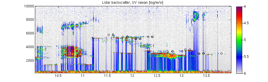
Vertically pointing UV lidar, showing broken low cloud, multi-level supercooled liquid water layers, and specular reflection 10.30-11; 2500-4000m
Circles = overpasses directly over Chilbolton
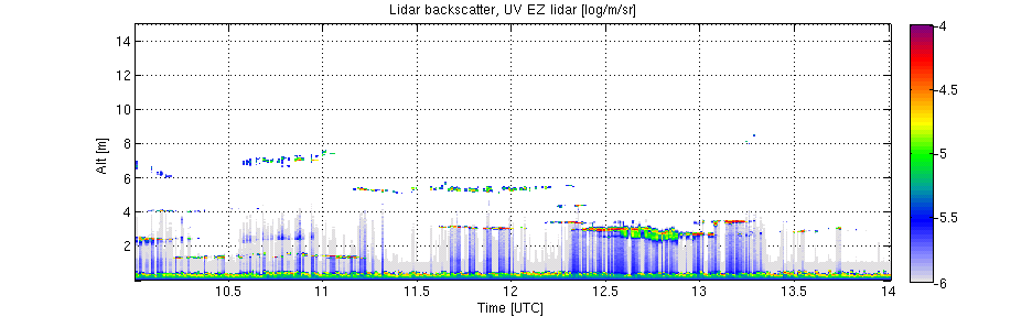
Off vertical UV lidar, showing liquid water layers + ice/drizzle falling out 12.5-13UTC
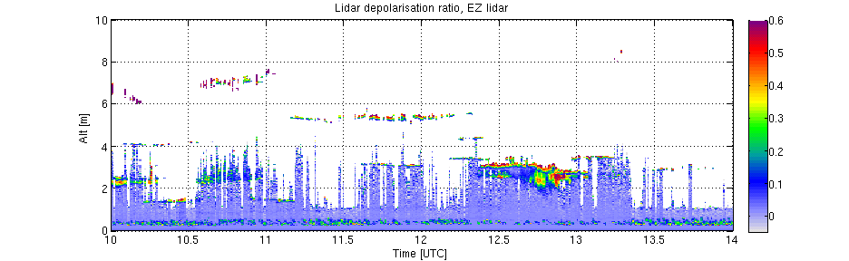
Depolarisation ration, drizzle shows up as blue (zero depol) ice much higher (0.3) - can see where drizzle/ice dominate 12.5-13UT:
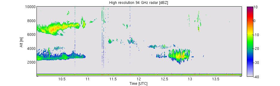
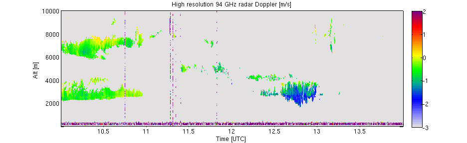
High res 94GHz radar - sensitive to large ice and drizzle:
Radar Doppler Velocity - see unrimed ice falling 0.5m/s, big drizzle drops falling 2m/s:
Radar Spectral width - large values = broad range of particle fall speeds or turbulence

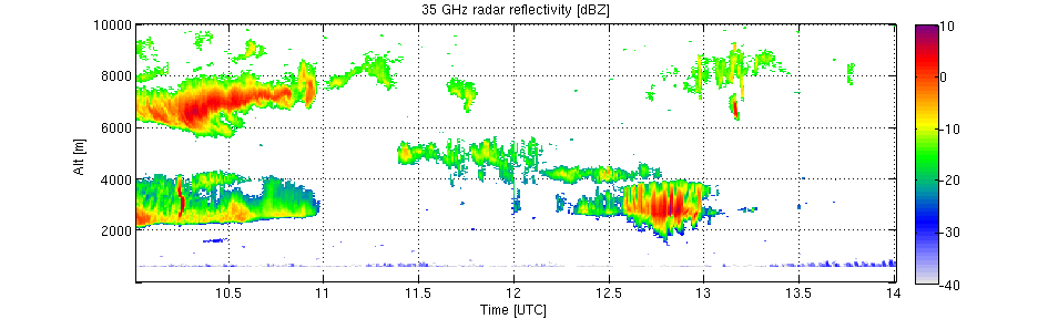
35GHz radar - more sensitive to thin clouds than the 94GHz:
Example radar Doppler spectrum showing two seperate populations - ice falling 1m/s, drizzle falling 2m/s. White crosses are Doppler lidar profile (much more sensitive to smaller particles). x-axis is velocity, y-axis is height.
